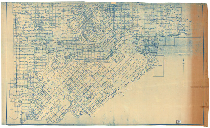
[Val Verde County]
Print $20.00
- Digital $50.00
[Val Verde County]
1898
Size: 39.1 x 32.4 inches
63095
[Val Verde County]
Print $20.00
- Digital $50.00
[Val Verde County]
1898
Size: 42.6 x 34.9 inches
63096
[Val Verde County]
Print $20.00
- Digital $50.00
[Val Verde County]
1898
Size: 41.1 x 37.1 inches
63097
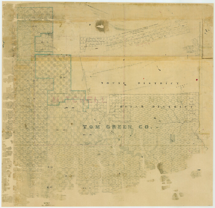
[Tom Green County]
Print $20.00
- Digital $50.00
[Tom Green County]
1888
Size: 33.2 x 34.4 inches
16901
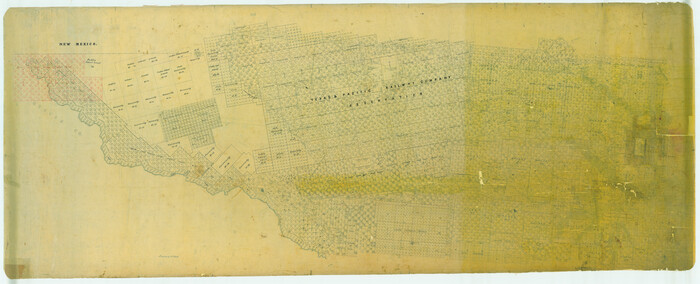
[Tom Green County]
Print $40.00
- Digital $50.00
[Tom Green County]
1888
Size: 45.8 x 113.0 inches
82060
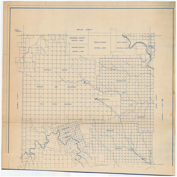
[Throckmorton County]
Print $20.00
- Digital $50.00
[Throckmorton County]
Size: 39.7 x 40.0 inches
89875
[South Half - Brown County, Texas]
Print $40.00
- Digital $50.00
[South Half - Brown County, Texas]
1919
Size: 41.7 x 68.4 inches
97383
[Randall County map]
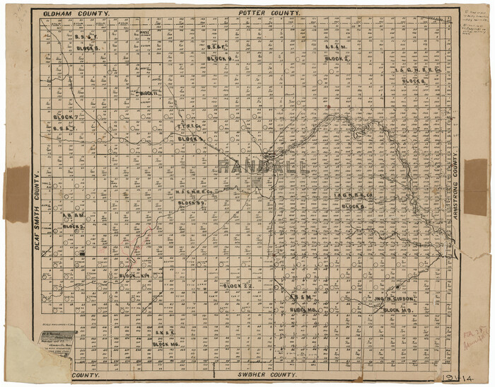
Print $20.00
- Digital $50.00
[Randall County map]
Size: 21.3 x 17.0 inches
91752
[Peter's Colony surveys in Stephens County]
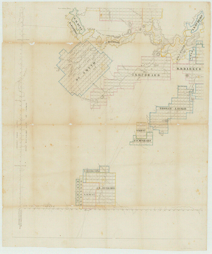
Print $20.00
- Digital $50.00
[Peter's Colony surveys in Stephens County]
Size: 25.3 x 21.1 inches
75986
[Palmer and Castro Counties]
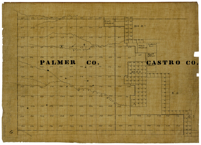
Print $20.00
- Digital $50.00
[Palmer and Castro Counties]
1910
Size: 19.3 x 26.3 inches
1763
[McMullen and Live Oak County]
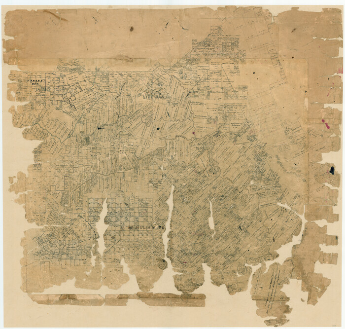
Print $20.00
- Digital $50.00
[McMullen and Live Oak County]
1870
Size: 34.3 x 36.0 inches
10789
[Marion County, Texas]
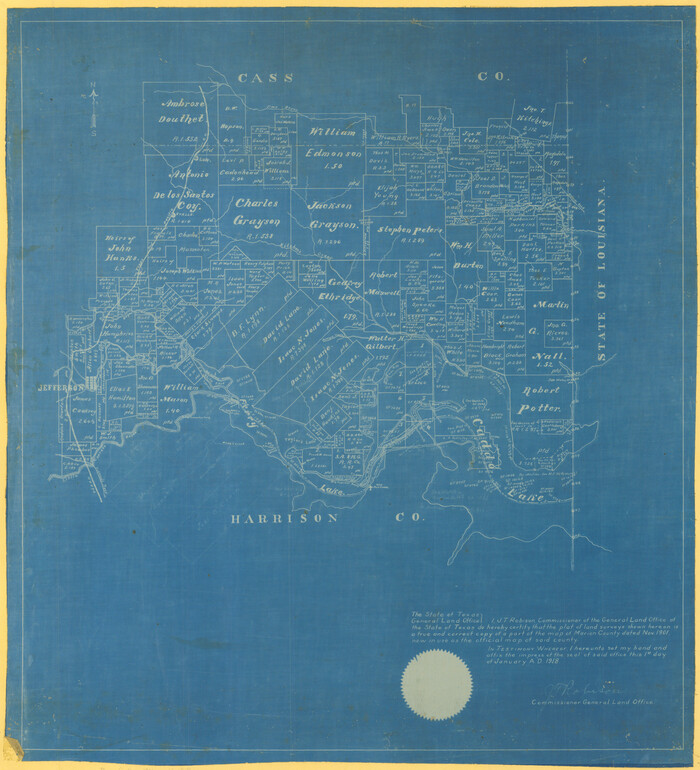
Print $20.00
- Digital $50.00
[Marion County, Texas]
1901
Size: 26.5 x 24.1 inches
75777
[Map] of Goliad Land District
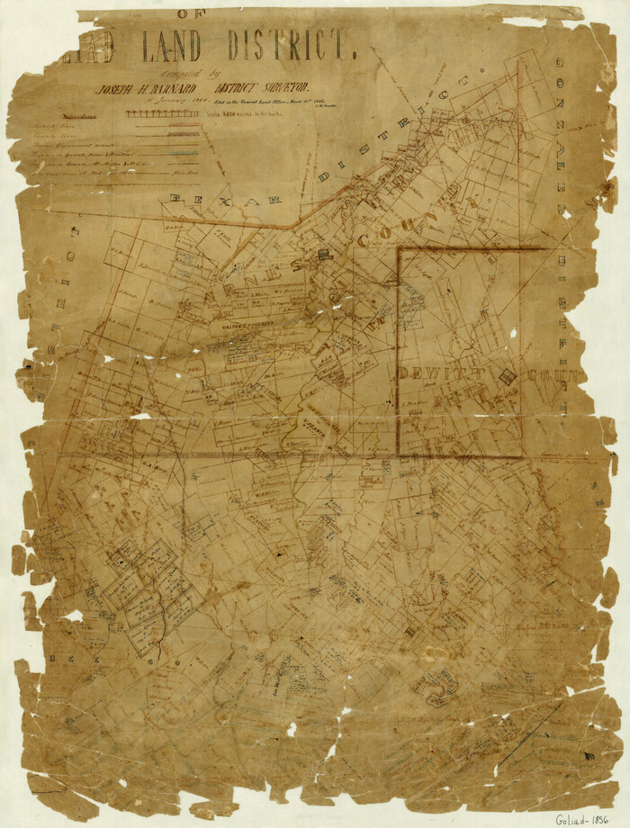
Print $20.00
- Digital $50.00
[Map] of Goliad Land District
1856
Size: 33.5 x 25.2 inches
3586
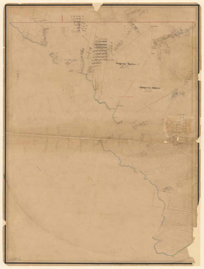
[Map of Zapata County]
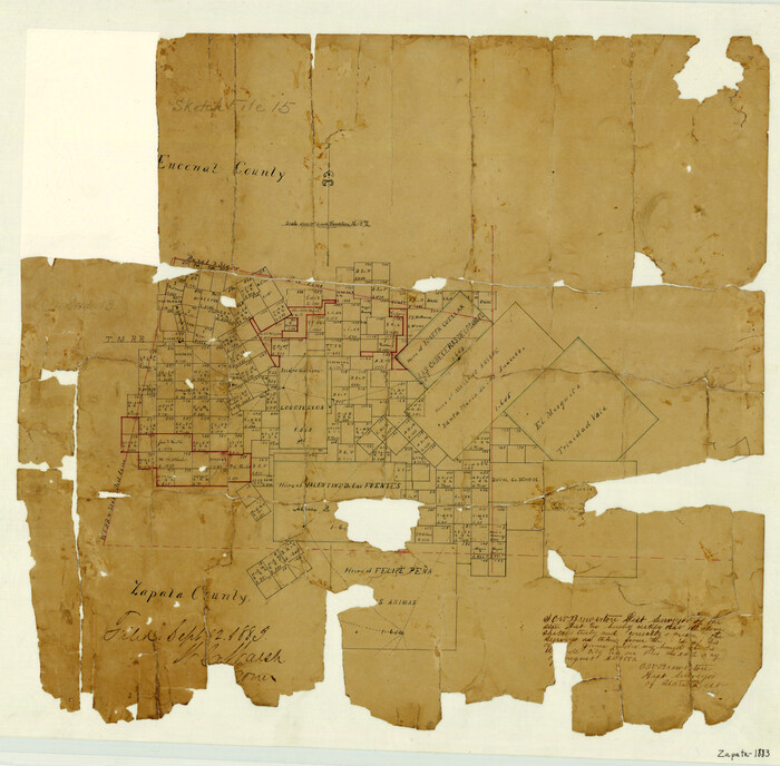
Print $20.00
- Digital $50.00
[Map of Zapata County]
1883
Size: 20.5 x 20.9 inches
4178
[Map of Val Verde County]
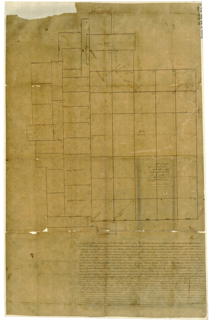
Print $20.00
- Digital $50.00
[Map of Val Verde County]
1931
Size: 36.4 x 24.1 inches
4110
[Map of Uvalde County]
Print $20.00
- Digital $50.00
[Map of Uvalde County]
1862
Size: 27.7 x 26.7 inches
4108
[Map of Upshur County]
Print $20.00
- Digital $50.00
[Map of Upshur County]
1850
Size: 25.2 x 17.8 inches
4651
[Map of Tom Green County]
Print $20.00
- Digital $50.00
[Map of Tom Green County]
Size: 23.9 x 36.5 inches
4085
[Map of Tom Green County]
Print $40.00
- Digital $50.00
[Map of Tom Green County]
1933
Size: 50.0 x 60.6 inches
82061
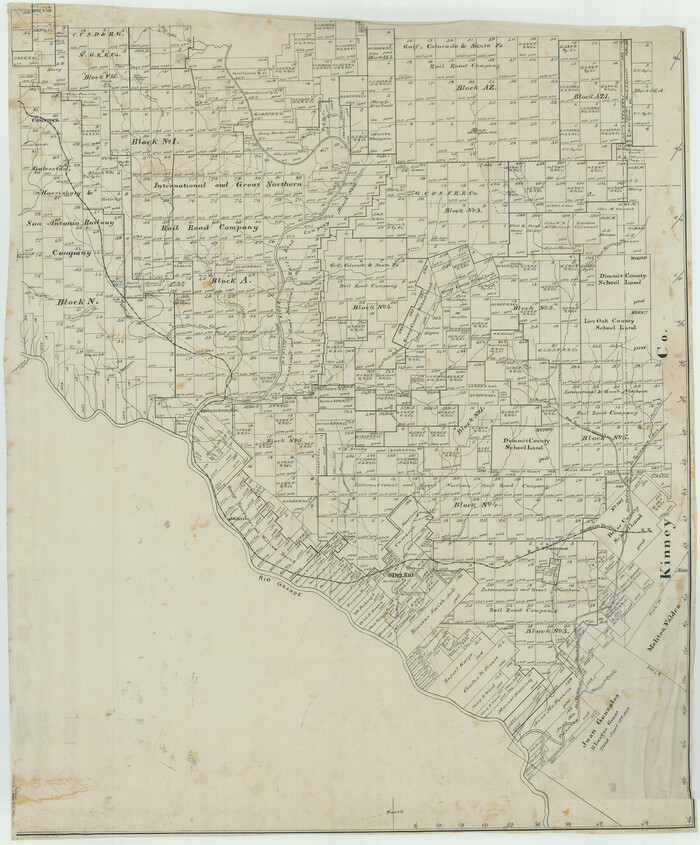
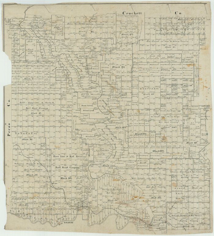
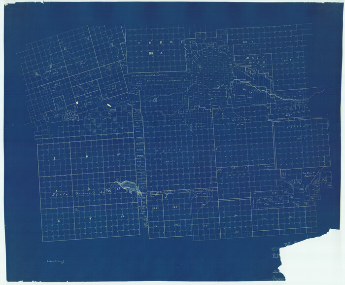
[Map of Terrell County]
Print $20.00
- Digital $50.00
[Map of Terrell County]
Size: 38.0 x 24.0 inches
4074
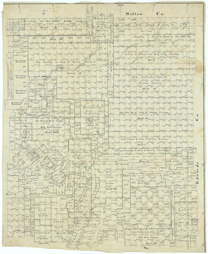
[Map of Sterling County]
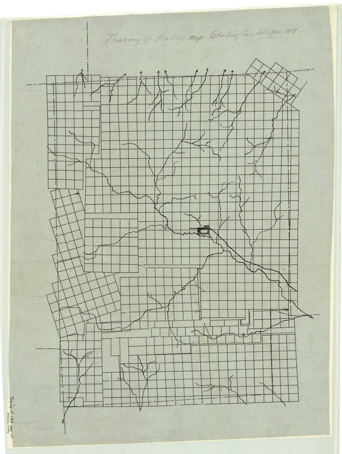
Print $20.00
- Digital $50.00
[Map of Sterling County]
1919
Size: 30.2 x 22.8 inches
4055
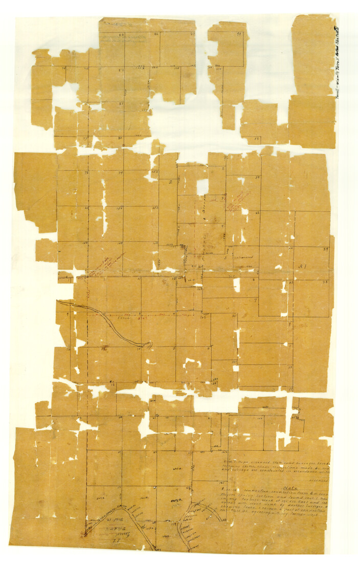
[Map of Starr County]
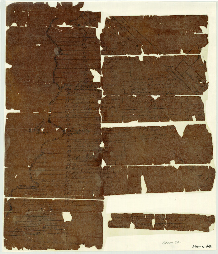
Print $20.00
- Digital $50.00
[Map of Starr County]
Size: 18.8 x 16.2 inches
4049
[Map of Sabine County]
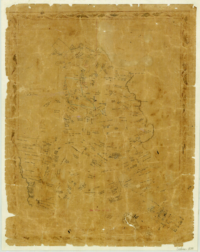
Print $20.00
- Digital $50.00
[Map of Sabine County]
1839
Size: 23.9 x 18.9 inches
4009
[Map of Polk County]
Print $20.00
- Digital $50.00
[Map of Polk County]
1855
Size: 21.2 x 31.0 inches
4613
[Map of Polk County]
Print $20.00
- Digital $50.00
[Map of Polk County]
Size: 21.7 x 25.8 inches
4614
[Victoria District]
![1945, [Victoria District], General Map Collection](https://historictexasmaps.com/wmedia_w700/maps/1945.tif.jpg)
Print $20.00
- Digital $50.00
[Victoria District]
-
Size
34.8 x 25.6 inches
-
Map/Doc
1945
[Val Verde County]
Print $20.00
- Digital $50.00
[Val Verde County]
1898
-
Size
39.1 x 32.4 inches
-
Map/Doc
63095
-
Creation Date
1898
[Val Verde County]
Print $20.00
- Digital $50.00
[Val Verde County]
1898
-
Size
42.6 x 34.9 inches
-
Map/Doc
63096
-
Creation Date
1898
[Val Verde County]
Print $20.00
- Digital $50.00
[Val Verde County]
1898
-
Size
41.1 x 37.1 inches
-
Map/Doc
63097
-
Creation Date
1898
[Tom Green County]
Print $20.00
- Digital $50.00
[Tom Green County]
1888
-
Size
33.2 x 34.4 inches
-
Map/Doc
16901
-
Creation Date
1888
[Tom Green County]
Print $40.00
- Digital $50.00
[Tom Green County]
1888
-
Size
45.8 x 113.0 inches
-
Map/Doc
82060
-
Creation Date
1888
[Throckmorton County]
Print $20.00
- Digital $50.00
[Throckmorton County]
-
Size
39.7 x 40.0 inches
-
Map/Doc
89875
[South Half - Brown County, Texas]
Print $40.00
- Digital $50.00
[South Half - Brown County, Texas]
1919
-
Size
41.7 x 68.4 inches
-
Map/Doc
97383
-
Creation Date
1919
[Scurry County]
![63030, [Scurry County], General Map Collection](https://historictexasmaps.com/wmedia_w700/maps/63030.tif.jpg)
Print $20.00
- Digital $50.00
[Scurry County]
1901
-
Size
34.3 x 42.5 inches
-
Map/Doc
63030
-
Creation Date
1901
[Randall County]
![92970, [Randall County], Twichell Survey Records](https://historictexasmaps.com/wmedia_w700/maps/92970-1.tif.jpg)
Print $20.00
- Digital $50.00
[Randall County]
-
Size
14.7 x 12.0 inches
-
Map/Doc
92970
[Randall County map]
Print $20.00
- Digital $50.00
[Randall County map]
-
Size
21.3 x 17.0 inches
-
Map/Doc
91752
[Peter's Colony surveys in Stephens County]
Print $20.00
- Digital $50.00
[Peter's Colony surveys in Stephens County]
-
Size
25.3 x 21.1 inches
-
Map/Doc
75986
[Palmer and Castro Counties]
Print $20.00
- Digital $50.00
[Palmer and Castro Counties]
1910
-
Size
19.3 x 26.3 inches
-
Map/Doc
1763
-
Creation Date
1910
[McMullen and Live Oak County]
Print $20.00
- Digital $50.00
[McMullen and Live Oak County]
1870
-
Size
34.3 x 36.0 inches
-
Map/Doc
10789
-
Creation Date
1870
[Marion County, Texas]
Print $20.00
- Digital $50.00
[Marion County, Texas]
1901
-
Size
26.5 x 24.1 inches
-
Map/Doc
75777
-
Creation Date
1901
[Map] of Goliad Land District
Print $20.00
- Digital $50.00
[Map] of Goliad Land District
1856
-
Size
33.5 x 25.2 inches
-
Map/Doc
3586
-
Creation Date
1856
[Map of Zapata County]
Print $20.00
- Digital $50.00
[Map of Zapata County]
1883
-
Size
20.5 x 20.9 inches
-
Map/Doc
4178
-
Creation Date
1883
[Map of Val Verde County]
Print $20.00
- Digital $50.00
[Map of Val Verde County]
1931
-
Size
36.4 x 24.1 inches
-
Map/Doc
4110
-
Creation Date
1931
[Map of Uvalde County]
Print $20.00
- Digital $50.00
[Map of Uvalde County]
1862
-
Size
27.7 x 26.7 inches
-
Map/Doc
4108
-
Creation Date
1862
[Map of Upshur County]
Print $20.00
- Digital $50.00
[Map of Upshur County]
1850
-
Size
25.2 x 17.8 inches
-
Map/Doc
4651
-
Creation Date
1850
[Map of Tom Green County]
Print $20.00
- Digital $50.00
[Map of Tom Green County]
-
Size
23.9 x 36.5 inches
-
Map/Doc
4085
[Map of Tom Green County]
Print $40.00
- Digital $50.00
[Map of Tom Green County]
1933
-
Size
50.0 x 60.6 inches
-
Map/Doc
82061
-
Creation Date
1933
[Map of Terrell County]
Print $20.00
- Digital $50.00
[Map of Terrell County]
-
Size
38.0 x 24.0 inches
-
Map/Doc
4074
[Map of Sterling County]
Print $20.00
- Digital $50.00
[Map of Sterling County]
1919
-
Size
30.2 x 22.8 inches
-
Map/Doc
4055
-
Creation Date
1919
[Map of Starr County]
Print $20.00
- Digital $50.00
[Map of Starr County]
-
Size
18.8 x 16.2 inches
-
Map/Doc
4049
[Map of Sabine County]
Print $20.00
- Digital $50.00
[Map of Sabine County]
1839
-
Size
23.9 x 18.9 inches
-
Map/Doc
4009
-
Creation Date
1839
[Map of Polk County]
Print $20.00
- Digital $50.00
[Map of Polk County]
1855
-
Size
21.2 x 31.0 inches
-
Map/Doc
4613
-
Creation Date
1855
[Map of Polk County]
Print $20.00
- Digital $50.00
[Map of Polk County]
-
Size
21.7 x 25.8 inches
-
Map/Doc
4614