52 results

A New Map of the Whole Continent of America. Divided into North and South and West Indies, wherein are exactly decribed the United States of North America as well as the Several European Possessions according to the Preliminaries of Peace…
95135.tif
Print $40.00 - Digital $50.00

A New Map of the Whole Continent of America. Divided into North and South and West Indies, wherein are exactly decribed the United States of North America as well as the Several European Possessions according to the Preliminaries of Peace…

Size: 22.0 x 48.3 inches
95135
A New Map of the Whole Continent of America. Divided into North and South and West Indies, wherein are exactly decribed the United States of North America as well as the Several European Possessions according to the Preliminaries of Peace…
95136.tif
Print $40.00 - Digital $50.00

A New Map of the Whole Continent of America. Divided into North and South and West Indies, wherein are exactly decribed the United States of North America as well as the Several European Possessions according to the Preliminaries of Peace…

Size: 22.0 x 48.7 inches
95136
A New Map of the Whole Continent of America. Divided into North and South and West Indies, wherein are exactly decribed the United States of North America as well as the Several European Possessions according to the Preliminaries of Peace…
95137.tif
Print $40.00 - Digital $50.00

A New Map of the Whole Continent of America. Divided into North and South and West Indies, wherein are exactly decribed the United States of North America as well as the Several European Possessions according to the Preliminaries of Peace…

Size: 42.8 x 48.8 inches
95137
A New, Plaine, and Exact map of America : described by N.I. Visscher, and don into English, enlarged, and corrected, according to I. Blaeu, with the habits of the countries, and the manner of the cheife Citties, the like never before
96787.tif
Print $20.00 - Digital $50.00

A New, Plaine, and Exact map of America : described by N.I. Visscher, and don into English, enlarged, and corrected, according to I. Blaeu, with the habits of the countries, and the manner of the cheife Citties, the like never before

1658

Size: 16.4 x 20.9 inches
96787
America
93811.tif
Print $20.00 - Digital $50.00

America

1607

Size: 18.1 x 21.3 inches
93811
America siue India Nova ad magnae Gerardi Mercatoris aui Vniversalis imitationem in compendium redacta
93807.tif
Print $20.00 - Digital $50.00

America siue India Nova ad magnae Gerardi Mercatoris aui Vniversalis imitationem in compendium redacta

1595

Size: 18.3 x 21.6 inches
93807
America siue India Nova ad magnae Gerardi Mercatoris aui Vniversalis imitationem in compendium redacta
93808.tif
Print $20.00 - Digital $50.00

America siue India Nova ad magnae Gerardi Mercatoris aui Vniversalis imitationem in compendium redacta

1585

Size: 16.9 x 20.2 inches
93808
America sive novvs orbis respectv evropaeorvm inferior globi terrestris pars 1596
93809.tif
Print $20.00 - Digital $50.00

America sive novvs orbis respectv evropaeorvm inferior globi terrestris pars 1596

1596
Size: 14.7 x 18.1 inches
93809
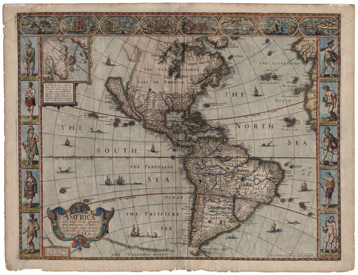
America with those known parts in that unknowne worlde both people and manner of buildings
93816.tif
Print $20.00 - Digital $50.00

America with those known parts in that unknowne worlde both people and manner of buildings

1626

Size: 17.1 x 22.2 inches
93816
America with those known parts in that unknowne worlde both people and manner of buildings
93830.tif
Print $20.00 - Digital $50.00

America with those known parts in that unknowne worlde both people and manner of buildings

1626
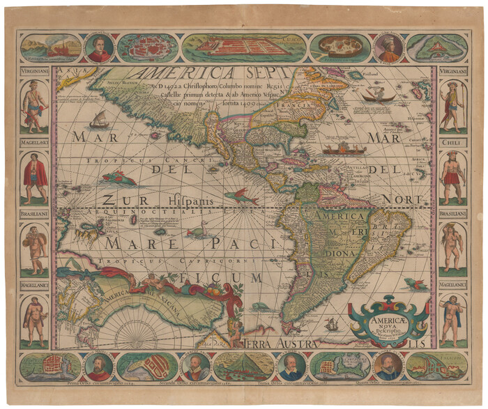
Size: 17.2 x 22.3 inches
93830
Americae Nova Descriptio
95370.tif
Print $20.00 - Digital $50.00

Americae Nova Descriptio

1652

Size: 19.7 x 23.5 inches
95370
Americae Nova Descriptio
95708.tif
Print $20.00 - Digital $50.00

Americae Nova Descriptio

Size: 14.5 x 18.0 inches
95708
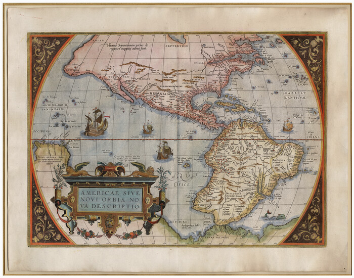
Americae Sive Novi Orbis Nova Descriptio
93805.tif
Print $20.00 - Digital $50.00

Americae Sive Novi Orbis Nova Descriptio

1579

Size: 18.0 x 22.9 inches
93805
Americae Sive Novi Orbis Nova Descriptio
93810-1.tif
Print $20.00 - Digital $50.00

Americae Sive Novi Orbis Nova Descriptio

1606
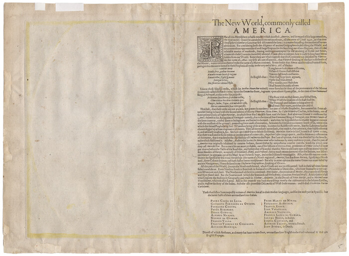
Size: 16.5 x 22.4 inches
93810
Americae Sive Novi Orbis Nova Descriptio
93829.tif
Print $20.00 - Digital $50.00

Americae Sive Novi Orbis Nova Descriptio

1606

Size: 16.4 x 22.3 inches
93829
Americae Sive Novi Orbis, Nova Descriptio
95834.tif
Print $20.00 - Digital $50.00

Americae Sive Novi Orbis, Nova Descriptio

1573
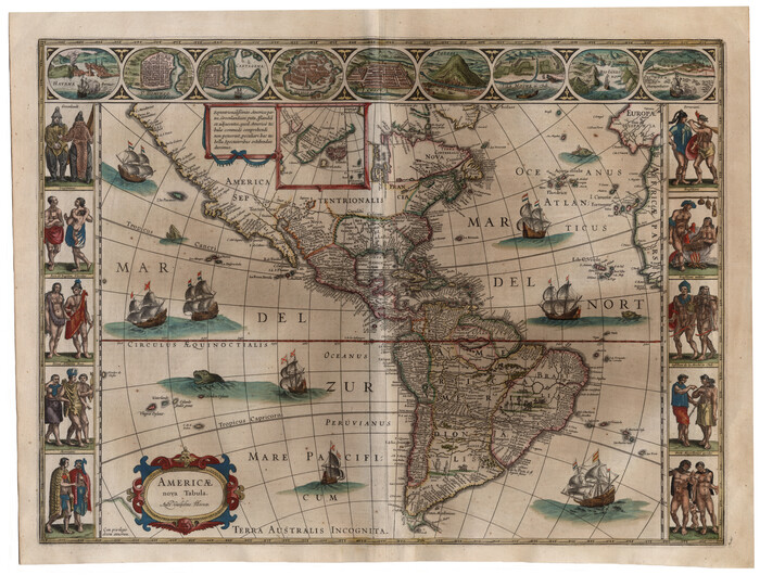
Size: 15.6 x 22.3 inches
95834
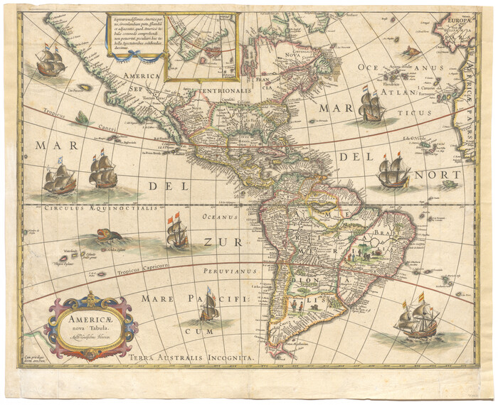
Americae nova Tabula
93812.tif
Print $20.00 - Digital $50.00

Americae nova Tabula

1635

Size: 18.4 x 24.3 inches
93812
Americae nova Tabula
93813.tif
Print $20.00 - Digital $50.00

Americae nova Tabula

1617

Size: 16.0 x 21.5 inches
93813
Americæ Nova Tabula
95827.tif
Print $20.00 - Digital $50.00

Americæ Nova Tabula

Size: 15.3 x 18.7 inches
95827
Amèrica noviter delineata
93814.tif
Print $20.00 - Digital $50.00

Amèrica noviter delineata

1630

Size: 21.5 x 24.7 inches
93814
Bowles's New Pocket Map of America divided into its Provinces, Colonies, States, Governments &c. exhibiting the British and Spanish Empires therein; together with the Territories belonging to the French, Dutch, Danes & Portuguese
93838.tif
Print $20.00 - Digital $50.00

Bowles's New Pocket Map of America divided into its Provinces, Colonies, States, Governments &c. exhibiting the British and Spanish Empires therein; together with the Territories belonging to the French, Dutch, Danes & Portuguese

1784

Size: 21.3 x 23.1 inches
93838
Carte Nouvelle de la Mer du Sud
93824.tif
Print $20.00 - Digital $50.00

Carte Nouvelle de la Mer du Sud

1730

Size: 25.8 x 39.6 inches
93824
Carte d'Amerique, Divisee en ses Principaux Pays, Dressee sur les Memoires les plus recents, et sur differents Voyages, et assujettie aux observations Astronomiques de Mrs. de l'Academie Royale des Sciences
96430.tif
Print $40.00 - Digital $50.00

Carte d'Amerique, Divisee en ses Principaux Pays, Dressee sur les Memoires les plus recents, et sur differents Voyages, et assujettie aux observations Astronomiques de Mrs. de l'Academie Royale des Sciences

1787
Size: 43.5 x 51.3 inches
96430
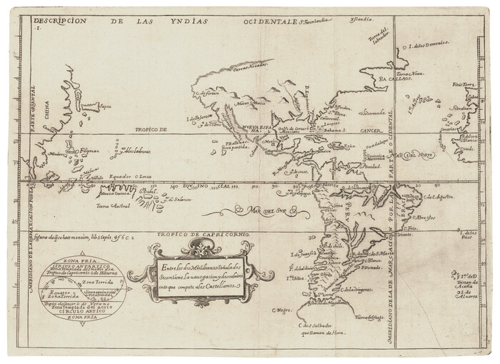
Descripcion de las Yndias Ocidentales
95962-1.tif
Print $20.00 - Digital $50.00

Descripcion de las Yndias Ocidentales

Size: 9.6 x 13.2 inches
95962
Die Neüwen Inseln / so hinder Hispanien gegen Orient bey dem Landt Indie ligen
93803.tif
Print $20.00 - Digital $50.00

Die Neüwen Inseln / so hinder Hispanien gegen Orient bey dem Landt Indie ligen

1540
Size: 12.3 x 15.6 inches
93803
Die Neüwen Inseln / so hinder Hispanien gegen Orient bey dem Landt Indie ligen
93831.tif
Print $20.00 - Digital $50.00

Die Neüwen Inseln / so hinder Hispanien gegen Orient bey dem Landt Indie ligen

1540
Size: 10.8 x 15.8 inches
93831
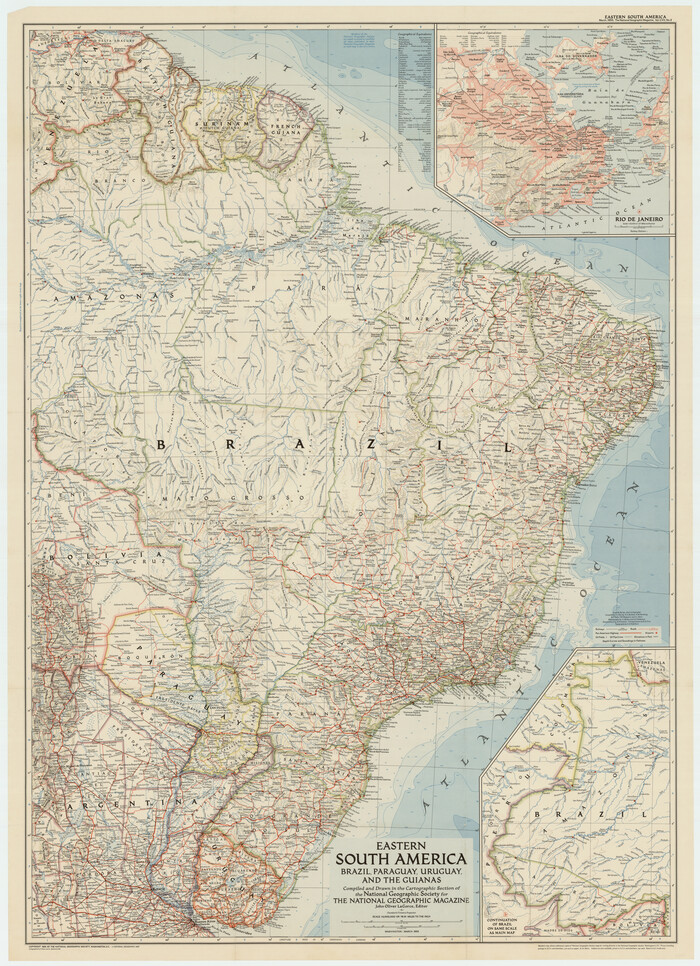
Eastern South America Brazil, Paraguay, Uruguay, and the Guianas
92389-1.tif

Eastern South America Brazil, Paraguay, Uruguay, and the Guianas

1955

Size: 29.8 x 41.2 inches
92389
Il Cuscho Citta Principale Della Provincia del Peru
97026.tif
Print $20.00 - Digital $50.00

Il Cuscho Citta Principale Della Provincia del Peru

1592

Size: 12.3 x 15.4 inches
97026
L'Amerique Meridionale, et Septentrionale Dressee selon les derniers Relations et suivant les Nouvelles Decouvertes
95134.tif
Print $20.00 - Digital $50.00

L'Amerique Meridionale, et Septentrionale Dressee selon les derniers Relations et suivant les Nouvelles Decouvertes

Size: 18.9 x 24.1 inches
95134
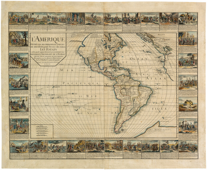
L'Amerique divisée en ses principales parties où sont distingués les uns des autres les estats selon quils appartiennent presentement aux differents souverains de l'Europe
95188.tif
Print $20.00 - Digital $50.00

L'Amerique divisée en ses principales parties où sont distingués les uns des autres les estats selon quils appartiennent presentement aux differents souverains de l'Europe

1752

Size: 36.0 x 43.6 inches
95188
A New Map of the Whole Continent of America. Divided into North and South and West Indies, wherein are exactly decribed the United States of North America as well as the Several European Possessions according to the Preliminaries of Peace…
95135, A New Map of the Whole Continent of America. Divided into North and South and West Indies, wherein are exactly decribed the United States of North America as well as the Several European Possessions according to the Preliminaries of Peace…, General Map Collection
Print $40.00 - Digital $50.00

A New Map of the Whole Continent of America. Divided into North and South and West Indies, wherein are exactly decribed the United States of North America as well as the Several European Possessions according to the Preliminaries of Peace…

  • Size

    22.0 x 48.3 inches

  • Map/Doc

    95135

A New Map of the Whole Continent of America. Divided into North and South and West Indies, wherein are exactly decribed the United States of North America as well as the Several European Possessions according to the Preliminaries of Peace…
95136, A New Map of the Whole Continent of America. Divided into North and South and West Indies, wherein are exactly decribed the United States of North America as well as the Several European Possessions according to the Preliminaries of Peace…, General Map Collection
Print $40.00 - Digital $50.00

A New Map of the Whole Continent of America. Divided into North and South and West Indies, wherein are exactly decribed the United States of North America as well as the Several European Possessions according to the Preliminaries of Peace…

  • Size

    22.0 x 48.7 inches

  • Map/Doc

    95136

A New Map of the Whole Continent of America. Divided into North and South and West Indies, wherein are exactly decribed the United States of North America as well as the Several European Possessions according to the Preliminaries of Peace…
95137, A New Map of the Whole Continent of America. Divided into North and South and West Indies, wherein are exactly decribed the United States of North America as well as the Several European Possessions according to the Preliminaries of Peace…, General Map Collection
Print $40.00 - Digital $50.00

A New Map of the Whole Continent of America. Divided into North and South and West Indies, wherein are exactly decribed the United States of North America as well as the Several European Possessions according to the Preliminaries of Peace…

  • Size

    42.8 x 48.8 inches

  • Map/Doc

    95137

A New, Plaine, and Exact map of America : described by N.I. Visscher, and don into English, enlarged, and corrected, according to I. Blaeu, with the habits of the countries, and the manner of the cheife Citties, the like never before
Print $20.00 - Digital $50.00

A New, Plaine, and Exact map of America : described by N.I. Visscher, and don into English, enlarged, and corrected, according to I. Blaeu, with the habits of the countries, and the manner of the cheife Citties, the like never before

1658

  • Size

    16.4 x 20.9 inches

  • Map/Doc

    96787

  • Creation Date

    1658

America
93811, America, Holcomb Digital Map Collection
Print $20.00 - Digital $50.00

America

1607

  • Size

    18.1 x 21.3 inches

  • Map/Doc

    93811

  • Creation Date

    1607

America siue India Nova ad magnae Gerardi Mercatoris aui Vniversalis imitationem in compendium redacta
93807, America siue India Nova ad magnae Gerardi Mercatoris aui Vniversalis imitationem in compendium redacta, Holcomb Digital Map Collection
Print $20.00 - Digital $50.00

America siue India Nova ad magnae Gerardi Mercatoris aui Vniversalis imitationem in compendium redacta

1595

  • Size

    18.3 x 21.6 inches

  • Map/Doc

    93807

  • Creation Date

    1595

America siue India Nova ad magnae Gerardi Mercatoris aui Vniversalis imitationem in compendium redacta
93808, America siue India Nova ad magnae Gerardi Mercatoris aui Vniversalis imitationem in compendium redacta, Holcomb Digital Map Collection
Print $20.00 - Digital $50.00

America siue India Nova ad magnae Gerardi Mercatoris aui Vniversalis imitationem in compendium redacta

1585

  • Size

    16.9 x 20.2 inches

  • Map/Doc

    93808

  • Creation Date

    1585

America sive novvs orbis respectv evropaeorvm inferior globi terrestris pars 1596
93809, America sive novvs orbis respectv evropaeorvm inferior globi terrestris pars 1596, Holcomb Digital Map Collection
Print $20.00 - Digital $50.00

America sive novvs orbis respectv evropaeorvm inferior globi terrestris pars 1596

1596

  • Size

    14.7 x 18.1 inches

  • Map/Doc

    93809

  • Creation Date

    1596

America with those known parts in that unknowne worlde both people and manner of buildings
93816, America with those known parts in that unknowne worlde both people and manner of buildings, Holcomb Digital Map Collection
Print $20.00 - Digital $50.00

America with those known parts in that unknowne worlde both people and manner of buildings

1626

  • Size

    17.1 x 22.2 inches

  • Map/Doc

    93816

  • Creation Date

    1626

America with those known parts in that unknowne worlde both people and manner of buildings
93830, America with those known parts in that unknowne worlde both people and manner of buildings, Holcomb Digital Map Collection
Print $20.00 - Digital $50.00

America with those known parts in that unknowne worlde both people and manner of buildings

1626

  • Size

    17.2 x 22.3 inches

  • Map/Doc

    93830

  • Creation Date

    1626

Americae Nova Descriptio
95370, Americae Nova Descriptio, Holcomb Digital Map Collection
Print $20.00 - Digital $50.00

Americae Nova Descriptio

1652

  • Size

    19.7 x 23.5 inches

  • Map/Doc

    95370

  • Creation Date

    1652

Americae Nova Descriptio
95708, Americae Nova Descriptio, General Map Collection
Print $20.00 - Digital $50.00

Americae Nova Descriptio

  • Size

    14.5 x 18.0 inches

  • Map/Doc

    95708

Americae Sive Novi Orbis Nova Descriptio
93805, Americae Sive Novi Orbis Nova Descriptio, Holcomb Digital Map Collection
Print $20.00 - Digital $50.00

Americae Sive Novi Orbis Nova Descriptio

1579

  • Size

    18.0 x 22.9 inches

  • Map/Doc

    93805

  • Creation Date

    1579

Americae Sive Novi Orbis Nova Descriptio
93810, Americae Sive Novi Orbis Nova Descriptio, Holcomb Digital Map Collection
Print $20.00 - Digital $50.00

Americae Sive Novi Orbis Nova Descriptio

1606

  • Size

    16.5 x 22.4 inches

  • Map/Doc

    93810

  • Creation Date

    1606

Americae Sive Novi Orbis Nova Descriptio
93829, Americae Sive Novi Orbis Nova Descriptio, Holcomb Digital Map Collection
Print $20.00 - Digital $50.00

Americae Sive Novi Orbis Nova Descriptio

1606

  • Size

    16.4 x 22.3 inches

  • Map/Doc

    93829

  • Creation Date

    1606

Americae Sive Novi Orbis, Nova Descriptio
95834, Americae Sive Novi Orbis, Nova Descriptio, General Map Collection - 1
Print $20.00 - Digital $50.00

Americae Sive Novi Orbis, Nova Descriptio

1573

  • Size

    15.6 x 22.3 inches

  • Map/Doc

    95834

  • Creation Date

    1573

Americae nova Tabula
93812, Americae nova Tabula, Holcomb Digital Map Collection
Print $20.00 - Digital $50.00

Americae nova Tabula

1635

  • Size

    18.4 x 24.3 inches

  • Map/Doc

    93812

  • Creation Date

    1635

Americae nova Tabula
93813, Americae nova Tabula, Holcomb Digital Map Collection
Print $20.00 - Digital $50.00

Americae nova Tabula

1617

  • Size

    16.0 x 21.5 inches

  • Map/Doc

    93813

  • Creation Date

    1617

Americæ Nova Tabula
95827, Americæ Nova Tabula, General Map Collection
Print $20.00 - Digital $50.00

Americæ Nova Tabula

  • Size

    15.3 x 18.7 inches

  • Map/Doc

    95827

Amèrica noviter delineata
93814, Amèrica noviter delineata, Holcomb Digital Map Collection
Print $20.00 - Digital $50.00

Amèrica noviter delineata

1630

  • Size

    21.5 x 24.7 inches

  • Map/Doc

    93814

  • Creation Date

    1630

Bowles's New Pocket Map of America divided into its Provinces, Colonies, States, Governments &c. exhibiting the British and Spanish Empires therein; together with the Territories belonging to the French, Dutch, Danes & Portuguese
93838, Bowles's New Pocket Map of America divided into its Provinces, Colonies, States, Governments &c. exhibiting the British and Spanish Empires therein; together with the Territories belonging to the French, Dutch, Danes & Portuguese, Holcomb Digital Map Collection
Print $20.00 - Digital $50.00

Bowles's New Pocket Map of America divided into its Provinces, Colonies, States, Governments &c. exhibiting the British and Spanish Empires therein; together with the Territories belonging to the French, Dutch, Danes & Portuguese

1784

  • Size

    21.3 x 23.1 inches

  • Map/Doc

    93838

  • Creation Date

    1784

Carte Nouvelle de la Mer du Sud
93824, Carte Nouvelle de la Mer du Sud, Holcomb Digital Map Collection
Print $20.00 - Digital $50.00

Carte Nouvelle de la Mer du Sud

1730

  • Size

    25.8 x 39.6 inches

  • Map/Doc

    93824

  • Creation Date

    1730

Carte d'Amerique, Divisee en ses Principaux Pays, Dressee sur les Memoires les plus recents, et sur differents Voyages, et assujettie aux observations Astronomiques de Mrs. de l'Academie Royale des Sciences
96430, Carte d'Amerique, Divisee en ses Principaux Pays, Dressee sur les Memoires les plus recents, et sur differents Voyages, et assujettie aux observations Astronomiques de Mrs. de l'Academie Royale des Sciences, Holcomb Digital Map Collection
Print $40.00 - Digital $50.00

Carte d'Amerique, Divisee en ses Principaux Pays, Dressee sur les Memoires les plus recents, et sur differents Voyages, et assujettie aux observations Astronomiques de Mrs. de l'Academie Royale des Sciences

1787

  • Size

    43.5 x 51.3 inches

  • Map/Doc

    96430

  • Creation Date

    1787

Descripcion de las Yndias Ocidentales
95962, Descripcion de las Yndias Ocidentales, General Map Collection
Print $20.00 - Digital $50.00

Descripcion de las Yndias Ocidentales

  • Size

    9.6 x 13.2 inches

  • Map/Doc

    95962

Die Neüwen Inseln / so hinder Hispanien gegen Orient bey dem Landt Indie ligen
93803, Die Neüwen Inseln / so hinder Hispanien gegen Orient bey dem Landt Indie ligen, Holcomb Digital Map Collection
Print $20.00 - Digital $50.00

Die Neüwen Inseln / so hinder Hispanien gegen Orient bey dem Landt Indie ligen

1540

  • Size

    12.3 x 15.6 inches

  • Map/Doc

    93803

  • Creation Date

    1540

Die Neüwen Inseln / so hinder Hispanien gegen Orient bey dem Landt Indie ligen
93831, Die Neüwen Inseln / so hinder Hispanien gegen Orient bey dem Landt Indie ligen, Holcomb Digital Map Collection
Print $20.00 - Digital $50.00

Die Neüwen Inseln / so hinder Hispanien gegen Orient bey dem Landt Indie ligen

1540

  • Size

    10.8 x 15.8 inches

  • Map/Doc

    93831

  • Creation Date

    1540

Eastern South America Brazil, Paraguay, Uruguay, and the Guianas
92389, Eastern South America Brazil, Paraguay, Uruguay, and the Guianas, Twichell Survey Records

Eastern South America Brazil, Paraguay, Uruguay, and the Guianas

1955

  • Size

    29.8 x 41.2 inches

  • Map/Doc

    92389

  • Creation Date

    1955

Il Cuscho Citta Principale Della Provincia del Peru
Print $20.00 - Digital $50.00

Il Cuscho Citta Principale Della Provincia del Peru

1592

  • Size

    12.3 x 15.4 inches

  • Map/Doc

    97026

  • Creation Date

    1592

L'Amerique Meridionale, et Septentrionale Dressee selon les derniers Relations et suivant les Nouvelles Decouvertes
95134, L'Amerique Meridionale, et Septentrionale Dressee selon les derniers Relations et suivant les Nouvelles Decouvertes, General Map Collection
Print $20.00 - Digital $50.00

L'Amerique Meridionale, et Septentrionale Dressee selon les derniers Relations et suivant les Nouvelles Decouvertes

  • Size

    18.9 x 24.1 inches

  • Map/Doc

    95134

L'Amerique divisée en ses principales parties où sont distingués les uns des autres les estats selon quils appartiennent presentement aux differents souverains de l'Europe
95188, L'Amerique divisée en ses principales parties où sont distingués les uns des autres les estats selon quils appartiennent presentement aux differents souverains de l'Europe, Holcomb Digital Map Collection
Print $20.00 - Digital $50.00

L'Amerique divisée en ses principales parties où sont distingués les uns des autres les estats selon quils appartiennent presentement aux differents souverains de l'Europe

1752

  • Size

    36.0 x 43.6 inches

  • Map/Doc

    95188

  • Creation Date

    1752