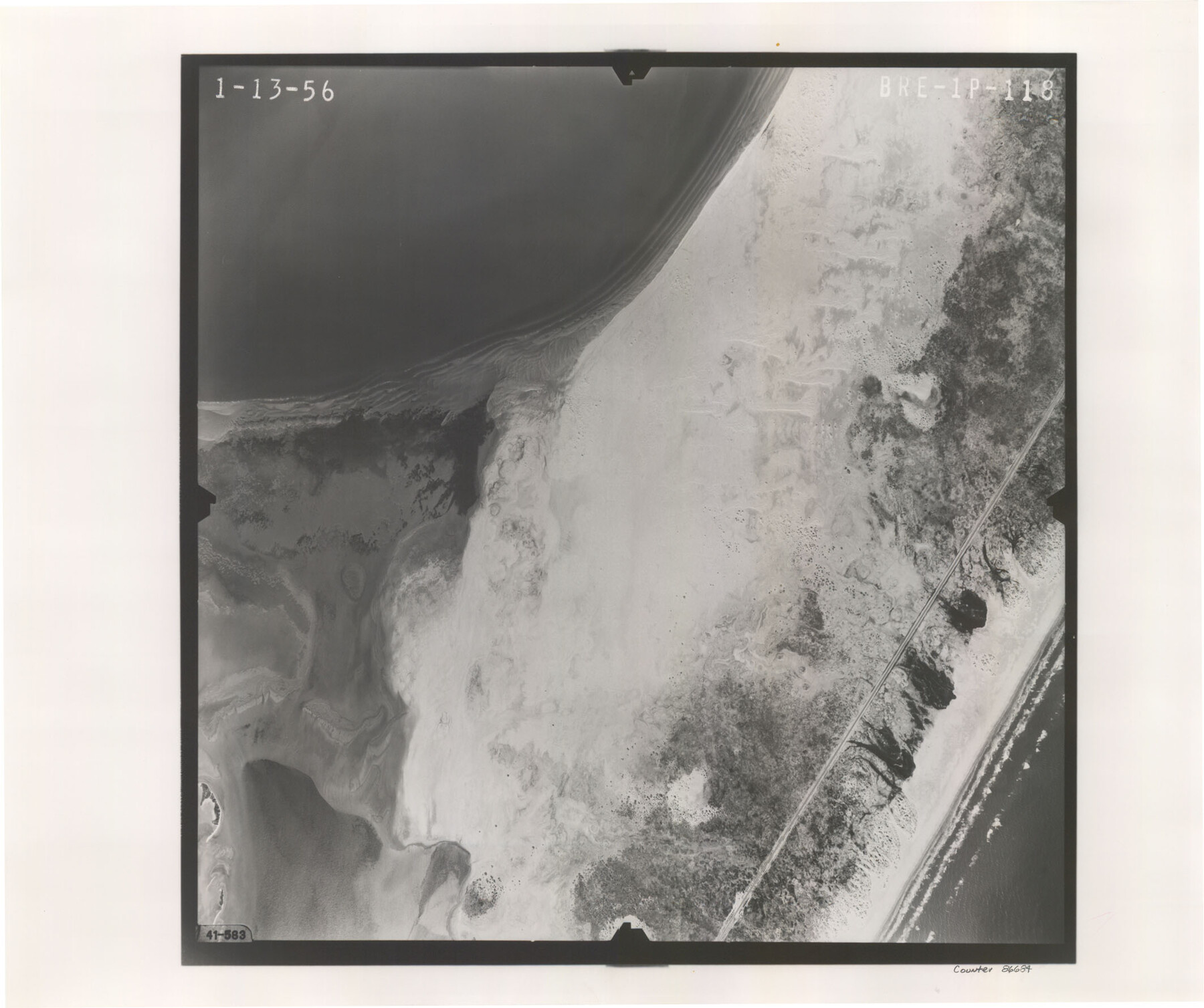
Flight Mission No. BRE-1P, Frame 118, Nueces County
BRE-1P-118
-
Map/Doc
86684
-
Collection
General Map Collection
-
Object Dates
1956/1/13 (Creation Date)
-
People and Organizations
U. S. Department of Agriculture (Publisher)
-
Counties
Nueces
-
Subjects
Aerial Photograph
-
Height x Width
17.8 x 21.2 inches
45.2 x 53.8 cm
-
Comments
Flown by V. L. Beavers and Associates of San Antonio, Texas.
Part of: General Map Collection
Travis County Rolled Sketch 28

Print $20.00
- Digital $50.00
Travis County Rolled Sketch 28
1941
Size 22.7 x 27.0 inches
Map/Doc 8030
Loving County Sketch File 5

Print $10.00
- Digital $50.00
Loving County Sketch File 5
Size 9.7 x 8.3 inches
Map/Doc 30412
Clay County Boundary File 15

Print $8.00
- Digital $50.00
Clay County Boundary File 15
Size 13.3 x 8.2 inches
Map/Doc 51418
Pecos County Working Sketch 5

Print $20.00
- Digital $50.00
Pecos County Working Sketch 5
1886
Size 22.8 x 19.2 inches
Map/Doc 71475
Runnels County

Print $40.00
- Digital $50.00
Runnels County
1948
Size 49.8 x 39.8 inches
Map/Doc 95629
Henderson County Working Sketch 17

Print $20.00
- Digital $50.00
Henderson County Working Sketch 17
1937
Size 27.3 x 27.4 inches
Map/Doc 66150
Galveston County Sketch File 11

Print $40.00
- Digital $50.00
Galveston County Sketch File 11
Size 16.3 x 13.2 inches
Map/Doc 23374
Flight Mission No. CGI-3N, Frame 186, Cameron County

Print $20.00
- Digital $50.00
Flight Mission No. CGI-3N, Frame 186, Cameron County
1954
Size 18.6 x 22.3 inches
Map/Doc 84650
Jack County Sketch File 13

Print $4.00
- Digital $50.00
Jack County Sketch File 13
Size 10.3 x 8.0 inches
Map/Doc 27537
Crane County Sketch File 24

Print $20.00
- Digital $50.00
Crane County Sketch File 24
Size 23.0 x 17.0 inches
Map/Doc 11212
Jasper County

Print $40.00
- Digital $50.00
Jasper County
1946
Size 49.8 x 43.9 inches
Map/Doc 95542
Terrell County Working Sketch 44

Print $40.00
- Digital $50.00
Terrell County Working Sketch 44
1957
Size 40.0 x 71.4 inches
Map/Doc 62137
You may also like
Angelina County Sketch File 21

Print $6.00
- Digital $50.00
Angelina County Sketch File 21
1883
Size 8.8 x 4.0 inches
Map/Doc 13038
Culberson County Rolled Sketch 41

Print $88.00
- Digital $50.00
Culberson County Rolled Sketch 41
1944
Size 57.5 x 46.0 inches
Map/Doc 8752
Texas Railroad Map

Print $20.00
- Digital $50.00
Texas Railroad Map
1981
Size 34.8 x 35.6 inches
Map/Doc 2101
Bee County Sketch File 28

Print $6.00
- Digital $50.00
Bee County Sketch File 28
Size 14.4 x 8.7 inches
Map/Doc 14335
Flight Mission No. DAG-21K, Frame 96, Matagorda County

Print $20.00
- Digital $50.00
Flight Mission No. DAG-21K, Frame 96, Matagorda County
1952
Size 18.4 x 22.4 inches
Map/Doc 86425
Harrison County Working Sketch 14

Print $20.00
- Digital $50.00
Harrison County Working Sketch 14
1961
Size 35.6 x 32.0 inches
Map/Doc 66034

Hardeman County Working Sketch Graphic Index

Print $20.00
- Digital $50.00
Hardeman County Working Sketch Graphic Index
1935
Size 42.9 x 40.5 inches
Map/Doc 76566
Controlled Mosaic by Jack Amman Photogrammetric Engineers, Inc - Sheet 28

Print $20.00
- Digital $50.00
Controlled Mosaic by Jack Amman Photogrammetric Engineers, Inc - Sheet 28
1954
Size 20.0 x 24.0 inches
Map/Doc 83479

King County Sketch File 6

Print $4.00
- Digital $50.00
King County Sketch File 6
Size 14.4 x 8.8 inches
Map/Doc 29026
Sketch from Dawson, Martin and Gaines Co's. (a part of Andrews Co. added)

Print $40.00
- Digital $50.00
Sketch from Dawson, Martin and Gaines Co's. (a part of Andrews Co. added)
1900
Size 45.0 x 50.6 inches
Map/Doc 89781