A Map of Mexico, Louisiana and the Missouri Territory, including also the State of Mississippi, Alabama Territory, East & West Florida, Georgia, South Carolina & part of the Island of Cuba

Print $40.00
A Map of Mexico, Louisiana and the Missouri Territory, including also the State of Mississippi, Alabama Territory, East & West Florida, Georgia, South Carolina & part of the Island of Cuba
Size: 66.9 x 64.2 inches
95312
A new and complete county map of all the rail roads in the United States & Canadas in operation & progress.

Print $20.00
A new and complete county map of all the rail roads in the United States & Canadas in operation & progress.
1857
Size: 19.3 x 22.0 inches
93606
Aeroplane view of business district Amarillo, Texas

Print $20.00
Aeroplane view of business district Amarillo, Texas
1912
Size: 18.9 x 21.4 inches
93467
Bird's Eye View of El Paso

Print $20.00
Bird's Eye View of El Paso
1885
Size: 20.0 x 30.0 inches
93621
Bissell's railway junction point map of Texas / especially designed and adapted for the computation of shortline distances in the application of freight rates promulgated by the Railroad Commission of Texas.

Print $20.00
Bissell's railway junction point map of Texas / especially designed and adapted for the computation of shortline distances in the application of freight rates promulgated by the Railroad Commission of Texas.
1891
Size: 31.5 x 26.8 inches
93600
Boundaries between Brownsville, Texas and Matamoros, Tam. (Mexico)

Print $20.00
Boundaries between Brownsville, Texas and Matamoros, Tam. (Mexico)
1910
Size: 15.0 x 11.8 inches
93559
Butt's Map of Cooke County, Texas

Print $20.00
Butt's Map of Cooke County, Texas
1888
Size: 17.5 x 14.5 inches
88920
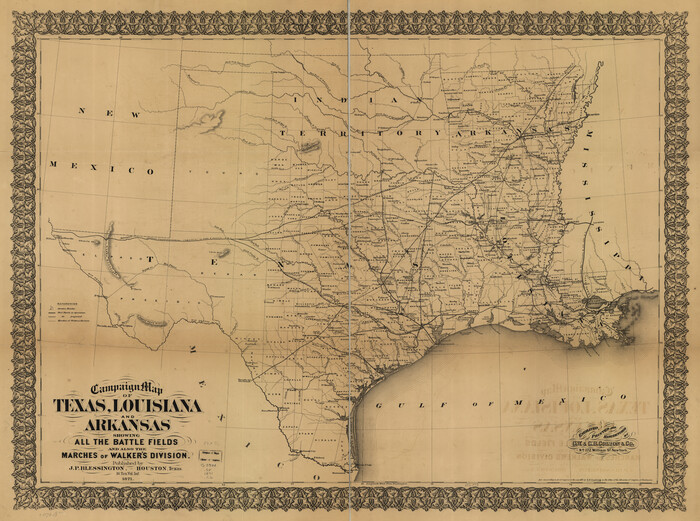
Campaign map of Texas, Louisiana and Arkansas, showing all the battle fields and also the marches of Walker's Division. [1861-65]
Print $20.00
Campaign map of Texas, Louisiana and Arkansas, showing all the battle fields and also the marches of Walker's Division. [1861-65]
1871
Size: 27.6 x 37.0 inches
93567
Carta General de la República Mexicana formada por Antonio García y Cubas

Print $40.00
Carta General de la República Mexicana formada por Antonio García y Cubas
1863
Size: 48.7 x 57.1 inches
95307
Carte de la côte de la Louisiane depuis la Baye St. Joseph, jusqu'à celle de St. Bernard où tous les ports et bons mouillages sont marquez par des ancres; avec la quantité de piés d'eau que l'on y trouve.

Print $20.00
Carte de la côte de la Louisiane depuis la Baye St. Joseph, jusqu'à celle de St. Bernard où tous les ports et bons mouillages sont marquez par des ancres; avec la quantité de piés d'eau que l'on y trouve.
1732
Size: 11.4 x 32.7 inches
93607
City and Harbor of Port Arthur Texas, Bird's Eye View Looking South to the Gulf of Mexico

Print $20.00
City and Harbor of Port Arthur Texas, Bird's Eye View Looking South to the Gulf of Mexico
1912
Size: 17.4 x 39.9 inches
93483
City of Houston and Environs

Print $20.00
City of Houston and Environs
1895
Size: 30.4 x 33.6 inches
93486
Clarendon, Texas, Donley Co.

Print $20.00
Clarendon, Texas, Donley Co.
1890
Size: 17.4 x 28.6 inches
93468
Colton's United States shewing the military stations, forts, &c

Print $20.00
Colton's United States shewing the military stations, forts, &c
1861
Size: 14.6 x 17.3 inches
93565
Colton's new map of the state of Texas, the Indian Territory and adjoining portions of New Mexico, Louisiana, and Arkansas

Print $20.00
Colton's new map of the state of Texas, the Indian Territory and adjoining portions of New Mexico, Louisiana, and Arkansas
1872
Size: 31.1 x 36.6 inches
93579
Colton's rail road and county map of the southern states containing the latest information.

Print $20.00
Colton's rail road and county map of the southern states containing the latest information.
1864
Size: 24.4 x 31.1 inches
93570
Corpus Christi and Rio Grande Railway Company

Print $20.00
Corpus Christi and Rio Grande Railway Company
Size: 14.6 x 24.0 inches
95314
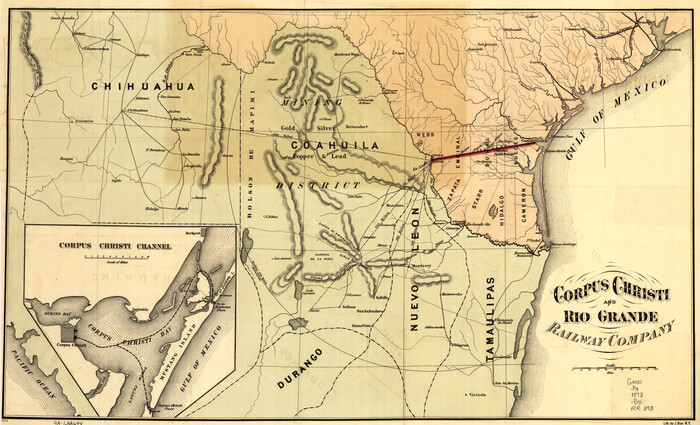
Corpus Christi and Rio Grande Railway Company, [map showing the proposed railroad between Laredo and Corpus Christi and its connections with Mexico]
Print $20.00
Corpus Christi and Rio Grande Railway Company, [map showing the proposed railroad between Laredo and Corpus Christi and its connections with Mexico]
1874
Size: 14.6 x 24.0 inches
93580
Croquis del terro, camino, bosques, barrancas, cerro y beredas de Cerro-gordo con las posiciones de las topas Mejicanas y Americanas con sus respectivos Generales Cuerpos y Baterias el dis 18 de Abril de 1847

Print $20.00
Croquis del terro, camino, bosques, barrancas, cerro y beredas de Cerro-gordo con las posiciones de las topas Mejicanas y Americanas con sus respectivos Generales Cuerpos y Baterias el dis 18 de Abril de 1847
1847
Size: 20.1 x 26.0 inches
97343
Dallas, Texas. With the Projected River and Navigation Improvements. Viewed from Above the Sister City of Oak Cliff

Print $20.00
Dallas, Texas. With the Projected River and Navigation Improvements. Viewed from Above the Sister City of Oak Cliff
1892
Size: 20.9 x 29.7 inches
93474
A Map of Mexico, Louisiana and the Missouri Territory, including also the State of Mississippi, Alabama Territory, East & West Florida, Georgia, South Carolina & part of the Island of Cuba
Print $40.00
A Map of Mexico, Louisiana and the Missouri Territory, including also the State of Mississippi, Alabama Territory, East & West Florida, Georgia, South Carolina & part of the Island of Cuba
-
Size
66.9 x 64.2 inches
-
Map/Doc
95312
A new and complete county map of all the rail roads in the United States & Canadas in operation & progress.
Print $20.00
A new and complete county map of all the rail roads in the United States & Canadas in operation & progress.
1857
-
Size
19.3 x 22.0 inches
-
Map/Doc
93606
-
Creation Date
1857
Aeroplane view of business district Amarillo, Texas
Print $20.00
Aeroplane view of business district Amarillo, Texas
1912
-
Size
18.9 x 21.4 inches
-
Map/Doc
93467
-
Creation Date
1912
Alvord, Texas

Print $20.00
Alvord, Texas
1890
-
Size
14.4 x 22.8 inches
-
Map/Doc
93471
-
Creation Date
1890
Bird's Eye View of El Paso
Print $20.00
Bird's Eye View of El Paso
1885
-
Size
20.0 x 30.0 inches
-
Map/Doc
93621
-
Creation Date
1885
Bissell's railway junction point map of Texas / especially designed and adapted for the computation of shortline distances in the application of freight rates promulgated by the Railroad Commission of Texas.
Print $20.00
Bissell's railway junction point map of Texas / especially designed and adapted for the computation of shortline distances in the application of freight rates promulgated by the Railroad Commission of Texas.
1891
-
Size
31.5 x 26.8 inches
-
Map/Doc
93600
-
Creation Date
1891
Borden County

Print $20.00
Borden County
1892
-
Size
24.5 x 19.4 inches
-
Map/Doc
88909
-
Creation Date
1892
Bosque Co[unty]
![88910, Bosque Co[unty], Library of Congress](https://historictexasmaps.com/wmedia_w700/maps/88910.tif.jpg)
Print $20.00
Bosque Co[unty]
1879
-
Size
24.7 x 29.3 inches
-
Map/Doc
88910
-
Creation Date
1879
Boundaries between Brownsville, Texas and Matamoros, Tam. (Mexico)
Print $20.00
Boundaries between Brownsville, Texas and Matamoros, Tam. (Mexico)
1910
-
Size
15.0 x 11.8 inches
-
Map/Doc
93559
-
Creation Date
1910
Bowie County

Print $20.00
Bowie County
1894
-
Size
17.5 x 22.4 inches
-
Map/Doc
88911
-
Creation Date
1894
Brazoria County

Print $20.00
Brazoria County
1877
-
Size
23.2 x 21.5 inches
-
Map/Doc
88912
-
Creation Date
1877
Butt's Map of Cooke County, Texas
Print $20.00
Butt's Map of Cooke County, Texas
1888
-
Size
17.5 x 14.5 inches
-
Map/Doc
88920
-
Creation Date
1888
Campaign map of Texas, Louisiana and Arkansas, showing all the battle fields and also the marches of Walker's Division. [1861-65]
Print $20.00
Campaign map of Texas, Louisiana and Arkansas, showing all the battle fields and also the marches of Walker's Division. [1861-65]
1871
-
Size
27.6 x 37.0 inches
-
Map/Doc
93567
-
Creation Date
1871
Carta General de la República Mexicana formada por Antonio García y Cubas
Print $40.00
Carta General de la República Mexicana formada por Antonio García y Cubas
1863
-
Size
48.7 x 57.1 inches
-
Map/Doc
95307
-
Creation Date
1863
Carte de la côte de la Louisiane depuis la Baye St. Joseph, jusqu'à celle de St. Bernard où tous les ports et bons mouillages sont marquez par des ancres; avec la quantité de piés d'eau que l'on y trouve.
Print $20.00
Carte de la côte de la Louisiane depuis la Baye St. Joseph, jusqu'à celle de St. Bernard où tous les ports et bons mouillages sont marquez par des ancres; avec la quantité de piés d'eau que l'on y trouve.
1732
-
Size
11.4 x 32.7 inches
-
Map/Doc
93607
-
Creation Date
1732
Childress, Texas

Print $20.00
Childress, Texas
1890
-
Size
28.9 x 40.9 inches
-
Map/Doc
93484
-
Creation Date
1890
City and Harbor of Port Arthur Texas, Bird's Eye View Looking South to the Gulf of Mexico
Print $20.00
City and Harbor of Port Arthur Texas, Bird's Eye View Looking South to the Gulf of Mexico
1912
-
Size
17.4 x 39.9 inches
-
Map/Doc
93483
-
Creation Date
1912
City of Houston and Environs
Print $20.00
City of Houston and Environs
1895
-
Size
30.4 x 33.6 inches
-
Map/Doc
93486
-
Creation Date
1895
Clarendon, Texas, Donley Co.
Print $20.00
Clarendon, Texas, Donley Co.
1890
-
Size
17.4 x 28.6 inches
-
Map/Doc
93468
-
Creation Date
1890
Collingsworth County

Print $20.00
Collingsworth County
1892
-
Size
24.5 x 19.4 inches
-
Map/Doc
88918
-
Creation Date
1892
Colton's United States shewing the military stations, forts, &c
Print $20.00
Colton's United States shewing the military stations, forts, &c
1861
-
Size
14.6 x 17.3 inches
-
Map/Doc
93565
-
Creation Date
1861
Colton's new map of the state of Texas, the Indian Territory and adjoining portions of New Mexico, Louisiana, and Arkansas
Print $20.00
Colton's new map of the state of Texas, the Indian Territory and adjoining portions of New Mexico, Louisiana, and Arkansas
1872
-
Size
31.1 x 36.6 inches
-
Map/Doc
93579
-
Creation Date
1872
Colton's rail road and county map of the southern states containing the latest information.
Print $20.00
Colton's rail road and county map of the southern states containing the latest information.
1864
-
Size
24.4 x 31.1 inches
-
Map/Doc
93570
-
Creation Date
1864
Corpus Christi and Rio Grande Railway Company
Print $20.00
Corpus Christi and Rio Grande Railway Company
-
Size
14.6 x 24.0 inches
-
Map/Doc
95314
Corpus Christi and Rio Grande Railway Company, [map showing the proposed railroad between Laredo and Corpus Christi and its connections with Mexico]
Print $20.00
Corpus Christi and Rio Grande Railway Company, [map showing the proposed railroad between Laredo and Corpus Christi and its connections with Mexico]
1874
-
Size
14.6 x 24.0 inches
-
Map/Doc
93580
-
Creation Date
1874
Croquis del terro, camino, bosques, barrancas, cerro y beredas de Cerro-gordo con las posiciones de las topas Mejicanas y Americanas con sus respectivos Generales Cuerpos y Baterias el dis 18 de Abril de 1847
Print $20.00
Croquis del terro, camino, bosques, barrancas, cerro y beredas de Cerro-gordo con las posiciones de las topas Mejicanas y Americanas con sus respectivos Generales Cuerpos y Baterias el dis 18 de Abril de 1847
1847
-
Size
20.1 x 26.0 inches
-
Map/Doc
97343
-
Creation Date
1847
Crosby County

Print $20.00
Crosby County
1892
-
Size
24.6 x 19.6 inches
-
Map/Doc
88921
-
Creation Date
1892
Dallam County

Print $20.00
Dallam County
1888
-
Size
25.1 x 28.2 inches
-
Map/Doc
88922
-
Creation Date
1888
Dallas, Texas. With the Projected River and Navigation Improvements. Viewed from Above the Sister City of Oak Cliff
Print $20.00
Dallas, Texas. With the Projected River and Navigation Improvements. Viewed from Above the Sister City of Oak Cliff
1892
-
Size
20.9 x 29.7 inches
-
Map/Doc
93474
-
Creation Date
1892
Dawson County

Print $20.00
Dawson County
1892
-
Size
24.4 x 19.5 inches
-
Map/Doc
88923
-
Creation Date
1892