A Plat of 23 Miles of the Colorado River
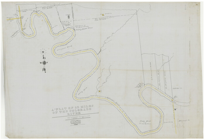
Print $40.00
- Digital $50.00
A Plat of 23 Miles of the Colorado River
1918
Size: 38.3 x 56.7 inches
65651
Brown County Sketch File 10

Print $40.00
- Digital $50.00
Brown County Sketch File 10
1868
Size: 17.4 x 22.3 inches
11019
Brown County Sketch File 15

Print $4.00
- Digital $50.00
Brown County Sketch File 15
1857
Size: 12.2 x 8.0 inches
16610
Brown County Sketch File X

Print $4.00
- Digital $50.00
Brown County Sketch File X
1882
Size: 8.1 x 11.7 inches
16580
Callahan County Sketch File 10

Print $40.00
- Digital $50.00
Callahan County Sketch File 10
Size: 21.7 x 24.7 inches
11039
Callahan County Sketch File 11

Print $64.00
- Digital $50.00
Callahan County Sketch File 11
Size: 11.4 x 8.4 inches
35887
Callahan County Sketch File 12

Print $40.00
- Digital $50.00
Callahan County Sketch File 12
1872
Size: 17.8 x 26.2 inches
11041
Callahan County Sketch File 2

Print $8.00
- Digital $50.00
Callahan County Sketch File 2
1858
Size: 11.8 x 8.7 inches
35853
Callahan County Working Sketch 1

Print $20.00
- Digital $50.00
Callahan County Working Sketch 1
1939
Size: 30.6 x 32.6 inches
67883
Coleman County Boundary File 17 (1)

Print $52.00
- Digital $50.00
Coleman County Boundary File 17 (1)
Size: 7.7 x 3.9 inches
51628
Coleman County Boundary File 17 (2)

Print $19.00
- Digital $50.00
Coleman County Boundary File 17 (2)
Size: 5.6 x 17.4 inches
51645
Coleman County Boundary File 17 (3)

Print $36.00
- Digital $50.00
Coleman County Boundary File 17 (3)
Size: 22.0 x 5.9 inches
51654
Coleman County Boundary File 17a

Print $84.00
- Digital $50.00
Coleman County Boundary File 17a
Size: 17.5 x 17.1 inches
51663
Coleman County Rolled Sketch 2

Print $20.00
- Digital $50.00
Coleman County Rolled Sketch 2
Size: 18.3 x 24.9 inches
5528
Coleman County Rolled Sketch 6

Print $20.00
- Digital $50.00
Coleman County Rolled Sketch 6
Size: 20.9 x 14.4 inches
5529
Coleman County Rolled Sketch 7

Print $20.00
- Digital $50.00
Coleman County Rolled Sketch 7
Size: 19.3 x 14.3 inches
5530
Coleman County Rolled Sketch 8

Print $40.00
- Digital $50.00
Coleman County Rolled Sketch 8
1951
Size: 58.8 x 40.8 inches
8634
Coleman County Sketch File 10

Print $20.00
- Digital $50.00
Coleman County Sketch File 10
1848
Size: 28.0 x 13.2 inches
11119
Coleman County Sketch File 10a

Print $24.00
- Digital $50.00
Coleman County Sketch File 10a
1859
Size: 12.4 x 8.1 inches
18678
Coleman County Sketch File 15

Print $4.00
- Digital $50.00
Coleman County Sketch File 15
1848
Size: 7.3 x 13.0 inches
18681
Coleman County Sketch File 16

Print $4.00
- Digital $50.00
Coleman County Sketch File 16
1849
Size: 9.6 x 8.3 inches
18683
A Plat of 23 Miles of the Colorado River
Print $40.00
- Digital $50.00
A Plat of 23 Miles of the Colorado River
1918
-
Size
38.3 x 56.7 inches
-
Map/Doc
65651
-
Creation Date
1918
Brown County Sketch File 10
Print $40.00
- Digital $50.00
Brown County Sketch File 10
1868
-
Size
17.4 x 22.3 inches
-
Map/Doc
11019
-
Creation Date
1868
Brown County Sketch File 15
Print $4.00
- Digital $50.00
Brown County Sketch File 15
1857
-
Size
12.2 x 8.0 inches
-
Map/Doc
16610
-
Creation Date
1857
Brown County Sketch File X
Print $4.00
- Digital $50.00
Brown County Sketch File X
1882
-
Size
8.1 x 11.7 inches
-
Map/Doc
16580
-
Creation Date
1882
Callahan County Sketch File 10
Print $40.00
- Digital $50.00
Callahan County Sketch File 10
-
Size
21.7 x 24.7 inches
-
Map/Doc
11039
Callahan County Sketch File 11
Print $64.00
- Digital $50.00
Callahan County Sketch File 11
-
Size
11.4 x 8.4 inches
-
Map/Doc
35887
Callahan County Sketch File 12
Print $40.00
- Digital $50.00
Callahan County Sketch File 12
1872
-
Size
17.8 x 26.2 inches
-
Map/Doc
11041
-
Creation Date
1872
Callahan County Sketch File 2
Print $8.00
- Digital $50.00
Callahan County Sketch File 2
1858
-
Size
11.8 x 8.7 inches
-
Map/Doc
35853
-
Creation Date
1858
Callahan County Working Sketch 1
Print $20.00
- Digital $50.00
Callahan County Working Sketch 1
1939
-
Size
30.6 x 32.6 inches
-
Map/Doc
67883
-
Creation Date
1939
Coleman Co.

Print $40.00
- Digital $50.00
Coleman Co.
1897
-
Size
50.4 x 39.2 inches
-
Map/Doc
4913
-
Creation Date
1897
Coleman County

Print $40.00
- Digital $50.00
Coleman County
1945
-
Size
54.9 x 37.1 inches
-
Map/Doc
1803
-
Creation Date
1945
Coleman County

Print $20.00
- Digital $50.00
Coleman County
1858
-
Size
25.2 x 22.5 inches
-
Map/Doc
3409
-
Creation Date
1858
Coleman County

Print $20.00
- Digital $50.00
Coleman County
1862
-
Size
22.5 x 21.6 inches
-
Map/Doc
3414
-
Creation Date
1862
Coleman County

Print $40.00
- Digital $50.00
Coleman County
1897
-
Size
49.4 x 34.9 inches
-
Map/Doc
66758
-
Creation Date
1897
Coleman County

Print $40.00
- Digital $50.00
Coleman County
1945
-
Size
54.7 x 37.1 inches
-
Map/Doc
73109
-
Creation Date
1945
Coleman County

Print $40.00
- Digital $50.00
Coleman County
1945
-
Size
54.5 x 35.4 inches
-
Map/Doc
77241
-
Creation Date
1945
Coleman County

Print $40.00
Coleman County
1949
-
Size
68.6 x 43.1 inches
-
Map/Doc
81518
-
Creation Date
1949
Coleman County

Print $40.00
- Digital $50.00
Coleman County
1945
-
Size
55.7 x 37.1 inches
-
Map/Doc
95458
-
Creation Date
1945
Coleman County Boundary File 17 (1)
Print $52.00
- Digital $50.00
Coleman County Boundary File 17 (1)
-
Size
7.7 x 3.9 inches
-
Map/Doc
51628
Coleman County Boundary File 17 (2)
Print $19.00
- Digital $50.00
Coleman County Boundary File 17 (2)
-
Size
5.6 x 17.4 inches
-
Map/Doc
51645
Coleman County Boundary File 17 (3)
Print $36.00
- Digital $50.00
Coleman County Boundary File 17 (3)
-
Size
22.0 x 5.9 inches
-
Map/Doc
51654
Coleman County Boundary File 17a
Print $84.00
- Digital $50.00
Coleman County Boundary File 17a
-
Size
17.5 x 17.1 inches
-
Map/Doc
51663
Coleman County Rolled Sketch 2
Print $20.00
- Digital $50.00
Coleman County Rolled Sketch 2
-
Size
18.3 x 24.9 inches
-
Map/Doc
5528
Coleman County Rolled Sketch 6
Print $20.00
- Digital $50.00
Coleman County Rolled Sketch 6
-
Size
20.9 x 14.4 inches
-
Map/Doc
5529
Coleman County Rolled Sketch 7
Print $20.00
- Digital $50.00
Coleman County Rolled Sketch 7
-
Size
19.3 x 14.3 inches
-
Map/Doc
5530
Coleman County Rolled Sketch 8
Print $40.00
- Digital $50.00
Coleman County Rolled Sketch 8
1951
-
Size
58.8 x 40.8 inches
-
Map/Doc
8634
-
Creation Date
1951
Coleman County Sketch File 10
Print $20.00
- Digital $50.00
Coleman County Sketch File 10
1848
-
Size
28.0 x 13.2 inches
-
Map/Doc
11119
-
Creation Date
1848
Coleman County Sketch File 10a
Print $24.00
- Digital $50.00
Coleman County Sketch File 10a
1859
-
Size
12.4 x 8.1 inches
-
Map/Doc
18678
-
Creation Date
1859
Coleman County Sketch File 15
Print $4.00
- Digital $50.00
Coleman County Sketch File 15
1848
-
Size
7.3 x 13.0 inches
-
Map/Doc
18681
-
Creation Date
1848
Coleman County Sketch File 16
Print $4.00
- Digital $50.00
Coleman County Sketch File 16
1849
-
Size
9.6 x 8.3 inches
-
Map/Doc
18683
-
Creation Date
1849