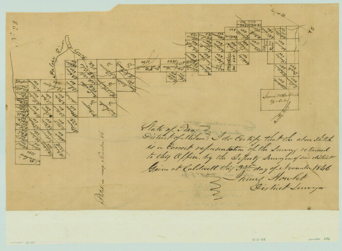
[Surveys along the Bosque River]
Print $3.00
- Digital $50.00
[Surveys along the Bosque River]
1846
Size: 9.4 x 12.8 inches
236
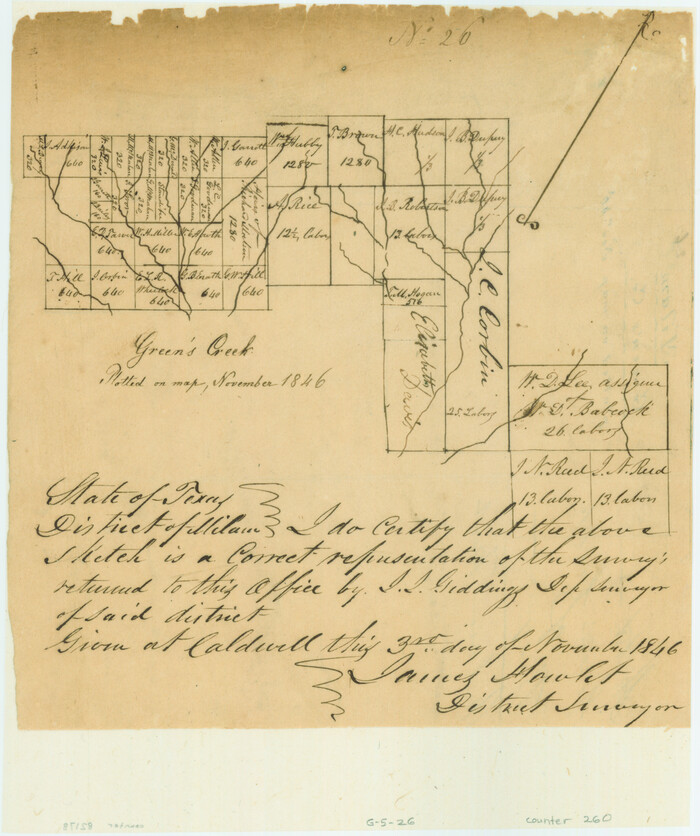
[Surveys along the Bosque River]
Print $2.00
- Digital $50.00
[Surveys along the Bosque River]
1846
Size: 9.3 x 7.8 inches
260
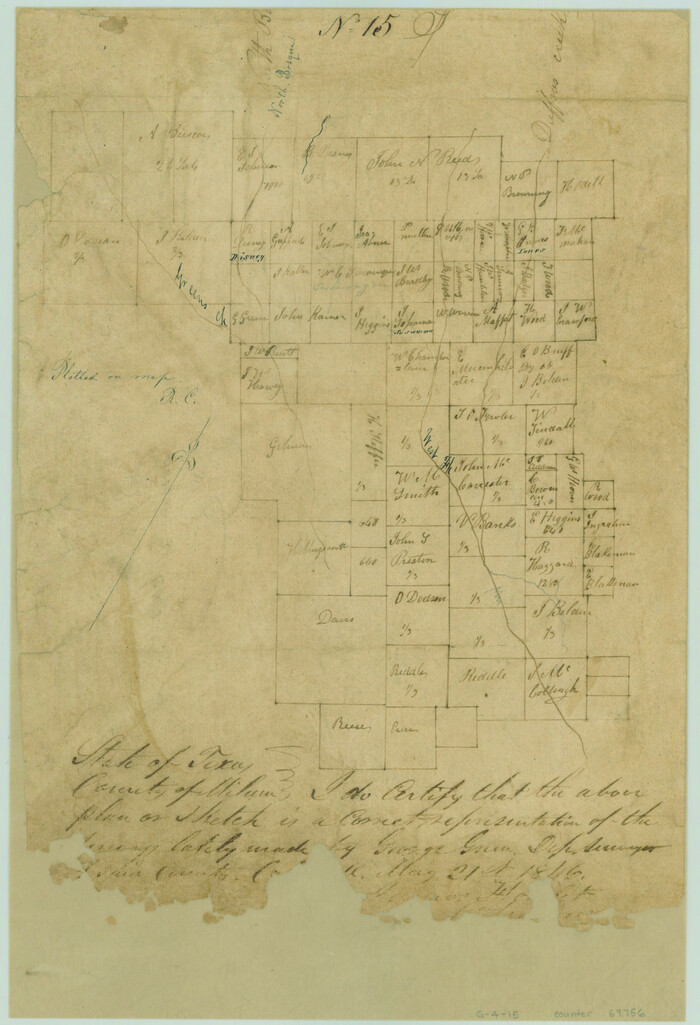
[Surveys along Green's Creek and the North Bosque River]
Print $2.00
- Digital $50.00
[Surveys along Green's Creek and the North Bosque River]
1846
Size: 11.9 x 8.1 inches
69756
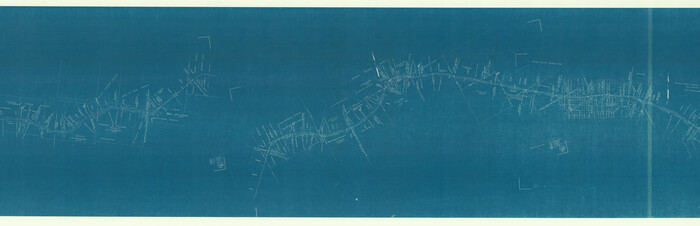
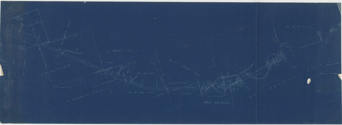
[Ft. W. & R. G. Ry. Right of Way Map, Chapin to Bluffdale, Hood County, Texas]
Print $40.00
- Digital $50.00
[Ft. W. & R. G. Ry. Right of Way Map, Chapin to Bluffdale, Hood County, Texas]
1918
Size: 38.8 x 120.3 inches
64643
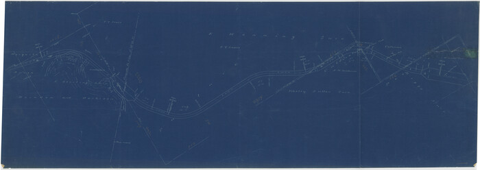
[Fort Worth & Rio Grande Ry.] Map, Tracings of Located Line, Dublin to Comanche
Print $20.00
- Digital $50.00
[Fort Worth & Rio Grande Ry.] Map, Tracings of Located Line, Dublin to Comanche
Size: 15.3 x 41.6 inches
64353
[Fort Worth & Rio Grande Ry.]
Print $20.00
- Digital $50.00
[Fort Worth & Rio Grande Ry.]
Size: 15.2 x 43.0 inches
64354
Somervell County Working Sketch 6

Print $20.00
- Digital $50.00
Somervell County Working Sketch 6
1992
Size: 23.2 x 21.5 inches
63910
Somervell County Working Sketch 5

Print $20.00
- Digital $50.00
Somervell County Working Sketch 5
1975
Size: 33.3 x 39.4 inches
63909
Somervell County Sketch File 6

Print $6.00
- Digital $50.00
Somervell County Sketch File 6
1939
Size: 13.6 x 8.6 inches
36847
Somervell County Rolled Sketch D

Print $20.00
- Digital $50.00
Somervell County Rolled Sketch D
1939
Size: 17.3 x 21.0 inches
7794
Somervell County Rolled Sketch A

Print $20.00
- Digital $50.00
Somervell County Rolled Sketch A
Size: 14.8 x 15.2 inches
75999
Representation of surveys on the waters of the Paluxy and Bosque in the crosstimbers in Milam District

Print $2.00
- Digital $50.00
Representation of surveys on the waters of the Paluxy and Bosque in the crosstimbers in Milam District
1847
Size: 13.9 x 8.0 inches
258
Plat of 39 7/10 Acres of Land Owned by W. D. Twichell

Print $2.00
- Digital $50.00
Plat of 39 7/10 Acres of Land Owned by W. D. Twichell
Size: 7.1 x 8.1 inches
92089
Palo Pinto County Working Sketch 15

Print $20.00
- Digital $50.00
Palo Pinto County Working Sketch 15
1971
Size: 26.4 x 30.8 inches
71398
Palo Pinto County Sketch File 3

Print $20.00
- Digital $50.00
Palo Pinto County Sketch File 3
1850
Size: 24.6 x 19.3 inches
12132
Map of the Recognised Line, M. El. P. & P. RR. from Texas & Arkansas State Line to Milam & Bexar Land District Line

Print $40.00
- Digital $50.00
Map of the Recognised Line, M. El. P. & P. RR. from Texas & Arkansas State Line to Milam & Bexar Land District Line
Size: 15.3 x 89.4 inches
64638
Map of Erath County

Print $20.00
- Digital $50.00
Map of Erath County
1856
Size: 22.4 x 28.0 inches
3519
Map of Erath County

Print $20.00
- Digital $50.00
Map of Erath County
1872
Size: 20.2 x 19.8 inches
3521
Map of Erath County

Print $20.00
- Digital $50.00
Map of Erath County
1872
Size: 21.0 x 19.4 inches
4537
Map of Erath County

Print $40.00
- Digital $50.00
Map of Erath County
1896
Size: 49.6 x 43.5 inches
4943
Map of Erath County

Print $40.00
- Digital $50.00
Map of Erath County
1896
Size: 48.6 x 45.1 inches
66821
Map of Erath County

Print $40.00
- Digital $50.00
Map of Erath County
1896
Size: 50.4 x 45.1 inches
7820
Hood County Working Sketch 9

Print $20.00
- Digital $50.00
Hood County Working Sketch 9
1972
Size: 28.0 x 31.7 inches
66203
Hood County Sketch File 27

Print $4.00
- Digital $50.00
Hood County Sketch File 27
1873
Size: 12.9 x 8.5 inches
26629
Hood County Sketch File 25

Print $12.00
- Digital $50.00
Hood County Sketch File 25
1958
Size: 11.3 x 8.9 inches
26623
Hood County Sketch File 24

Print $8.00
- Digital $50.00
Hood County Sketch File 24
1942
Size: 11.0 x 9.0 inches
26619
Hood County Sketch File 22a

Print $5.00
- Digital $50.00
Hood County Sketch File 22a
Size: 13.7 x 9.3 inches
26617
Hood County Sketch File 10

Print $20.00
- Digital $50.00
Hood County Sketch File 10
Size: 20.6 x 22.9 inches
11778
Hood County Sketch File 1

Print $5.00
- Digital $50.00
Hood County Sketch File 1
Size: 11.0 x 15.2 inches
26569
Hood County Rolled Sketch 2

Print $20.00
- Digital $50.00
Hood County Rolled Sketch 2
1958
Size: 18.0 x 27.4 inches
6219
[Surveys along the Bosque River]
Print $3.00
- Digital $50.00
[Surveys along the Bosque River]
1846
-
Size
9.4 x 12.8 inches
-
Map/Doc
236
-
Creation Date
1846
[Surveys along the Bosque River]
Print $2.00
- Digital $50.00
[Surveys along the Bosque River]
1846
-
Size
9.3 x 7.8 inches
-
Map/Doc
260
-
Creation Date
1846
[Surveys along Green's Creek and the North Bosque River]
Print $2.00
- Digital $50.00
[Surveys along Green's Creek and the North Bosque River]
1846
-
Size
11.9 x 8.1 inches
-
Map/Doc
69756
-
Creation Date
1846
[Ft. W. & R. G. Ry. Right of Way Map, Chapin to Bluffdale, Hood County, Texas]
Print $40.00
- Digital $50.00
[Ft. W. & R. G. Ry. Right of Way Map, Chapin to Bluffdale, Hood County, Texas]
1918
-
Size
38.8 x 120.3 inches
-
Map/Doc
64643
-
Creation Date
1918
[Fort Worth & Rio Grande Ry.] Map, Tracings of Located Line, Dublin to Comanche
Print $20.00
- Digital $50.00
[Fort Worth & Rio Grande Ry.] Map, Tracings of Located Line, Dublin to Comanche
-
Size
15.3 x 41.6 inches
-
Map/Doc
64353
[Fort Worth & Rio Grande Ry.]
Print $20.00
- Digital $50.00
[Fort Worth & Rio Grande Ry.]
-
Size
15.2 x 43.0 inches
-
Map/Doc
64354
Somervell County Working Sketch 6
Print $20.00
- Digital $50.00
Somervell County Working Sketch 6
1992
-
Size
23.2 x 21.5 inches
-
Map/Doc
63910
-
Creation Date
1992
Somervell County Working Sketch 5
Print $20.00
- Digital $50.00
Somervell County Working Sketch 5
1975
-
Size
33.3 x 39.4 inches
-
Map/Doc
63909
-
Creation Date
1975
Somervell County Sketch File 6
Print $6.00
- Digital $50.00
Somervell County Sketch File 6
1939
-
Size
13.6 x 8.6 inches
-
Map/Doc
36847
-
Creation Date
1939
Somervell County Rolled Sketch D
Print $20.00
- Digital $50.00
Somervell County Rolled Sketch D
1939
-
Size
17.3 x 21.0 inches
-
Map/Doc
7794
-
Creation Date
1939
Somervell County Rolled Sketch A
Print $20.00
- Digital $50.00
Somervell County Rolled Sketch A
-
Size
14.8 x 15.2 inches
-
Map/Doc
75999
Representation of surveys on the waters of the Paluxy and Bosque in the crosstimbers in Milam District
Print $2.00
- Digital $50.00
Representation of surveys on the waters of the Paluxy and Bosque in the crosstimbers in Milam District
1847
-
Size
13.9 x 8.0 inches
-
Map/Doc
258
-
Creation Date
1847
Plat of 39 7/10 Acres of Land Owned by W. D. Twichell
Print $2.00
- Digital $50.00
Plat of 39 7/10 Acres of Land Owned by W. D. Twichell
-
Size
7.1 x 8.1 inches
-
Map/Doc
92089
Palo Pinto County Working Sketch 15
Print $20.00
- Digital $50.00
Palo Pinto County Working Sketch 15
1971
-
Size
26.4 x 30.8 inches
-
Map/Doc
71398
-
Creation Date
1971
Palo Pinto County Sketch File 3
Print $20.00
- Digital $50.00
Palo Pinto County Sketch File 3
1850
-
Size
24.6 x 19.3 inches
-
Map/Doc
12132
-
Creation Date
1850
Map of the Recognised Line, M. El. P. & P. RR. from Texas & Arkansas State Line to Milam & Bexar Land District Line
Print $40.00
- Digital $50.00
Map of the Recognised Line, M. El. P. & P. RR. from Texas & Arkansas State Line to Milam & Bexar Land District Line
-
Size
15.3 x 89.4 inches
-
Map/Doc
64638
Map of Erath County
Print $20.00
- Digital $50.00
Map of Erath County
1856
-
Size
22.4 x 28.0 inches
-
Map/Doc
3519
-
Creation Date
1856
Map of Erath County
Print $20.00
- Digital $50.00
Map of Erath County
1872
-
Size
20.2 x 19.8 inches
-
Map/Doc
3521
-
Creation Date
1872
Map of Erath County
Print $20.00
- Digital $50.00
Map of Erath County
1872
-
Size
21.0 x 19.4 inches
-
Map/Doc
4537
-
Creation Date
1872
Map of Erath County
Print $40.00
- Digital $50.00
Map of Erath County
1896
-
Size
49.6 x 43.5 inches
-
Map/Doc
4943
-
Creation Date
1896
Map of Erath County
Print $40.00
- Digital $50.00
Map of Erath County
1896
-
Size
48.6 x 45.1 inches
-
Map/Doc
66821
-
Creation Date
1896
Map of Erath County
Print $40.00
- Digital $50.00
Map of Erath County
1896
-
Size
50.4 x 45.1 inches
-
Map/Doc
7820
-
Creation Date
1896
Hood County Working Sketch 9
Print $20.00
- Digital $50.00
Hood County Working Sketch 9
1972
-
Size
28.0 x 31.7 inches
-
Map/Doc
66203
-
Creation Date
1972
Hood County Sketch File 27
Print $4.00
- Digital $50.00
Hood County Sketch File 27
1873
-
Size
12.9 x 8.5 inches
-
Map/Doc
26629
-
Creation Date
1873
Hood County Sketch File 25
Print $12.00
- Digital $50.00
Hood County Sketch File 25
1958
-
Size
11.3 x 8.9 inches
-
Map/Doc
26623
-
Creation Date
1958
Hood County Sketch File 24
Print $8.00
- Digital $50.00
Hood County Sketch File 24
1942
-
Size
11.0 x 9.0 inches
-
Map/Doc
26619
-
Creation Date
1942
Hood County Sketch File 22a
Print $5.00
- Digital $50.00
Hood County Sketch File 22a
-
Size
13.7 x 9.3 inches
-
Map/Doc
26617
Hood County Sketch File 10
Print $20.00
- Digital $50.00
Hood County Sketch File 10
-
Size
20.6 x 22.9 inches
-
Map/Doc
11778
Hood County Sketch File 1
Print $5.00
- Digital $50.00
Hood County Sketch File 1
-
Size
11.0 x 15.2 inches
-
Map/Doc
26569
Hood County Rolled Sketch 2
Print $20.00
- Digital $50.00
Hood County Rolled Sketch 2
1958
-
Size
18.0 x 27.4 inches
-
Map/Doc
6219
-
Creation Date
1958