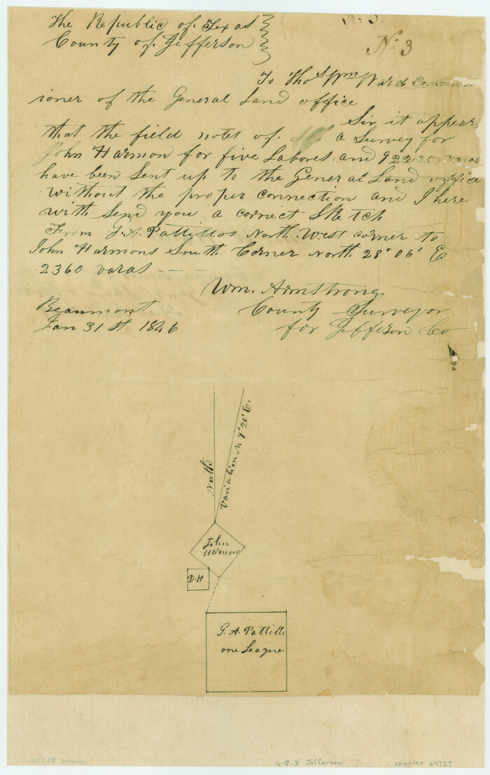
[Surveys in the Jefferson District: G. A. Patillo's league, Big Sandy, Sabine Bay]
Print $20.00
- Digital $50.00
[Surveys in the Jefferson District: G. A. Patillo's league, Big Sandy, Sabine Bay]
1846
Size: 14.4 x 20.9 inches
69727
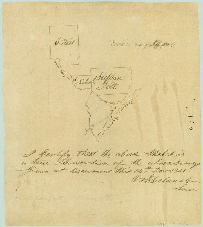
[Surveys in the Jefferson District on the Sabine River]
Print $2.00
- Digital $50.00
[Surveys in the Jefferson District on the Sabine River]
1841
Size: 8.7 x 7.8 inches
325
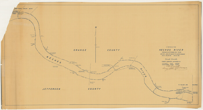
[Sketch for Mineral Application 14125 - Neches River, R. B. Moore]
Print $40.00
- Digital $50.00
[Sketch for Mineral Application 14125 - Neches River, R. B. Moore]
1928
Size: 26.1 x 50.0 inches
65667
[Sketch for Mineral Application 14125 - Neches River, R. B. Moore]
Print $40.00
- Digital $50.00
[Sketch for Mineral Application 14125 - Neches River, R. B. Moore]
1928
Size: 50.1 x 26.6 inches
65668
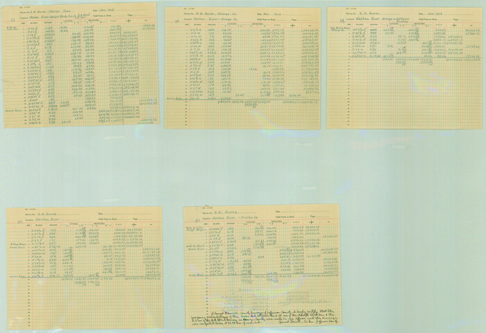
[Neches River Bed, Plat and Calculations]
Print $40.00
- Digital $50.00
[Neches River Bed, Plat and Calculations]
1928
Size: 27.3 x 51.0 inches
2466
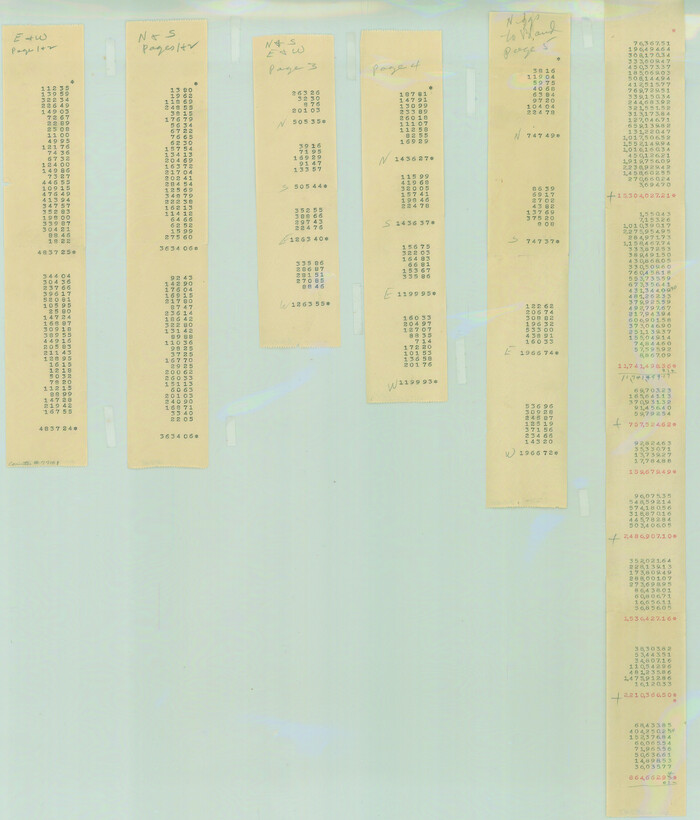
[Neches River Bed, Plat and Calculations]
Print $20.00
- Digital $50.00
[Neches River Bed, Plat and Calculations]
1928
Size: 25.6 x 37.2 inches
77100
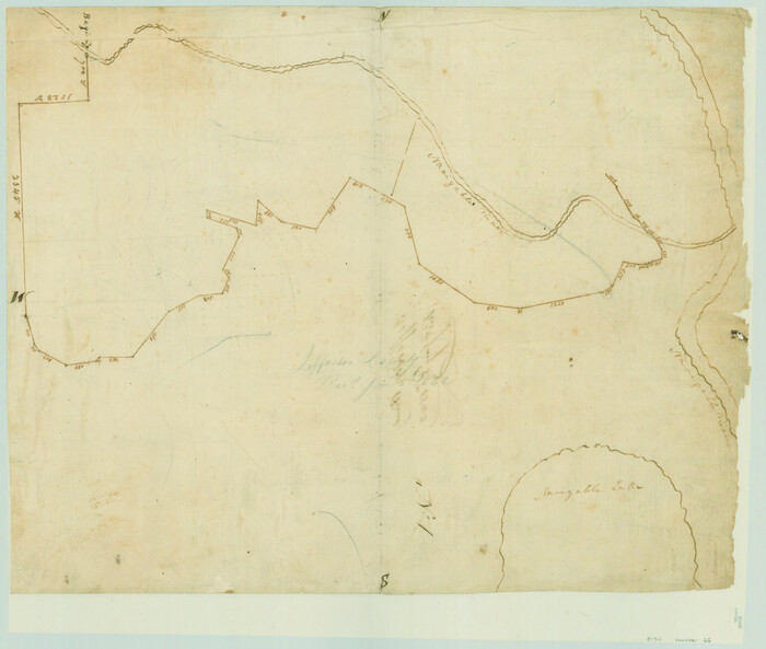
[Neches River Bed, Plat and Calculations]
Print $20.00
- Digital $50.00
[Neches River Bed, Plat and Calculations]
1928
Size: 23.2 x 19.8 inches
77101
[Meanders of a navigable river, perhaps Cow Bayou]
Print $20.00
- Digital $50.00
[Meanders of a navigable river, perhaps Cow Bayou]
1842
Size: 14.0 x 16.6 inches
66
Texas Gulf Coast from the Sabine River to the Rio Grande Showing Location of Navigation Districts

Print $20.00
- Digital $50.00
Texas Gulf Coast from the Sabine River to the Rio Grande Showing Location of Navigation Districts
1954
Size: 45.0 x 43.8 inches
73596
Sketches of Surveys in Jefferson County

Print $2.00
- Digital $50.00
Sketches of Surveys in Jefferson County
1841
Size: 7.5 x 7.0 inches
326
Sabine and Neches Rivers

Print $20.00
- Digital $50.00
Sabine and Neches Rivers
1925
Size: 19.6 x 44.0 inches
69816
Sabine and Neches Rivers

Print $20.00
- Digital $50.00
Sabine and Neches Rivers
1971
Size: 19.7 x 44.4 inches
69817
Sabine and Neches Rivers

Print $20.00
- Digital $50.00
Sabine and Neches Rivers
1973
Size: 19.7 x 44.6 inches
69818
Sabine and Neches Rivers

Print $20.00
- Digital $50.00
Sabine and Neches Rivers
1976
Size: 19.8 x 44.9 inches
69819
Sabine and Neches Rivers

Print $20.00
- Digital $50.00
Sabine and Neches Rivers
1987
Size: 19.6 x 44.7 inches
69820
Sabine Pass and mouth of the River Sabine in the sea

Print $20.00
- Digital $50.00
Sabine Pass and mouth of the River Sabine in the sea
1840
Size: 22.5 x 18.4 inches
65382
Sabine Pass and Lake

Print $20.00
- Digital $50.00
Sabine Pass and Lake
1925
Size: 43.6 x 28.0 inches
69821
Sabine Pass and Lake

Print $20.00
- Digital $50.00
Sabine Pass and Lake
1945
Size: 46.5 x 27.3 inches
69822
Sabine Pass and Lake

Print $20.00
- Digital $50.00
Sabine Pass and Lake
1958
Size: 47.1 x 27.5 inches
69823
Sabine Pass and Lake

Print $20.00
- Digital $50.00
Sabine Pass and Lake
1961
Size: 46.7 x 28.1 inches
69824
Sabine Pass and Lake

Print $20.00
- Digital $50.00
Sabine Pass and Lake
1971
Size: 47.0 x 27.5 inches
69825
Sabine Pass and Lake

Print $20.00
- Digital $50.00
Sabine Pass and Lake
1973
Size: 47.0 x 27.8 inches
69826
Sabine Pass and Lake

Print $20.00
- Digital $50.00
Sabine Pass and Lake
1975
Size: 46.9 x 27.8 inches
69827
Sabine Pass and Lake

Print $40.00
- Digital $50.00
Sabine Pass and Lake
1992
Size: 49.2 x 28.6 inches
69828
Revised map of west half of Sabine Lake and Sabine Pass, showing subdivision for mineral development; Jefferson and Orange Counties

Print $40.00
- Digital $50.00
Revised map of west half of Sabine Lake and Sabine Pass, showing subdivision for mineral development; Jefferson and Orange Counties
1979
Size: 72.1 x 41.5 inches
1935
Revised Map of West Half of Sabine Lake, Jefferson & Orange Cos., showing subdivision for mineral development

Print $40.00
- Digital $50.00
Revised Map of West Half of Sabine Lake, Jefferson & Orange Cos., showing subdivision for mineral development
1957
Size: 58.9 x 42.0 inches
2898
Preliminary Chart No. 31 of the Sea Coast of the United States from Galveston Bay to Matagorda Bay, Texas

Print $20.00
- Digital $50.00
Preliminary Chart No. 31 of the Sea Coast of the United States from Galveston Bay to Matagorda Bay, Texas
1857
Size: 22.7 x 38.7 inches
69949
Preliminary Chart No. 31 of the Sea Coast of the United States from Galveston Bay to Matagorda Bay, Texas

Print $20.00
- Digital $50.00
Preliminary Chart No. 31 of the Sea Coast of the United States from Galveston Bay to Matagorda Bay, Texas
1857
Size: 23.3 x 28.1 inches
69950
[Surveys in the Jefferson District: G. A. Patillo's league, Big Sandy, Sabine Bay]
Print $20.00
- Digital $50.00
[Surveys in the Jefferson District: G. A. Patillo's league, Big Sandy, Sabine Bay]
1846
-
Size
14.4 x 20.9 inches
-
Map/Doc
69727
-
Creation Date
1846
[Surveys in the Jefferson District on the Sabine River]
Print $2.00
- Digital $50.00
[Surveys in the Jefferson District on the Sabine River]
1841
-
Size
8.7 x 7.8 inches
-
Map/Doc
325
-
Creation Date
1841
[Sketch for Mineral Application 14125 - Neches River, R. B. Moore]
Print $40.00
- Digital $50.00
[Sketch for Mineral Application 14125 - Neches River, R. B. Moore]
1928
-
Size
26.1 x 50.0 inches
-
Map/Doc
65667
-
Creation Date
1928
[Sketch for Mineral Application 14125 - Neches River, R. B. Moore]
Print $40.00
- Digital $50.00
[Sketch for Mineral Application 14125 - Neches River, R. B. Moore]
1928
-
Size
50.1 x 26.6 inches
-
Map/Doc
65668
-
Creation Date
1928
[Sabine Pass]
![73343, [Sabine Pass], General Map Collection](https://historictexasmaps.com/wmedia_w700/maps/73343.tif.jpg)
Print $20.00
- Digital $50.00
[Sabine Pass]
1916
-
Size
18.5 x 26.5 inches
-
Map/Doc
73343
-
Creation Date
1916
[Sabine Pass]
![78263, [Sabine Pass], General Map Collection](https://historictexasmaps.com/wmedia_w700/maps/78263.tif.jpg)
Print $20.00
- Digital $50.00
[Sabine Pass]
1916
-
Size
29.2 x 42.1 inches
-
Map/Doc
78263
-
Creation Date
1916
[Neches River Bed, Plat and Calculations]
Print $40.00
- Digital $50.00
[Neches River Bed, Plat and Calculations]
1928
-
Size
27.3 x 51.0 inches
-
Map/Doc
2466
-
Creation Date
1928
[Neches River Bed, Plat and Calculations]
Print $20.00
- Digital $50.00
[Neches River Bed, Plat and Calculations]
1928
-
Size
25.6 x 37.2 inches
-
Map/Doc
77100
-
Creation Date
1928
[Neches River Bed, Plat and Calculations]
Print $20.00
- Digital $50.00
[Neches River Bed, Plat and Calculations]
1928
-
Size
23.2 x 19.8 inches
-
Map/Doc
77101
-
Creation Date
1928
[Meanders of a navigable river, perhaps Cow Bayou]
Print $20.00
- Digital $50.00
[Meanders of a navigable river, perhaps Cow Bayou]
1842
-
Size
14.0 x 16.6 inches
-
Map/Doc
66
-
Creation Date
1842
Texas Gulf Coast from the Sabine River to the Rio Grande Showing Location of Navigation Districts
Print $20.00
- Digital $50.00
Texas Gulf Coast from the Sabine River to the Rio Grande Showing Location of Navigation Districts
1954
-
Size
45.0 x 43.8 inches
-
Map/Doc
73596
-
Creation Date
1954
Sketches of Surveys in Jefferson County
Print $2.00
- Digital $50.00
Sketches of Surveys in Jefferson County
1841
-
Size
7.5 x 7.0 inches
-
Map/Doc
326
-
Creation Date
1841
Sabine and Neches Rivers
Print $20.00
- Digital $50.00
Sabine and Neches Rivers
1925
-
Size
19.6 x 44.0 inches
-
Map/Doc
69816
-
Creation Date
1925
Sabine and Neches Rivers
Print $20.00
- Digital $50.00
Sabine and Neches Rivers
1971
-
Size
19.7 x 44.4 inches
-
Map/Doc
69817
-
Creation Date
1971
Sabine and Neches Rivers
Print $20.00
- Digital $50.00
Sabine and Neches Rivers
1973
-
Size
19.7 x 44.6 inches
-
Map/Doc
69818
-
Creation Date
1973
Sabine and Neches Rivers
Print $20.00
- Digital $50.00
Sabine and Neches Rivers
1976
-
Size
19.8 x 44.9 inches
-
Map/Doc
69819
-
Creation Date
1976
Sabine and Neches Rivers
Print $20.00
- Digital $50.00
Sabine and Neches Rivers
1987
-
Size
19.6 x 44.7 inches
-
Map/Doc
69820
-
Creation Date
1987
Sabine Pass and mouth of the River Sabine in the sea
Print $20.00
- Digital $50.00
Sabine Pass and mouth of the River Sabine in the sea
1840
-
Size
22.5 x 18.4 inches
-
Map/Doc
65382
-
Creation Date
1840
Sabine Pass and Lake
Print $20.00
- Digital $50.00
Sabine Pass and Lake
1925
-
Size
43.6 x 28.0 inches
-
Map/Doc
69821
-
Creation Date
1925
Sabine Pass and Lake
Print $20.00
- Digital $50.00
Sabine Pass and Lake
1945
-
Size
46.5 x 27.3 inches
-
Map/Doc
69822
-
Creation Date
1945
Sabine Pass and Lake
Print $20.00
- Digital $50.00
Sabine Pass and Lake
1958
-
Size
47.1 x 27.5 inches
-
Map/Doc
69823
-
Creation Date
1958
Sabine Pass and Lake
Print $20.00
- Digital $50.00
Sabine Pass and Lake
1961
-
Size
46.7 x 28.1 inches
-
Map/Doc
69824
-
Creation Date
1961
Sabine Pass and Lake
Print $20.00
- Digital $50.00
Sabine Pass and Lake
1971
-
Size
47.0 x 27.5 inches
-
Map/Doc
69825
-
Creation Date
1971
Sabine Pass and Lake
Print $20.00
- Digital $50.00
Sabine Pass and Lake
1973
-
Size
47.0 x 27.8 inches
-
Map/Doc
69826
-
Creation Date
1973
Sabine Pass and Lake
Print $20.00
- Digital $50.00
Sabine Pass and Lake
1975
-
Size
46.9 x 27.8 inches
-
Map/Doc
69827
-
Creation Date
1975
Sabine Pass and Lake
Print $40.00
- Digital $50.00
Sabine Pass and Lake
1992
-
Size
49.2 x 28.6 inches
-
Map/Doc
69828
-
Creation Date
1992
Revised map of west half of Sabine Lake and Sabine Pass, showing subdivision for mineral development; Jefferson and Orange Counties
Print $40.00
- Digital $50.00
Revised map of west half of Sabine Lake and Sabine Pass, showing subdivision for mineral development; Jefferson and Orange Counties
1979
-
Size
72.1 x 41.5 inches
-
Map/Doc
1935
-
Creation Date
1979
Revised Map of West Half of Sabine Lake, Jefferson & Orange Cos., showing subdivision for mineral development
Print $40.00
- Digital $50.00
Revised Map of West Half of Sabine Lake, Jefferson & Orange Cos., showing subdivision for mineral development
1957
-
Size
58.9 x 42.0 inches
-
Map/Doc
2898
-
Creation Date
1957
Preliminary Chart No. 31 of the Sea Coast of the United States from Galveston Bay to Matagorda Bay, Texas
Print $20.00
- Digital $50.00
Preliminary Chart No. 31 of the Sea Coast of the United States from Galveston Bay to Matagorda Bay, Texas
1857
-
Size
22.7 x 38.7 inches
-
Map/Doc
69949
-
Creation Date
1857
Preliminary Chart No. 31 of the Sea Coast of the United States from Galveston Bay to Matagorda Bay, Texas
Print $20.00
- Digital $50.00
Preliminary Chart No. 31 of the Sea Coast of the United States from Galveston Bay to Matagorda Bay, Texas
1857
-
Size
23.3 x 28.1 inches
-
Map/Doc
69950
-
Creation Date
1857