[Young Territory]

Print $40.00
- Digital $50.00
[Young Territory]
1875
Size: 49.0 x 87.4 inches
16784
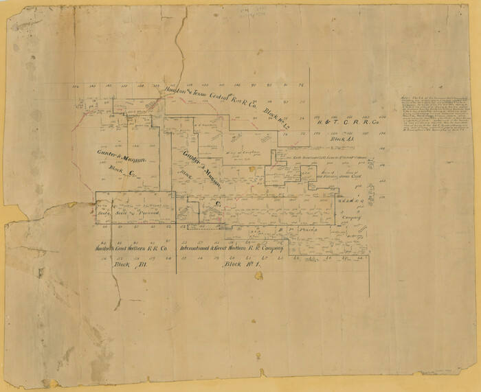
[Surveying Sketch of Houston and Texas Central R. R. Co., Gunter & Munson, Houston & Great Northern R. R. Co., International & Great Northern R. R. Company, et al]
Print $20.00
- Digital $50.00
[Surveying Sketch of Houston and Texas Central R. R. Co., Gunter & Munson, Houston & Great Northern R. R. Co., International & Great Northern R. R. Company, et al]
Size: 23.1 x 28.3 inches
75763
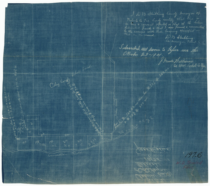
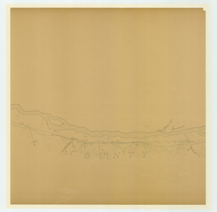
[Sketch showing the area around the state line in Roberts and Clay Counties, along the north bank of the Canadian River]
Print $20.00
- Digital $50.00
[Sketch showing the area around the state line in Roberts and Clay Counties, along the north bank of the Canadian River]
1901
Size: 14.3 x 12.7 inches
91762
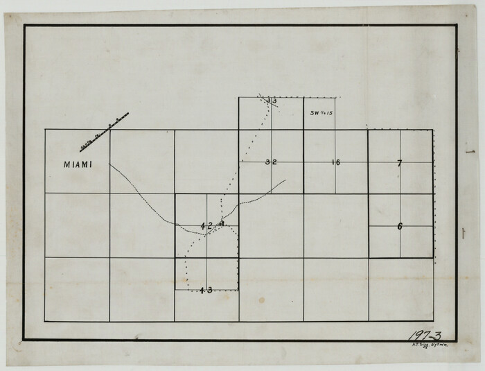
[Sketch showing sections 6, 7, 16, 32, 42 and 43]
Print $3.00
- Digital $50.00
[Sketch showing sections 6, 7, 16, 32, 42 and 43]
Size: 14.5 x 11.2 inches
91775
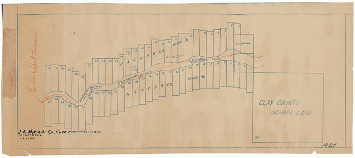
[Sketch showing H. & G. N. Block A on the north side of the Canadian River and H. & T. C. Block 46 on the south side of the Canadian River]
Print $20.00
- Digital $50.00
[Sketch showing H. & G. N. Block A on the north side of the Canadian River and H. & T. C. Block 46 on the south side of the Canadian River]
1927
Size: 25.1 x 11.2 inches
91763
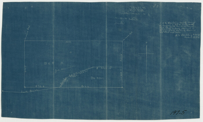
[Sketch showing Block H, Section 11 of Roberts County, including the south bank of the Canadian River]
Print $2.00
- Digital $50.00
[Sketch showing Block H, Section 11 of Roberts County, including the south bank of the Canadian River]
1919
Size: 14.4 x 8.8 inches
91761
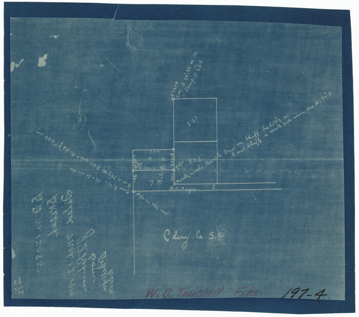
[Sketch showing Block 42, Sections 221 and 222 and Block H, Sections 7 and 9]
Print $2.00
- Digital $50.00
[Sketch showing Block 42, Sections 221 and 222 and Block H, Sections 7 and 9]
1919
Size: 5.6 x 5.0 inches
91714
[North and West Line of Gray County, North Line of Wheeler County]
Print $40.00
- Digital $50.00
[North and West Line of Gray County, North Line of Wheeler County]
Size: 43.4 x 71.6 inches
89943
[Location Survey of the Southern Kansas Railway, Kiowa Extension from a point in Drake's Location, in Indian Territory 100 miles from south line of Kansas, continuing up Wolf Creek and South Canadian River to Cottonwood Creek in Hutchinson County]
Print $20.00
- Digital $50.00
[Location Survey of the Southern Kansas Railway, Kiowa Extension from a point in Drake's Location, in Indian Territory 100 miles from south line of Kansas, continuing up Wolf Creek and South Canadian River to Cottonwood Creek in Hutchinson County]
1886
Size: 39.0 x 42.0 inches
88842
[Location Survey of the Southern Kansas Railway, Kiowa Extension from a point in Drake's Location, in Indian Territory 100 miles from south line of Kansas, continuing up Wolf Creek and South Canadian River to Cottonwood Creek in Hutchinson County]
Print $20.00
- Digital $50.00
[Location Survey of the Southern Kansas Railway, Kiowa Extension from a point in Drake's Location, in Indian Territory 100 miles from south line of Kansas, continuing up Wolf Creek and South Canadian River to Cottonwood Creek in Hutchinson County]
1886
Size: 39.0 x 40.0 inches
88843
[Location Survey of the Southern Kansas Railway, Kiowa Extension from a point in Drake's Location, in Indian Territory 100 miles from south line of Kansas, continuing up Wolf Creek and South Canadian River to Cottonwood Creek in Hutchinson County]
Print $20.00
- Digital $50.00
[Location Survey of the Southern Kansas Railway, Kiowa Extension from a point in Drake's Location, in Indian Territory 100 miles from south line of Kansas, continuing up Wolf Creek and South Canadian River to Cottonwood Creek in Hutchinson County]
1886
Size: 39.0 x 40.0 inches
88844
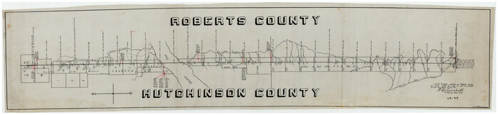
[County Line, Roberts and Hutchinson County]
Print $20.00
- Digital $50.00
[County Line, Roberts and Hutchinson County]
1907
Size: 33.7 x 7.7 inches
91184
Working Sketch in Roberts County, H. & G. N. RR Surveys, Block A

Print $20.00
- Digital $50.00
Working Sketch in Roberts County, H. & G. N. RR Surveys, Block A
1922
Size: 17.8 x 18.2 inches
91767
Sketch of H. & T. C. RR. Co. Lands on the Canadian River in Oldham and Wheeler Districts

Print $40.00
- Digital $50.00
Sketch of H. & T. C. RR. Co. Lands on the Canadian River in Oldham and Wheeler Districts
1884
Size: 88.9 x 23.8 inches
93193
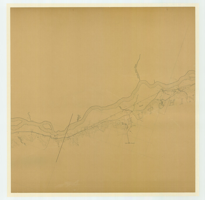
Sketch in NE Portion Hutchinson County

Print $20.00
- Digital $50.00
Sketch in NE Portion Hutchinson County
1913
Size: 36.9 x 43.3 inches
75815
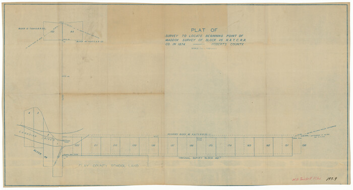
S/L Blk. 42 & H&TC Pt. of W/L[Sketch showing H. & T. C. Blocks 42 and 46]
Print $20.00
- Digital $50.00
S/L Blk. 42 & H&TC Pt. of W/L[Sketch showing H. & T. C. Blocks 42 and 46]
Size: 35.2 x 19.3 inches
91765
Roberts County, Texas

Print $20.00
- Digital $50.00
Roberts County, Texas
1878
Size: 19.2 x 18.5 inches
749
Roberts County, State of Texas

Print $20.00
Roberts County, State of Texas
1888
Size: 21.6 x 16.4 inches
88990
Roberts County Working Sketch Graphic Index

Print $20.00
- Digital $50.00
Roberts County Working Sketch Graphic Index
1932
Size: 41.2 x 37.3 inches
76684
Roberts County Working Sketch 9

Print $20.00
- Digital $50.00
Roberts County Working Sketch 9
1964
Size: 24.3 x 36.5 inches
63535
Roberts County Working Sketch 8

Print $20.00
- Digital $50.00
Roberts County Working Sketch 8
1963
Size: 21.9 x 26.0 inches
63534
Roberts County Working Sketch 7

Print $20.00
- Digital $50.00
Roberts County Working Sketch 7
1954
Size: 25.1 x 33.3 inches
63533
Roberts County Working Sketch 6

Print $20.00
- Digital $50.00
Roberts County Working Sketch 6
1952
Size: 29.3 x 21.9 inches
63532
Roberts County Working Sketch 5

Print $20.00
- Digital $50.00
Roberts County Working Sketch 5
1949
Size: 40.4 x 40.1 inches
63531
Roberts County Working Sketch 47

Print $20.00
- Digital $50.00
Roberts County Working Sketch 47
1996
Size: 19.6 x 34.7 inches
63573
Roberts County Working Sketch 46

Print $20.00
- Digital $50.00
Roberts County Working Sketch 46
1979
Size: 19.4 x 28.3 inches
63572
Roberts County Working Sketch 45

Print $20.00
- Digital $50.00
Roberts County Working Sketch 45
1979
Size: 23.7 x 20.0 inches
63571
Roberts County Working Sketch 44

Print $20.00
- Digital $50.00
Roberts County Working Sketch 44
1991
Size: 26.8 x 42.6 inches
63570
Roberts County Working Sketch 43

Print $20.00
- Digital $50.00
Roberts County Working Sketch 43
1990
Size: 19.3 x 37.6 inches
63569
[Young Territory]
Print $40.00
- Digital $50.00
[Young Territory]
1875
-
Size
49.0 x 87.4 inches
-
Map/Doc
16784
-
Creation Date
1875
[Surveying Sketch of Houston and Texas Central R. R. Co., Gunter & Munson, Houston & Great Northern R. R. Co., International & Great Northern R. R. Company, et al]
Print $20.00
- Digital $50.00
[Surveying Sketch of Houston and Texas Central R. R. Co., Gunter & Munson, Houston & Great Northern R. R. Co., International & Great Northern R. R. Company, et al]
-
Size
23.1 x 28.3 inches
-
Map/Doc
75763
[Sketch showing the area around the state line in Roberts and Clay Counties, along the north bank of the Canadian River]
Print $20.00
- Digital $50.00
[Sketch showing the area around the state line in Roberts and Clay Counties, along the north bank of the Canadian River]
1901
-
Size
14.3 x 12.7 inches
-
Map/Doc
91762
-
Creation Date
1901
[Sketch showing sections 6, 7, 16, 32, 42 and 43]
Print $3.00
- Digital $50.00
[Sketch showing sections 6, 7, 16, 32, 42 and 43]
-
Size
14.5 x 11.2 inches
-
Map/Doc
91775
[Sketch showing H. & G. N. Block A on the north side of the Canadian River and H. & T. C. Block 46 on the south side of the Canadian River]
Print $20.00
- Digital $50.00
[Sketch showing H. & G. N. Block A on the north side of the Canadian River and H. & T. C. Block 46 on the south side of the Canadian River]
1927
-
Size
25.1 x 11.2 inches
-
Map/Doc
91763
-
Creation Date
1927
[Sketch showing Block H, Section 11 of Roberts County, including the south bank of the Canadian River]
Print $2.00
- Digital $50.00
[Sketch showing Block H, Section 11 of Roberts County, including the south bank of the Canadian River]
1919
-
Size
14.4 x 8.8 inches
-
Map/Doc
91761
-
Creation Date
1919
[Sketch showing Block 42, Sections 221 and 222 and Block H, Sections 7 and 9]
Print $2.00
- Digital $50.00
[Sketch showing Block 42, Sections 221 and 222 and Block H, Sections 7 and 9]
1919
-
Size
5.6 x 5.0 inches
-
Map/Doc
91714
-
Creation Date
1919
[North and West Line of Gray County, North Line of Wheeler County]
Print $40.00
- Digital $50.00
[North and West Line of Gray County, North Line of Wheeler County]
-
Size
43.4 x 71.6 inches
-
Map/Doc
89943
[Location Survey of the Southern Kansas Railway, Kiowa Extension from a point in Drake's Location, in Indian Territory 100 miles from south line of Kansas, continuing up Wolf Creek and South Canadian River to Cottonwood Creek in Hutchinson County]
Print $20.00
- Digital $50.00
[Location Survey of the Southern Kansas Railway, Kiowa Extension from a point in Drake's Location, in Indian Territory 100 miles from south line of Kansas, continuing up Wolf Creek and South Canadian River to Cottonwood Creek in Hutchinson County]
1886
-
Size
39.0 x 42.0 inches
-
Map/Doc
88842
-
Creation Date
1886
[Location Survey of the Southern Kansas Railway, Kiowa Extension from a point in Drake's Location, in Indian Territory 100 miles from south line of Kansas, continuing up Wolf Creek and South Canadian River to Cottonwood Creek in Hutchinson County]
Print $20.00
- Digital $50.00
[Location Survey of the Southern Kansas Railway, Kiowa Extension from a point in Drake's Location, in Indian Territory 100 miles from south line of Kansas, continuing up Wolf Creek and South Canadian River to Cottonwood Creek in Hutchinson County]
1886
-
Size
39.0 x 40.0 inches
-
Map/Doc
88843
-
Creation Date
1886
[Location Survey of the Southern Kansas Railway, Kiowa Extension from a point in Drake's Location, in Indian Territory 100 miles from south line of Kansas, continuing up Wolf Creek and South Canadian River to Cottonwood Creek in Hutchinson County]
Print $20.00
- Digital $50.00
[Location Survey of the Southern Kansas Railway, Kiowa Extension from a point in Drake's Location, in Indian Territory 100 miles from south line of Kansas, continuing up Wolf Creek and South Canadian River to Cottonwood Creek in Hutchinson County]
1886
-
Size
39.0 x 40.0 inches
-
Map/Doc
88844
-
Creation Date
1886
[County Line, Roberts and Hutchinson County]
Print $20.00
- Digital $50.00
[County Line, Roberts and Hutchinson County]
1907
-
Size
33.7 x 7.7 inches
-
Map/Doc
91184
-
Creation Date
1907
Working Sketch in Roberts County, H. & G. N. RR Surveys, Block A
Print $20.00
- Digital $50.00
Working Sketch in Roberts County, H. & G. N. RR Surveys, Block A
1922
-
Size
17.8 x 18.2 inches
-
Map/Doc
91767
-
Creation Date
1922
Sketch of H. & T. C. RR. Co. Lands on the Canadian River in Oldham and Wheeler Districts
Print $40.00
- Digital $50.00
Sketch of H. & T. C. RR. Co. Lands on the Canadian River in Oldham and Wheeler Districts
1884
-
Size
88.9 x 23.8 inches
-
Map/Doc
93193
-
Creation Date
1884
Sketch in NE Portion Hutchinson County
Print $20.00
- Digital $50.00
Sketch in NE Portion Hutchinson County
1913
-
Size
36.9 x 43.3 inches
-
Map/Doc
75815
-
Creation Date
1913
S/L Blk. 42 & H&TC Pt. of W/L[Sketch showing H. & T. C. Blocks 42 and 46]
Print $20.00
- Digital $50.00
S/L Blk. 42 & H&TC Pt. of W/L[Sketch showing H. & T. C. Blocks 42 and 46]
-
Size
35.2 x 19.3 inches
-
Map/Doc
91765
Roberts County, Texas
Print $20.00
- Digital $50.00
Roberts County, Texas
1878
-
Size
19.2 x 18.5 inches
-
Map/Doc
749
-
Creation Date
1878
Roberts County, State of Texas
Print $20.00
Roberts County, State of Texas
1888
-
Size
21.6 x 16.4 inches
-
Map/Doc
88990
-
Creation Date
1888
Roberts County Working Sketch Graphic Index
Print $20.00
- Digital $50.00
Roberts County Working Sketch Graphic Index
1932
-
Size
41.2 x 37.3 inches
-
Map/Doc
76684
-
Creation Date
1932
Roberts County Working Sketch 9
Print $20.00
- Digital $50.00
Roberts County Working Sketch 9
1964
-
Size
24.3 x 36.5 inches
-
Map/Doc
63535
-
Creation Date
1964
Roberts County Working Sketch 8
Print $20.00
- Digital $50.00
Roberts County Working Sketch 8
1963
-
Size
21.9 x 26.0 inches
-
Map/Doc
63534
-
Creation Date
1963
Roberts County Working Sketch 7
Print $20.00
- Digital $50.00
Roberts County Working Sketch 7
1954
-
Size
25.1 x 33.3 inches
-
Map/Doc
63533
-
Creation Date
1954
Roberts County Working Sketch 6
Print $20.00
- Digital $50.00
Roberts County Working Sketch 6
1952
-
Size
29.3 x 21.9 inches
-
Map/Doc
63532
-
Creation Date
1952
Roberts County Working Sketch 5
Print $20.00
- Digital $50.00
Roberts County Working Sketch 5
1949
-
Size
40.4 x 40.1 inches
-
Map/Doc
63531
-
Creation Date
1949
Roberts County Working Sketch 47
Print $20.00
- Digital $50.00
Roberts County Working Sketch 47
1996
-
Size
19.6 x 34.7 inches
-
Map/Doc
63573
-
Creation Date
1996
Roberts County Working Sketch 46
Print $20.00
- Digital $50.00
Roberts County Working Sketch 46
1979
-
Size
19.4 x 28.3 inches
-
Map/Doc
63572
-
Creation Date
1979
Roberts County Working Sketch 45
Print $20.00
- Digital $50.00
Roberts County Working Sketch 45
1979
-
Size
23.7 x 20.0 inches
-
Map/Doc
63571
-
Creation Date
1979
Roberts County Working Sketch 44
Print $20.00
- Digital $50.00
Roberts County Working Sketch 44
1991
-
Size
26.8 x 42.6 inches
-
Map/Doc
63570
-
Creation Date
1991
Roberts County Working Sketch 43
Print $20.00
- Digital $50.00
Roberts County Working Sketch 43
1990
-
Size
19.3 x 37.6 inches
-
Map/Doc
63569
-
Creation Date
1990