Fisher County Sketch File 1

Print $20.00
- Digital $50.00
Fisher County Sketch File 1
Size: 43.5 x 18.3 inches
10448
Fisher County Sketch File 5

Print $20.00
- Digital $50.00
Fisher County Sketch File 5
1887
Size: 35.3 x 47.6 inches
10449
Garza County Sketch File 5a

Print $20.00
- Digital $50.00
Garza County Sketch File 5a
1895
Size: 20.7 x 38.2 inches
10463
Nolan County Sketch File 2

Print $40.00
- Digital $50.00
Nolan County Sketch File 2
Size: 49.5 x 41.6 inches
10556
Fisher County Sketch File 10

Print $20.00
- Digital $50.00
Fisher County Sketch File 10
Size: 9.7 x 37.0 inches
11477
Garza County Sketch File 15

Print $20.00
- Digital $50.00
Garza County Sketch File 15
1902
Size: 16.8 x 14.7 inches
11545
Garza County Sketch File D

Print $20.00
- Digital $50.00
Garza County Sketch File D
1901
Size: 18.4 x 12.2 inches
11550
Garza County Sketch File D1

Print $20.00
- Digital $50.00
Garza County Sketch File D1
1901
Size: 14.9 x 27.3 inches
11551
Scurry County Sketch File 3

Print $20.00
- Digital $50.00
Scurry County Sketch File 3
Size: 22.0 x 24.2 inches
12312
Borden County Sketch File 3

Print $4.00
- Digital $50.00
Borden County Sketch File 3
1902
Size: 7.3 x 12.8 inches
14703
Map of Scurry County

Print $20.00
- Digital $50.00
Map of Scurry County
1899
Size: 39.7 x 33.6 inches
16812
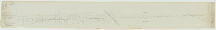
[Plat No. 1, Connecting line from SW corner of Jones Co. to SE corner of Borden Co.]
Print $40.00
- Digital $50.00
[Plat No. 1, Connecting line from SW corner of Jones Co. to SE corner of Borden Co.]
1908
Size: 18.1 x 128.8 inches
1698
Sketch showing county lines of Lynn, Garza, Borden, Scurry

Print $40.00
- Digital $50.00
Sketch showing county lines of Lynn, Garza, Borden, Scurry
1961
Size: 23.9 x 79.9 inches
1719
Map of Southeastern Part of Young Territory

Print $40.00
- Digital $50.00
Map of Southeastern Part of Young Territory
1874
Size: 54.7 x 30.1 inches
1989
Fisher County Sketch File 12

Print $22.00
- Digital $50.00
Fisher County Sketch File 12
1893
Size: 9.0 x 7.0 inches
22577
Garza County Sketch File C1

Print $10.00
- Digital $50.00
Garza County Sketch File C1
1900
Size: 12.9 x 8.1 inches
24015
Garza County Sketch File 6

Print $8.00
- Digital $50.00
Garza County Sketch File 6
1900
Size: 14.2 x 8.7 inches
24056
Scurry County Sketch File 1

Print $6.00
- Digital $50.00
Scurry County Sketch File 1
Size: 14.5 x 9.1 inches
36560
Scurry County Sketch File 2

Print $4.00
- Digital $50.00
Scurry County Sketch File 2
1888
Size: 13.2 x 7.4 inches
36563
Scurry County Sketch File 4

Print $26.00
- Digital $50.00
Scurry County Sketch File 4
1881
Size: 13.1 x 8.5 inches
36565
Scurry County Sketch File 5

Print $4.00
- Digital $50.00
Scurry County Sketch File 5
1990
Size: 14.4 x 8.9 inches
36568
Map of Alabama and Texas Cattle Co's Pasture

Print $20.00
- Digital $50.00
Map of Alabama and Texas Cattle Co's Pasture
Size: 17.6 x 18.1 inches
5064
Borden County Rolled Sketch 8

Print $20.00
- Digital $50.00
Borden County Rolled Sketch 8
1951
Size: 23.8 x 28.6 inches
5159
Scurry County Boundary File 1

Print $74.00
- Digital $50.00
Scurry County Boundary File 1
Size: 9.2 x 3.8 inches
58597
Nolan County, Texas

Print $20.00
- Digital $50.00
Nolan County, Texas
1880
Size: 29.5 x 22.7 inches
588
Fisher County Sketch File 1
Print $20.00
- Digital $50.00
Fisher County Sketch File 1
-
Size
43.5 x 18.3 inches
-
Map/Doc
10448
Fisher County Sketch File 5
Print $20.00
- Digital $50.00
Fisher County Sketch File 5
1887
-
Size
35.3 x 47.6 inches
-
Map/Doc
10449
-
Creation Date
1887
Garza County Sketch File 5a
Print $20.00
- Digital $50.00
Garza County Sketch File 5a
1895
-
Size
20.7 x 38.2 inches
-
Map/Doc
10463
-
Creation Date
1895
Nolan County Sketch File 2
Print $40.00
- Digital $50.00
Nolan County Sketch File 2
-
Size
49.5 x 41.6 inches
-
Map/Doc
10556
Fisher County Sketch File 10
Print $20.00
- Digital $50.00
Fisher County Sketch File 10
-
Size
9.7 x 37.0 inches
-
Map/Doc
11477
Garza County Sketch File 15
Print $20.00
- Digital $50.00
Garza County Sketch File 15
1902
-
Size
16.8 x 14.7 inches
-
Map/Doc
11545
-
Creation Date
1902
Garza County Sketch File D
Print $20.00
- Digital $50.00
Garza County Sketch File D
1901
-
Size
18.4 x 12.2 inches
-
Map/Doc
11550
-
Creation Date
1901
Garza County Sketch File D1
Print $20.00
- Digital $50.00
Garza County Sketch File D1
1901
-
Size
14.9 x 27.3 inches
-
Map/Doc
11551
-
Creation Date
1901
Scurry County Sketch File 3
Print $20.00
- Digital $50.00
Scurry County Sketch File 3
-
Size
22.0 x 24.2 inches
-
Map/Doc
12312
Borden County Sketch File 3
Print $4.00
- Digital $50.00
Borden County Sketch File 3
1902
-
Size
7.3 x 12.8 inches
-
Map/Doc
14703
-
Creation Date
1902
Map of Scurry County
Print $20.00
- Digital $50.00
Map of Scurry County
1899
-
Size
39.7 x 33.6 inches
-
Map/Doc
16812
-
Creation Date
1899
[Plat No. 1, Connecting line from SW corner of Jones Co. to SE corner of Borden Co.]
Print $40.00
- Digital $50.00
[Plat No. 1, Connecting line from SW corner of Jones Co. to SE corner of Borden Co.]
1908
-
Size
18.1 x 128.8 inches
-
Map/Doc
1698
-
Creation Date
1908
Sketch showing county lines of Lynn, Garza, Borden, Scurry
Print $40.00
- Digital $50.00
Sketch showing county lines of Lynn, Garza, Borden, Scurry
1961
-
Size
23.9 x 79.9 inches
-
Map/Doc
1719
-
Creation Date
1961
Scurry County

Print $20.00
- Digital $50.00
Scurry County
1921
-
Size
41.4 x 38.1 inches
-
Map/Doc
1895
-
Creation Date
1921
Young Territory

Print $20.00
- Digital $50.00
Young Territory
1873
-
Size
29.2 x 29.9 inches
-
Map/Doc
1976
-
Creation Date
1873
Map of Southeastern Part of Young Territory
Print $40.00
- Digital $50.00
Map of Southeastern Part of Young Territory
1874
-
Size
54.7 x 30.1 inches
-
Map/Doc
1989
-
Creation Date
1874
Fisher County Sketch File 12
Print $22.00
- Digital $50.00
Fisher County Sketch File 12
1893
-
Size
9.0 x 7.0 inches
-
Map/Doc
22577
-
Creation Date
1893
Garza County Sketch File C1
Print $10.00
- Digital $50.00
Garza County Sketch File C1
1900
-
Size
12.9 x 8.1 inches
-
Map/Doc
24015
-
Creation Date
1900
Garza County Sketch File 6
Print $8.00
- Digital $50.00
Garza County Sketch File 6
1900
-
Size
14.2 x 8.7 inches
-
Map/Doc
24056
-
Creation Date
1900
Scurry County Sketch File 1
Print $6.00
- Digital $50.00
Scurry County Sketch File 1
-
Size
14.5 x 9.1 inches
-
Map/Doc
36560
Scurry County Sketch File 2
Print $4.00
- Digital $50.00
Scurry County Sketch File 2
1888
-
Size
13.2 x 7.4 inches
-
Map/Doc
36563
-
Creation Date
1888
Scurry County Sketch File 4
Print $26.00
- Digital $50.00
Scurry County Sketch File 4
1881
-
Size
13.1 x 8.5 inches
-
Map/Doc
36565
-
Creation Date
1881
Scurry County Sketch File 5
Print $4.00
- Digital $50.00
Scurry County Sketch File 5
1990
-
Size
14.4 x 8.9 inches
-
Map/Doc
36568
-
Creation Date
1990
Scurry County

Print $20.00
- Digital $50.00
Scurry County
1896
-
Size
23.5 x 20.4 inches
-
Map/Doc
4022
-
Creation Date
1896
Scurry County

Print $20.00
- Digital $50.00
Scurry County
1880
-
Size
22.8 x 20.4 inches
-
Map/Doc
4023
-
Creation Date
1880
Scurry County

Print $20.00
- Digital $50.00
Scurry County
1884
-
Size
21.4 x 19.0 inches
-
Map/Doc
4024
-
Creation Date
1884
Map of Alabama and Texas Cattle Co's Pasture
Print $20.00
- Digital $50.00
Map of Alabama and Texas Cattle Co's Pasture
-
Size
17.6 x 18.1 inches
-
Map/Doc
5064
Borden County Rolled Sketch 8
Print $20.00
- Digital $50.00
Borden County Rolled Sketch 8
1951
-
Size
23.8 x 28.6 inches
-
Map/Doc
5159
-
Creation Date
1951
Scurry County Boundary File 1
Print $74.00
- Digital $50.00
Scurry County Boundary File 1
-
Size
9.2 x 3.8 inches
-
Map/Doc
58597
Nolan County, Texas
Print $20.00
- Digital $50.00
Nolan County, Texas
1880
-
Size
29.5 x 22.7 inches
-
Map/Doc
588
-
Creation Date
1880