Block 2 T. & N. Ry. Co., Block 97 H. T. C. Ry. Co.

Print $40.00
- Digital $50.00
Block 2 T. & N. Ry. Co., Block 97 H. T. C. Ry. Co.
1888
Size: 41.5 x 48.1 inches
89874
Borden County Rolled Sketch 8

Print $20.00
- Digital $50.00
Borden County Rolled Sketch 8
1951
Size: 23.8 x 28.6 inches
5159
Borden County Sketch File 3

Print $4.00
- Digital $50.00
Borden County Sketch File 3
1902
Size: 7.3 x 12.8 inches
14703
Borden County Working Sketch 3

Print $20.00
- Digital $50.00
Borden County Working Sketch 3
1944
Size: 21.3 x 23.5 inches
67463
Borden County Working Sketch 4

Print $20.00
- Digital $50.00
Borden County Working Sketch 4
1944
Size: 21.7 x 23.7 inches
67464
Borden County Working Sketch 9

Print $20.00
- Digital $50.00
Borden County Working Sketch 9
1951
Size: 24.8 x 42.3 inches
67469
Fisher County Sketch File 1

Print $20.00
- Digital $50.00
Fisher County Sketch File 1
Size: 43.5 x 18.3 inches
10448
Fisher County Sketch File 10

Print $20.00
- Digital $50.00
Fisher County Sketch File 10
Size: 9.7 x 37.0 inches
11477
Fisher County Sketch File 12

Print $22.00
- Digital $50.00
Fisher County Sketch File 12
1893
Size: 9.0 x 7.0 inches
22577
Fisher County Sketch File 5

Print $20.00
- Digital $50.00
Fisher County Sketch File 5
1887
Size: 35.3 x 47.6 inches
10449
Fisher County Working Sketch 14

Print $20.00
- Digital $50.00
Fisher County Working Sketch 14
1957
Size: 24.9 x 33.1 inches
69148
Garza County Sketch File 15

Print $20.00
- Digital $50.00
Garza County Sketch File 15
1902
Size: 16.8 x 14.7 inches
11545
Garza County Sketch File 5a

Print $20.00
- Digital $50.00
Garza County Sketch File 5a
1895
Size: 20.7 x 38.2 inches
10463
Garza County Sketch File 6

Print $8.00
- Digital $50.00
Garza County Sketch File 6
1900
Size: 14.2 x 8.7 inches
24056
Garza County Sketch File C1

Print $10.00
- Digital $50.00
Garza County Sketch File C1
1900
Size: 12.9 x 8.1 inches
24015
Garza County Sketch File D

Print $20.00
- Digital $50.00
Garza County Sketch File D
1901
Size: 18.4 x 12.2 inches
11550
Garza County Sketch File D1

Print $20.00
- Digital $50.00
Garza County Sketch File D1
1901
Size: 14.9 x 27.3 inches
11551
General Highway Map, Scurry County, Texas

Print $20.00
General Highway Map, Scurry County, Texas
1940
Size: 18.4 x 24.8 inches
79240
General Highway Map, Scurry County, Texas

Print $20.00
General Highway Map, Scurry County, Texas
1961
Size: 18.1 x 24.8 inches
79650
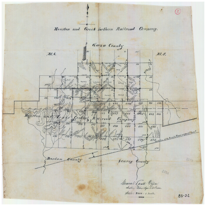
Houston and Great Northern Railroad Company [North of the 80 mile T. & P. Reserve]
Print $20.00
- Digital $50.00
Houston and Great Northern Railroad Company [North of the 80 mile T. & P. Reserve]
1900
Size: 15.6 x 15.8 inches
90895
Kent County Working Sketch 15

Print $40.00
- Digital $50.00
Kent County Working Sketch 15
1971
Size: 32.3 x 48.3 inches
70022
Kent County Working Sketch 18

Print $20.00
- Digital $50.00
Kent County Working Sketch 18
1974
Size: 33.5 x 31.5 inches
70025
Kent County Working Sketch 19

Print $40.00
- Digital $50.00
Kent County Working Sketch 19
1980
Size: 36.8 x 51.5 inches
70026
Kent County Working Sketch 2

Print $20.00
- Digital $50.00
Kent County Working Sketch 2
1947
Size: 43.7 x 42.7 inches
70008
Kent County Working Sketch 5

Print $40.00
- Digital $50.00
Kent County Working Sketch 5
1950
Size: 36.7 x 50.1 inches
70012
Map of Alabama and Texas Cattle Co's Pasture

Print $20.00
- Digital $50.00
Map of Alabama and Texas Cattle Co's Pasture
Size: 17.6 x 18.1 inches
5064
Map of Northern Boundary Line of Texas and Pacific 80 Mile Reservation

Print $20.00
- Digital $50.00
Map of Northern Boundary Line of Texas and Pacific 80 Mile Reservation
1902
Size: 16.8 x 16.7 inches
65694
Map of Scurry County

Print $20.00
- Digital $50.00
Map of Scurry County
1899
Size: 39.7 x 33.6 inches
16812
Map of Scurry County

Print $20.00
- Digital $50.00
Map of Scurry County
1899
Size: 39.8 x 34.7 inches
63029
Map of Scurry County

Print $20.00
- Digital $50.00
Map of Scurry County
Size: 17.8 x 22.7 inches
92921
Block 2 T. & N. Ry. Co., Block 97 H. T. C. Ry. Co.
Print $40.00
- Digital $50.00
Block 2 T. & N. Ry. Co., Block 97 H. T. C. Ry. Co.
1888
-
Size
41.5 x 48.1 inches
-
Map/Doc
89874
-
Creation Date
1888
Borden County Rolled Sketch 8
Print $20.00
- Digital $50.00
Borden County Rolled Sketch 8
1951
-
Size
23.8 x 28.6 inches
-
Map/Doc
5159
-
Creation Date
1951
Borden County Sketch File 3
Print $4.00
- Digital $50.00
Borden County Sketch File 3
1902
-
Size
7.3 x 12.8 inches
-
Map/Doc
14703
-
Creation Date
1902
Borden County Working Sketch 3
Print $20.00
- Digital $50.00
Borden County Working Sketch 3
1944
-
Size
21.3 x 23.5 inches
-
Map/Doc
67463
-
Creation Date
1944
Borden County Working Sketch 4
Print $20.00
- Digital $50.00
Borden County Working Sketch 4
1944
-
Size
21.7 x 23.7 inches
-
Map/Doc
67464
-
Creation Date
1944
Borden County Working Sketch 9
Print $20.00
- Digital $50.00
Borden County Working Sketch 9
1951
-
Size
24.8 x 42.3 inches
-
Map/Doc
67469
-
Creation Date
1951
Fisher County Sketch File 1
Print $20.00
- Digital $50.00
Fisher County Sketch File 1
-
Size
43.5 x 18.3 inches
-
Map/Doc
10448
Fisher County Sketch File 10
Print $20.00
- Digital $50.00
Fisher County Sketch File 10
-
Size
9.7 x 37.0 inches
-
Map/Doc
11477
Fisher County Sketch File 12
Print $22.00
- Digital $50.00
Fisher County Sketch File 12
1893
-
Size
9.0 x 7.0 inches
-
Map/Doc
22577
-
Creation Date
1893
Fisher County Sketch File 5
Print $20.00
- Digital $50.00
Fisher County Sketch File 5
1887
-
Size
35.3 x 47.6 inches
-
Map/Doc
10449
-
Creation Date
1887
Fisher County Working Sketch 14
Print $20.00
- Digital $50.00
Fisher County Working Sketch 14
1957
-
Size
24.9 x 33.1 inches
-
Map/Doc
69148
-
Creation Date
1957
Garza County Sketch File 15
Print $20.00
- Digital $50.00
Garza County Sketch File 15
1902
-
Size
16.8 x 14.7 inches
-
Map/Doc
11545
-
Creation Date
1902
Garza County Sketch File 5a
Print $20.00
- Digital $50.00
Garza County Sketch File 5a
1895
-
Size
20.7 x 38.2 inches
-
Map/Doc
10463
-
Creation Date
1895
Garza County Sketch File 6
Print $8.00
- Digital $50.00
Garza County Sketch File 6
1900
-
Size
14.2 x 8.7 inches
-
Map/Doc
24056
-
Creation Date
1900
Garza County Sketch File C1
Print $10.00
- Digital $50.00
Garza County Sketch File C1
1900
-
Size
12.9 x 8.1 inches
-
Map/Doc
24015
-
Creation Date
1900
Garza County Sketch File D
Print $20.00
- Digital $50.00
Garza County Sketch File D
1901
-
Size
18.4 x 12.2 inches
-
Map/Doc
11550
-
Creation Date
1901
Garza County Sketch File D1
Print $20.00
- Digital $50.00
Garza County Sketch File D1
1901
-
Size
14.9 x 27.3 inches
-
Map/Doc
11551
-
Creation Date
1901
General Highway Map, Scurry County, Texas
Print $20.00
General Highway Map, Scurry County, Texas
1940
-
Size
18.4 x 24.8 inches
-
Map/Doc
79240
-
Creation Date
1940
General Highway Map, Scurry County, Texas
Print $20.00
General Highway Map, Scurry County, Texas
1961
-
Size
18.1 x 24.8 inches
-
Map/Doc
79650
-
Creation Date
1961
Houston and Great Northern Railroad Company [North of the 80 mile T. & P. Reserve]
Print $20.00
- Digital $50.00
Houston and Great Northern Railroad Company [North of the 80 mile T. & P. Reserve]
1900
-
Size
15.6 x 15.8 inches
-
Map/Doc
90895
-
Creation Date
1900
Kent County Working Sketch 15
Print $40.00
- Digital $50.00
Kent County Working Sketch 15
1971
-
Size
32.3 x 48.3 inches
-
Map/Doc
70022
-
Creation Date
1971
Kent County Working Sketch 18
Print $20.00
- Digital $50.00
Kent County Working Sketch 18
1974
-
Size
33.5 x 31.5 inches
-
Map/Doc
70025
-
Creation Date
1974
Kent County Working Sketch 19
Print $40.00
- Digital $50.00
Kent County Working Sketch 19
1980
-
Size
36.8 x 51.5 inches
-
Map/Doc
70026
-
Creation Date
1980
Kent County Working Sketch 2
Print $20.00
- Digital $50.00
Kent County Working Sketch 2
1947
-
Size
43.7 x 42.7 inches
-
Map/Doc
70008
-
Creation Date
1947
Kent County Working Sketch 5
Print $40.00
- Digital $50.00
Kent County Working Sketch 5
1950
-
Size
36.7 x 50.1 inches
-
Map/Doc
70012
-
Creation Date
1950
Map of Alabama and Texas Cattle Co's Pasture
Print $20.00
- Digital $50.00
Map of Alabama and Texas Cattle Co's Pasture
-
Size
17.6 x 18.1 inches
-
Map/Doc
5064
Map of Northern Boundary Line of Texas and Pacific 80 Mile Reservation
Print $20.00
- Digital $50.00
Map of Northern Boundary Line of Texas and Pacific 80 Mile Reservation
1902
-
Size
16.8 x 16.7 inches
-
Map/Doc
65694
-
Creation Date
1902
Map of Scurry County
Print $20.00
- Digital $50.00
Map of Scurry County
1899
-
Size
39.7 x 33.6 inches
-
Map/Doc
16812
-
Creation Date
1899
Map of Scurry County
Print $20.00
- Digital $50.00
Map of Scurry County
1899
-
Size
39.8 x 34.7 inches
-
Map/Doc
63029
-
Creation Date
1899
Map of Scurry County
Print $20.00
- Digital $50.00
Map of Scurry County
-
Size
17.8 x 22.7 inches
-
Map/Doc
92921