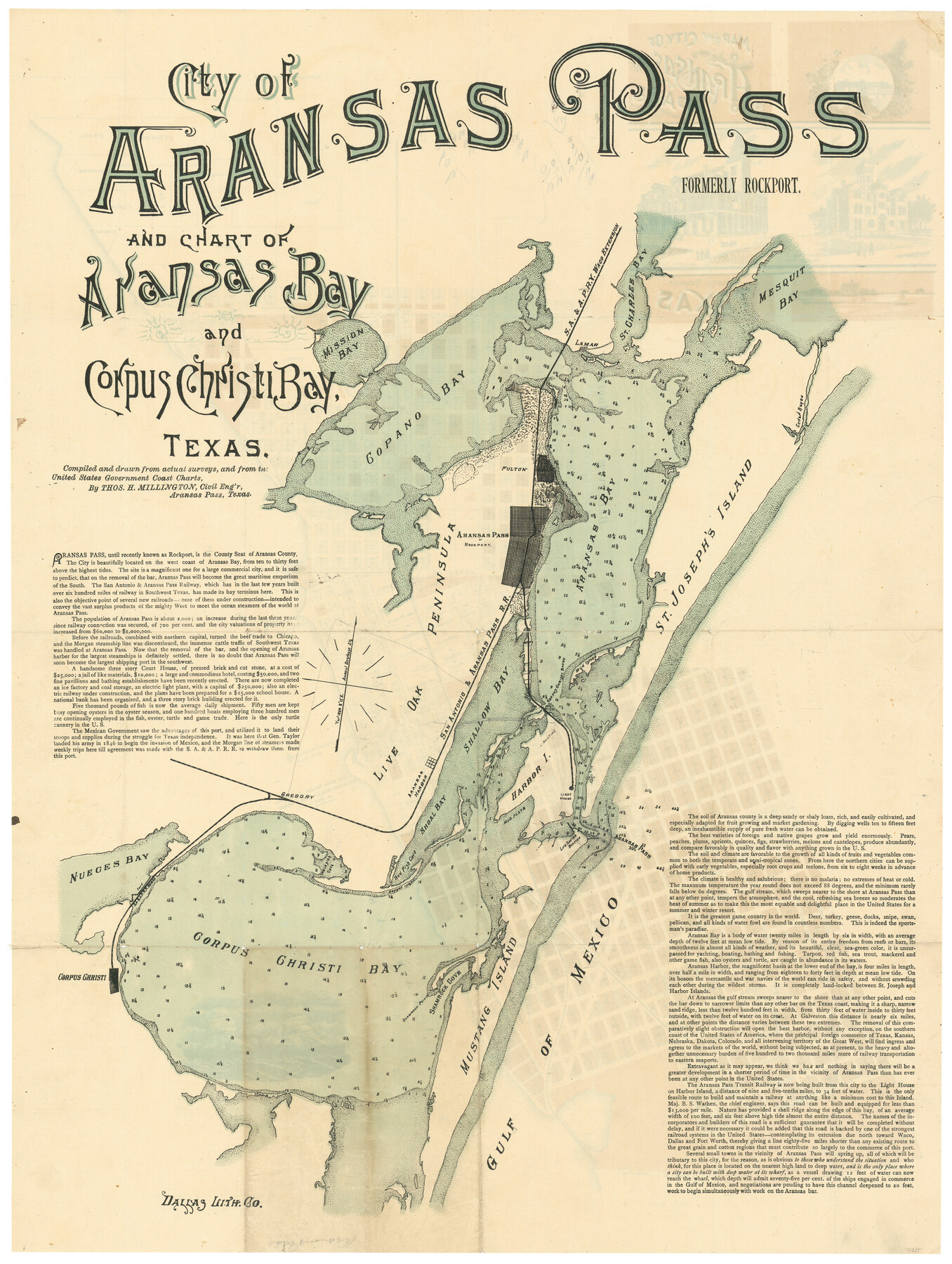
City of Aransas Pass and Chart of Aransas Bay and Corpus Christi Bay, Texas
-
Map/Doc
97265
-
Collection
General Map Collection
-
Object Dates
[1905] (Creation Date)
-
People and Organizations
Thos. H. Millington (Surveyor/Engineer)
-
Counties
Aransas
-
Subjects
City Coastal
-
Height x Width
28.4 x 21.4 inches
72.1 x 54.4 cm
-
Comments
See 97266 for map on verso.
Related maps
Map of the City of Aransas Pass

Print $20.00
- Digital $50.00
Map of the City of Aransas Pass
1905
Size 28.3 x 21.4 inches
Map/Doc 97266
Part of: General Map Collection
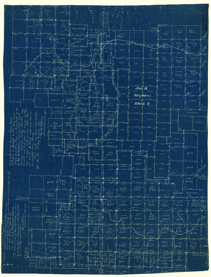
Lamar County Working Sketch 8

Print $20.00
- Digital $50.00
Lamar County Working Sketch 8
Size 39.3 x 31.6 inches
Map/Doc 70269
Flight Mission No. DAG-24K, Frame 41, Matagorda County

Print $20.00
- Digital $50.00
Flight Mission No. DAG-24K, Frame 41, Matagorda County
1953
Size 18.5 x 22.4 inches
Map/Doc 86528
Oldham County Working Sketch 6

Print $40.00
- Digital $50.00
Oldham County Working Sketch 6
Size 32.4 x 50.4 inches
Map/Doc 71328
Flight Mission No. CGI-2N, Frame 152, Cameron County

Print $20.00
- Digital $50.00
Flight Mission No. CGI-2N, Frame 152, Cameron County
1954
Size 18.7 x 22.1 inches
Map/Doc 84534
Kent County Working Sketch 23

Print $20.00
- Digital $50.00
Kent County Working Sketch 23
Size 47.2 x 43.0 inches
Map/Doc 70030
Kimble County Sketch File 6

Print $4.00
- Digital $50.00
Kimble County Sketch File 6
Size 6.4 x 8.0 inches
Map/Doc 28918
Copy of Surveyor's Field Book, Morris Browning - In Blocks 7, 5 & 4, I&GNRRCo., Hutchinson and Carson Counties, Texas

Print $2.00
- Digital $50.00
Copy of Surveyor's Field Book, Morris Browning - In Blocks 7, 5 & 4, I&GNRRCo., Hutchinson and Carson Counties, Texas
1888
Size 6.8 x 8.8 inches
Map/Doc 62274
Ward County Rolled Sketch 24C

Print $40.00
- Digital $50.00
Ward County Rolled Sketch 24C
1967
Size 54.8 x 24.4 inches
Map/Doc 10114
Flight Mission No. BRA-16M, Frame 166, Jefferson County

Print $20.00
- Digital $50.00
Flight Mission No. BRA-16M, Frame 166, Jefferson County
1953
Size 18.5 x 22.3 inches
Map/Doc 85764
Flight Mission No. CRC-4R, Frame 105, Chambers County

Print $20.00
- Digital $50.00
Flight Mission No. CRC-4R, Frame 105, Chambers County
1956
Size 18.8 x 22.4 inches
Map/Doc 84902
Fannin County Sketch File 24

Print $4.00
- Digital $50.00
Fannin County Sketch File 24
Size 13.2 x 8.6 inches
Map/Doc 22491
Bexar County Rolled Sketch 4B

Print $20.00
- Digital $50.00
Bexar County Rolled Sketch 4B
1989
Size 24.3 x 36.7 inches
Map/Doc 5139
You may also like
Nolan County Working Sketch 10

Print $40.00
- Digital $50.00
Nolan County Working Sketch 10
1971
Size 78.9 x 37.0 inches
Map/Doc 71301
Victoria County Sketch File 7

Print $6.00
- Digital $50.00
Victoria County Sketch File 7
1908
Size 11.4 x 17.4 inches
Map/Doc 12596
Cottle County Rolled Sketch 11
Print $20.00
- Digital $50.00
Cottle County Rolled Sketch 11
1927
Size 31.6 x 24.1 inches
Map/Doc 5568
Guide map of the Great Texas Cattle Trail from Red River crossing to the Old Reliable Kansas Pacific Railway

Print $20.00
- Digital $50.00
Guide map of the Great Texas Cattle Trail from Red River crossing to the Old Reliable Kansas Pacific Railway
1873
Size 23.4 x 17.6 inches
Map/Doc 93938
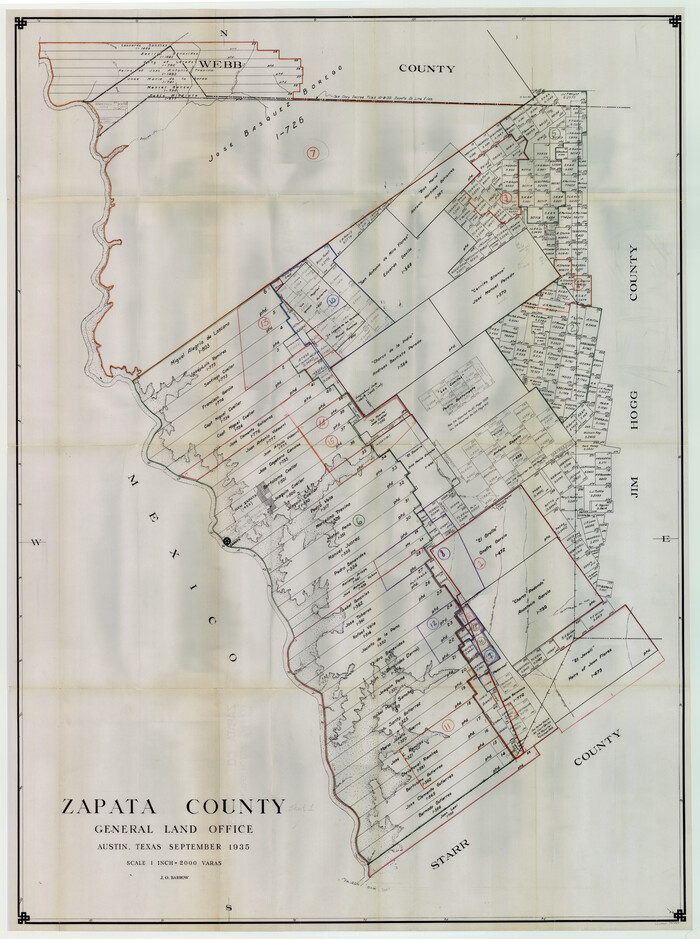
Zapata County Working Sketch Graphic Index, Sheet 1 (Sketches 1 to 18)
Print $40.00
- Digital $50.00
Zapata County Working Sketch Graphic Index, Sheet 1 (Sketches 1 to 18)
1935
Size 55.3 x 41.3 inches
Map/Doc 76749
[Surveys in Austin's Colony along the Brazos River and Oyster Creek]
![206, [Surveys in Austin's Colony along the Brazos River and Oyster Creek], General Map Collection](https://historictexasmaps.com/wmedia_w700/maps/206.tif.jpg)
Print $20.00
- Digital $50.00
[Surveys in Austin's Colony along the Brazos River and Oyster Creek]
1824
Size 23.1 x 17.2 inches
Map/Doc 206
Flight Mission No. CRE-1R, Frame 130, Jackson County

Print $20.00
- Digital $50.00
Flight Mission No. CRE-1R, Frame 130, Jackson County
1956
Size 18.4 x 22.3 inches
Map/Doc 85338
Grimes County Rolled Sketch 1

Print $20.00
- Digital $50.00
Grimes County Rolled Sketch 1
1945
Size 34.6 x 35.0 inches
Map/Doc 9007
West Part of Edwards County

Print $40.00
- Digital $50.00
West Part of Edwards County
1975
Size 59.9 x 39.7 inches
Map/Doc 95489
Map of lands in King County, Texas owned and leased by the Louisville Land and Cattle Company

Print $20.00
- Digital $50.00
Map of lands in King County, Texas owned and leased by the Louisville Land and Cattle Company
Size 29.1 x 25.1 inches
Map/Doc 717
Real County Sketch File 17

Print $6.00
- Digital $50.00
Real County Sketch File 17
1942
Size 5.6 x 4.3 inches
Map/Doc 35073
Brewster County Rolled Sketch 155

Print $20.00
- Digital $50.00
Brewster County Rolled Sketch 155
Size 36.8 x 24.7 inches
Map/Doc 78343