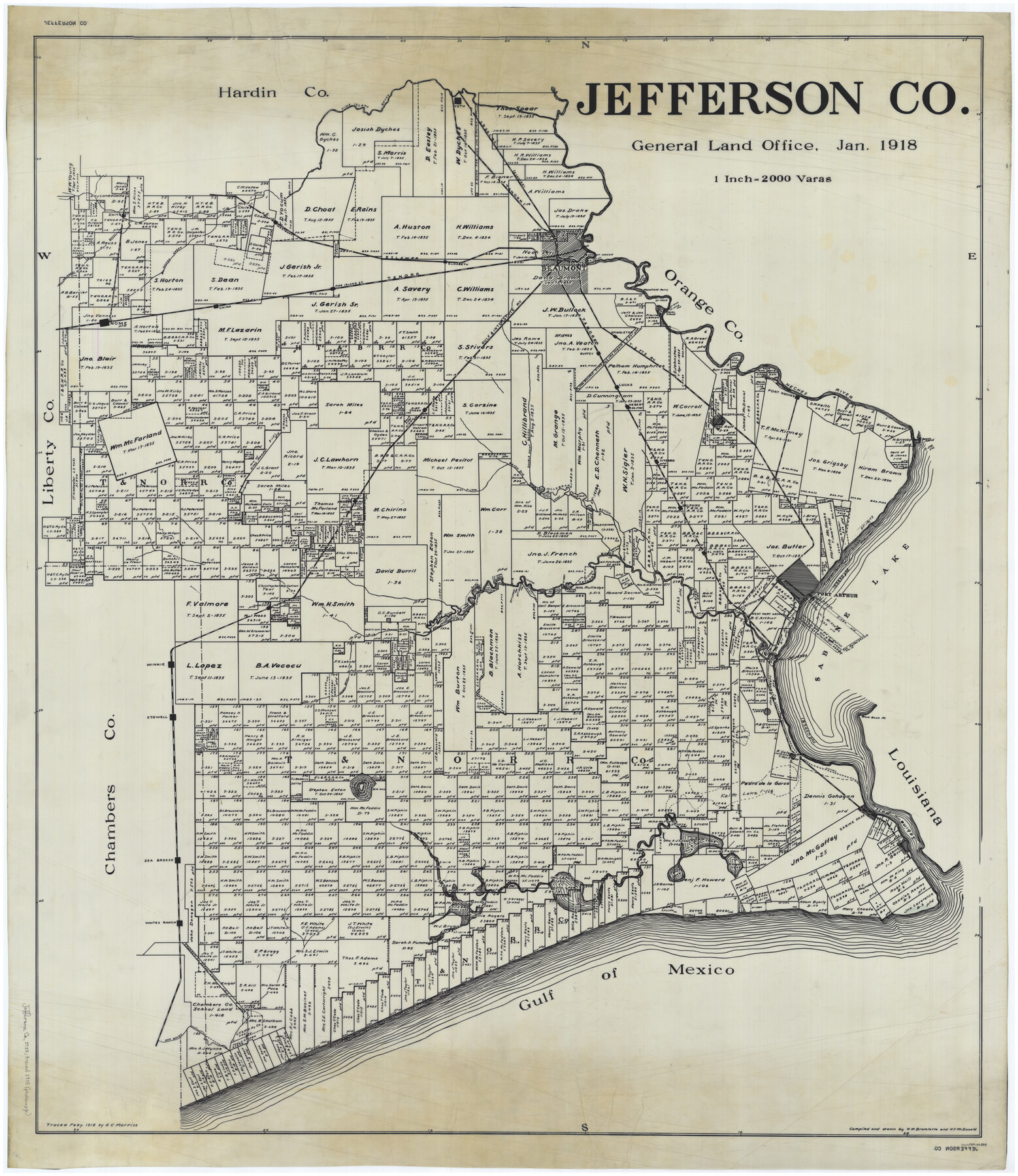
Jefferson Co.
-
Map/Doc
66884
-
Collection
General Map Collection
-
Object Dates
1918 (Creation Date)
-
People and Organizations
Texas General Land Office (Publisher)
H.F. McDonald (Compiler)
H.M. Bramlette (Compiler)
H.M. Bramlette (Draftsman)
H.F. McDonald (Draftsman)
-
Counties
Jefferson
-
Subjects
County
-
Height x Width
47.1 x 41.0 inches
119.6 x 104.1 cm
-
Comments
Traced in February 1918 by G. C. Morriss.
Part of: General Map Collection
Map of La Salle County

Print $20.00
- Digital $50.00
Map of La Salle County
1879
Size 26.2 x 25.3 inches
Map/Doc 3799
Presidio County Sketch File 58a

Print $14.00
- Digital $50.00
Presidio County Sketch File 58a
1980
Size 11.2 x 8.8 inches
Map/Doc 34628
Angelina County Rolled Sketch 3

Print $20.00
- Digital $50.00
Angelina County Rolled Sketch 3
Size 25.9 x 42.5 inches
Map/Doc 77186
Flight Mission No. CGI-3N, Frame 122, Cameron County

Print $20.00
- Digital $50.00
Flight Mission No. CGI-3N, Frame 122, Cameron County
1954
Size 18.6 x 22.2 inches
Map/Doc 84595
Martin County Working Sketch 12

Print $40.00
- Digital $50.00
Martin County Working Sketch 12
1971
Size 48.2 x 35.6 inches
Map/Doc 70830
Hardin County Working Sketch 40

Print $20.00
- Digital $50.00
Hardin County Working Sketch 40
1988
Size 23.0 x 14.4 inches
Map/Doc 63439
Calhoun County Working Sketch 14

Print $20.00
- Digital $50.00
Calhoun County Working Sketch 14
1991
Size 28.7 x 33.9 inches
Map/Doc 67830
Flight Mission No. BQR-4K, Frame 59, Brazoria County

Print $20.00
- Digital $50.00
Flight Mission No. BQR-4K, Frame 59, Brazoria County
1952
Size 18.7 x 22.4 inches
Map/Doc 83992
Reeves County Working Sketch 5

Print $20.00
- Digital $50.00
Reeves County Working Sketch 5
1938
Size 38.0 x 32.4 inches
Map/Doc 63448
Jeff Davis County Working Sketch 20

Print $40.00
- Digital $50.00
Jeff Davis County Working Sketch 20
1957
Size 63.0 x 32.8 inches
Map/Doc 66515
Newton County Rolled Sketch 14

Print $40.00
- Digital $50.00
Newton County Rolled Sketch 14
1953
Size 33.4 x 56.0 inches
Map/Doc 9579
Kimble County Rolled Sketch 44

Print $20.00
- Digital $50.00
Kimble County Rolled Sketch 44
Size 35.9 x 24.2 inches
Map/Doc 96810
You may also like
Township 6 North Range 13 West, North Western District, Louisiana

Print $20.00
- Digital $50.00
Township 6 North Range 13 West, North Western District, Louisiana
1841
Size 19.7 x 24.8 inches
Map/Doc 65864
Williamson County Sketch File 27

Print $12.00
- Digital $50.00
Williamson County Sketch File 27
1940
Size 14.3 x 8.7 inches
Map/Doc 40371
Brewster County Sketch File FN-32

Print $8.00
- Digital $50.00
Brewster County Sketch File FN-32
Size 11.1 x 8.7 inches
Map/Doc 15854
Bexar County Sketch File 36a

Print $10.00
- Digital $50.00
Bexar County Sketch File 36a
1873
Size 11.3 x 8.8 inches
Map/Doc 14507
Edwards County Working Sketch 127

Print $20.00
- Digital $50.00
Edwards County Working Sketch 127
1980
Size 21.0 x 24.1 inches
Map/Doc 69003
Dimmit County Working Sketch 7

Print $20.00
- Digital $50.00
Dimmit County Working Sketch 7
1927
Size 26.2 x 22.3 inches
Map/Doc 68668
Flight Mission No. CGI-3N, Frame 127, Cameron County

Print $20.00
- Digital $50.00
Flight Mission No. CGI-3N, Frame 127, Cameron County
1954
Size 18.8 x 22.4 inches
Map/Doc 84600
[Surveys along Halls Creek and Troublesome Creek]
![90934, [Surveys along Halls Creek and Troublesome Creek], Twichell Survey Records](https://historictexasmaps.com/wmedia_w700/maps/90934-1.tif.jpg)
Print $20.00
- Digital $50.00
[Surveys along Halls Creek and Troublesome Creek]
Size 34.1 x 28.6 inches
Map/Doc 90934

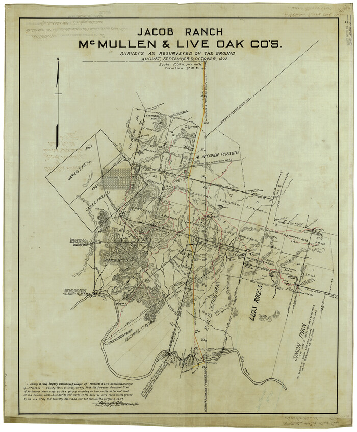
McMullen County Rolled Sketch 2
Print $20.00
- Digital $50.00
McMullen County Rolled Sketch 2
1922
Size 30.3 x 25.2 inches
Map/Doc 6721

Live Oak County Sketch File 32

Print $6.00
- Digital $50.00
Live Oak County Sketch File 32
1951
Size 11.1 x 8.6 inches
Map/Doc 30330