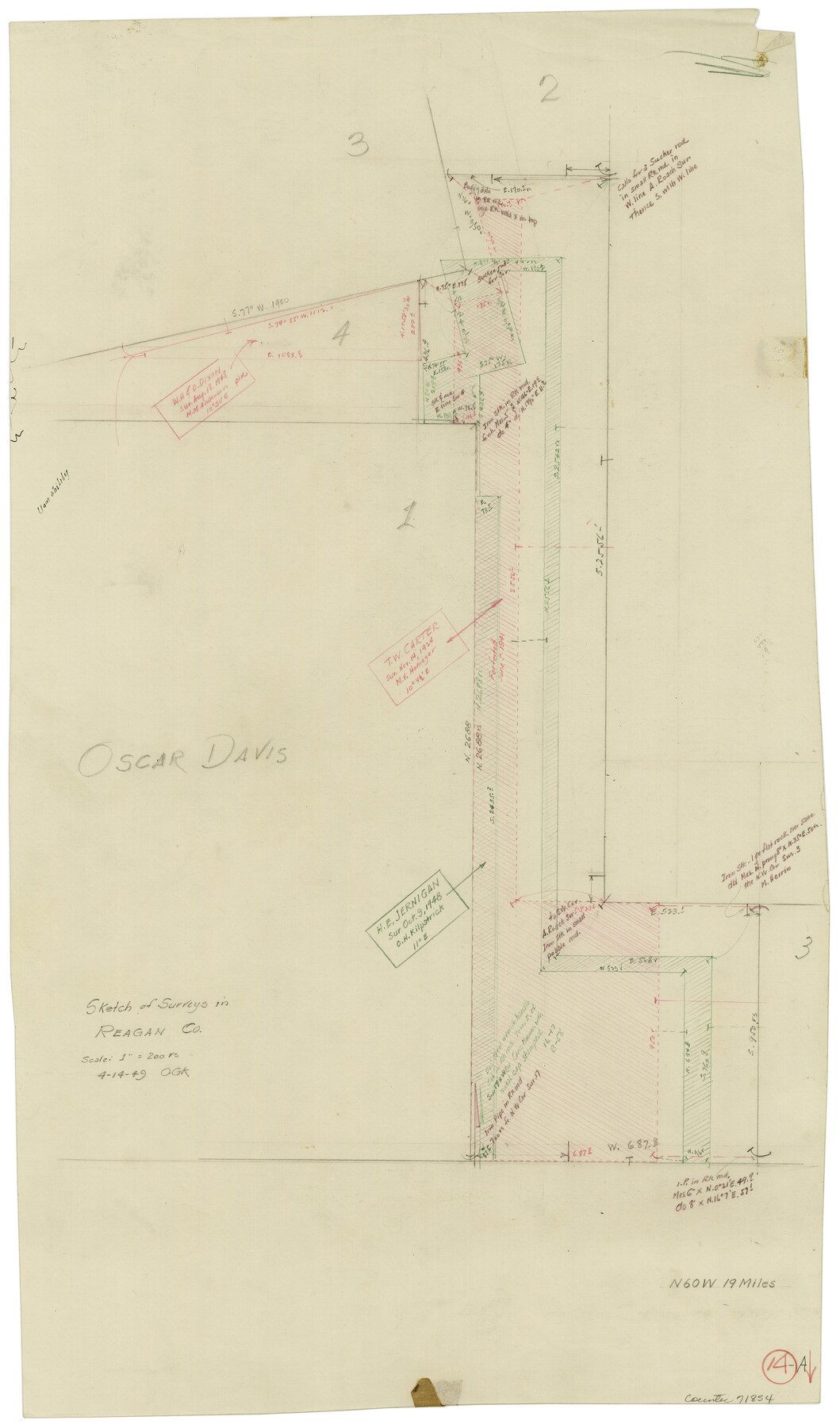
Reagan County Working Sketch 14a
-
Map/Doc
71854
-
Collection
General Map Collection
-
Object Dates
4/14/1949 (Creation Date)
-
People and Organizations
Otto G. Kurio (Draftsman)
-
Counties
Reagan
-
Subjects
Surveying Working Sketch
-
Height x Width
25.9 x 15.2 inches
65.8 x 38.6 cm
-
Scale
1" = 200 varas
Part of: General Map Collection
Clay County Sketch File 44

Print $20.00
- Digital $50.00
Clay County Sketch File 44
Size 24.7 x 36.0 inches
Map/Doc 11096

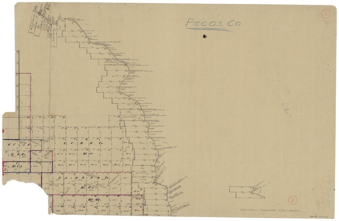
Pecos County Working Sketch 2
Print $20.00
- Digital $50.00
Pecos County Working Sketch 2
Size 18.1 x 28.3 inches
Map/Doc 71472
Flight Mission No. BRE-1P, Frame 149, Nueces County

Print $20.00
- Digital $50.00
Flight Mission No. BRE-1P, Frame 149, Nueces County
1956
Size 18.3 x 22.3 inches
Map/Doc 86709
Hutchinson County Working Sketch 7

Print $20.00
- Digital $50.00
Hutchinson County Working Sketch 7
1917
Size 16.5 x 11.9 inches
Map/Doc 66365
Freestone County Working Sketch 13

Print $40.00
- Digital $50.00
Freestone County Working Sketch 13
1980
Size 42.8 x 59.7 inches
Map/Doc 69255
Township 14 South Range 15 West of the Louisiana Meridian, Louisiana

Print $20.00
- Digital $50.00
Township 14 South Range 15 West of the Louisiana Meridian, Louisiana
1875
Size 19.6 x 24.6 inches
Map/Doc 65859
Anderson County Working Sketch 2

Print $20.00
- Digital $50.00
Anderson County Working Sketch 2
Size 31.8 x 37.7 inches
Map/Doc 67001
Edwards County Sketch File A13

Print $20.00
- Digital $50.00
Edwards County Sketch File A13
1901
Size 22.8 x 46.6 inches
Map/Doc 10444
Terrell County Working Sketch 46

Print $20.00
- Digital $50.00
Terrell County Working Sketch 46
1958
Size 23.8 x 23.4 inches
Map/Doc 62139
Brewster County Rolled Sketch 114

Print $20.00
- Digital $50.00
Brewster County Rolled Sketch 114
1964
Size 11.4 x 18.2 inches
Map/Doc 5282
Frio County Sketch File A

Print $40.00
- Digital $50.00
Frio County Sketch File A
1878
Size 16.4 x 13.4 inches
Map/Doc 23099
You may also like

Supreme Court of the United States, October Term, 1924, No. 13, Original - The State of Oklahoma, Complainant vs. The State of Texas, Defendant, The United States, Intervener

Print $20.00
- Digital $50.00
Supreme Court of the United States, October Term, 1924, No. 13, Original - The State of Oklahoma, Complainant vs. The State of Texas, Defendant, The United States, Intervener
1924
Size 33.7 x 33.7 inches
Map/Doc 75119
Maverick County Working Sketch 13

Print $20.00
- Digital $50.00
Maverick County Working Sketch 13
1969
Size 27.3 x 35.8 inches
Map/Doc 70905
Jackson County Boundary File 1

Print $24.00
- Digital $50.00
Jackson County Boundary File 1
Size 9.0 x 3.9 inches
Map/Doc 55420
Calhoun County Boundary File 5

Print $10.00
- Digital $50.00
Calhoun County Boundary File 5
Size 14.2 x 8.8 inches
Map/Doc 51009
Concho County Working Sketch 18

Print $20.00
- Digital $50.00
Concho County Working Sketch 18
1957
Size 19.2 x 25.2 inches
Map/Doc 68200
[Sketch of Hicks Strip No. 2 between M. H. Hagaman and Z. C. Collier Surveys]
![91893, [Sketch of Hicks Strip No. 2 between M. H. Hagaman and Z. C. Collier Surveys], Twichell Survey Records](https://historictexasmaps.com/wmedia_w700/maps/91893-1.tif.jpg)
Print $20.00
- Digital $50.00
[Sketch of Hicks Strip No. 2 between M. H. Hagaman and Z. C. Collier Surveys]
Size 15.1 x 14.9 inches
Map/Doc 91893
Wilson County Boundary File 9

Print $42.00
- Digital $50.00
Wilson County Boundary File 9
Size 14.3 x 8.9 inches
Map/Doc 60119
General Highway Map, Jones County, Texas

Print $20.00
General Highway Map, Jones County, Texas
1940
Size 18.5 x 24.8 inches
Map/Doc 79150
Val Verde County Working Sketch 58

Print $20.00
- Digital $50.00
Val Verde County Working Sketch 58
1958
Size 21.0 x 22.8 inches
Map/Doc 72193
Zavala County Rolled Sketch 30

Print $20.00
- Digital $50.00
Zavala County Rolled Sketch 30
Size 18.6 x 19.1 inches
Map/Doc 8331
