![94160, Austin and Vicinity [Recto], General Map Collection](https://historictexasmaps.com/wmedia_w1800h1800/maps/94160.tif.jpg)
Austin and Vicinity [Recto]
Ashburn's Austin City Map
-
Map/Doc
94160
-
Collection
General Map Collection
-
Object Dates
1959 (Creation Date)
-
People and Organizations
J. Foster Ashburn (Publisher)
James Harkins (Donor)
-
Counties
Travis
-
Subjects
City
-
Height x Width
24.3 x 18.2 inches
61.7 x 46.2 cm
-
Medium
paper, etching/engraving/lithograph
-
Scale
1" = 0.5 mile
-
Comments
For reference/research purposes only. Phillips Petroleum Company sponsored map of Austin. Donated by James Harkins. See 94161 for verso.
Related maps
![94161, Austin and Vicinity [Verso], General Map Collection](https://historictexasmaps.com/wmedia_w700/maps/94161.tif.jpg)
Part of: General Map Collection
Hardin County

Print $20.00
- Digital $50.00
Hardin County
1894
Size 46.8 x 43.4 inches
Map/Doc 16846
Austin County Boundary File 6

Print $16.00
- Digital $50.00
Austin County Boundary File 6
Size 11.1 x 8.4 inches
Map/Doc 50255
Ector County Working Sketch 11

Print $20.00
- Digital $50.00
Ector County Working Sketch 11
1954
Size 24.6 x 37.7 inches
Map/Doc 68854
Brewster County Rolled Sketch 114

Print $20.00
- Digital $50.00
Brewster County Rolled Sketch 114
1964
Size 11.7 x 17.7 inches
Map/Doc 5281
Harris County Working Sketch 55

Print $20.00
- Digital $50.00
Harris County Working Sketch 55
1950
Size 19.3 x 25.2 inches
Map/Doc 65947
Hudspeth County Working Sketch 22

Print $40.00
- Digital $50.00
Hudspeth County Working Sketch 22
1967
Size 45.8 x 62.8 inches
Map/Doc 66304
Pecos County Sketch File 119

Print $6.00
- Digital $50.00
Pecos County Sketch File 119
1925
Size 11.2 x 8.8 inches
Map/Doc 34111
Pecos County Working Sketch 5
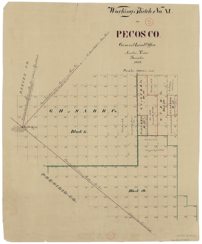
Print $20.00
- Digital $50.00
Pecos County Working Sketch 5
1886
Size 22.8 x 19.2 inches
Map/Doc 71475
Garza County Working Sketch Graphic Index

Print $20.00
- Digital $50.00
Garza County Working Sketch Graphic Index
1928
Size 46.7 x 36.2 inches
Map/Doc 76552
Flight Mission No. DIX-6P, Frame 109, Aransas County

Print $20.00
- Digital $50.00
Flight Mission No. DIX-6P, Frame 109, Aransas County
1956
Size 18.8 x 22.5 inches
Map/Doc 83815
Travis County Boundary File 24

Print $4.00
- Digital $50.00
Travis County Boundary File 24
Size 8.3 x 7.2 inches
Map/Doc 59457
Ft. W. & R. G. Ry. Right of Way Map, Chapin to Bluffdale, Hood County, Texas

Print $40.00
- Digital $50.00
Ft. W. & R. G. Ry. Right of Way Map, Chapin to Bluffdale, Hood County, Texas
1918
Size 37.3 x 120.2 inches
Map/Doc 64642
You may also like
Duval County Working Sketch 28

Print $20.00
- Digital $50.00
Duval County Working Sketch 28
1948
Size 29.7 x 37.4 inches
Map/Doc 68752
Edwards County Rolled Sketch 7

Print $20.00
- Digital $50.00
Edwards County Rolled Sketch 7
1881
Size 24.4 x 23.2 inches
Map/Doc 5800
Coke County Rolled Sketch 10

Print $20.00
- Digital $50.00
Coke County Rolled Sketch 10
1949
Size 25.3 x 15.0 inches
Map/Doc 5509
Half-circle Protractor with Arm and Vernier

Half-circle Protractor with Arm and Vernier
Size 0.8 x 15.0 inches
Map/Doc 97309
Gray County Boundary File 7

Print $4.00
- Digital $50.00
Gray County Boundary File 7
Size 8.0 x 8.8 inches
Map/Doc 53898
Wilson County Sketch File 10

Print $4.00
- Digital $50.00
Wilson County Sketch File 10
Size 6.7 x 6.2 inches
Map/Doc 40417
Bray Subdivision and McElroy Subdivision

Print $20.00
- Digital $50.00
Bray Subdivision and McElroy Subdivision
Size 19.3 x 25.2 inches
Map/Doc 92746
Jeff Davis County Working Sketch 27

Print $20.00
- Digital $50.00
Jeff Davis County Working Sketch 27
1960
Size 18.1 x 24.3 inches
Map/Doc 66522
Galveston County Rolled Sketch 25

Print $20.00
- Digital $50.00
Galveston County Rolled Sketch 25
1965
Size 18.7 x 24.3 inches
Map/Doc 5960
[Section 34, Block 194 G. C. & S. F.]
![91671, [Section 34, Block 194 G. C. & S. F.], Twichell Survey Records](https://historictexasmaps.com/wmedia_w700/maps/91671-1.tif.jpg)
Print $2.00
- Digital $50.00
[Section 34, Block 194 G. C. & S. F.]
1927
Size 7.6 x 5.9 inches
Map/Doc 91671
New Map of the State of Texas Compiled from J. De Cordova's large Map

Print $20.00
- Digital $50.00
New Map of the State of Texas Compiled from J. De Cordova's large Map
1856
Size 17.5 x 27.0 inches
Map/Doc 76172
Map of Jack County

Print $20.00
- Digital $50.00
Map of Jack County
1896
Size 43.6 x 38.9 inches
Map/Doc 66877