Hale County Working Sketch 8

Print $20.00
- Digital $50.00
Hale County Working Sketch 8
1982
Size: 22.2 x 34.5 inches
63328
Hale County Working Sketch 5

Print $20.00
- Digital $50.00
Hale County Working Sketch 5
1980
Size: 15.0 x 11.1 inches
63325
Swisher County Working Sketch 6

Print $20.00
- Digital $50.00
Swisher County Working Sketch 6
1979
Size: 23.2 x 19.7 inches
62417
Hale County Working Sketch 4

Print $20.00
- Digital $50.00
Hale County Working Sketch 4
1979
Size: 22.7 x 18.7 inches
63324
Floyd County Working Sketch 6

Print $20.00
- Digital $50.00
Floyd County Working Sketch 6
1965
Size: 22.9 x 31.3 inches
69185
Hale County Working Sketch 7

Print $20.00
- Digital $50.00
Hale County Working Sketch 7
1963
Size: 24.4 x 20.6 inches
63327
Hale County Working Sketch 6

Print $40.00
- Digital $50.00
Hale County Working Sketch 6
1963
Size: 68.9 x 38.8 inches
63326
Hale County Working Sketch 3

Print $20.00
- Digital $50.00
Hale County Working Sketch 3
1963
Size: 27.0 x 22.2 inches
63323
Lamb County Working Sketch 3

Print $20.00
- Digital $50.00
Lamb County Working Sketch 3
1962
Size: 32.1 x 37.7 inches
70276
General Highway Map, Hale County, Texas

Print $20.00
General Highway Map, Hale County, Texas
1961
Size: 24.7 x 18.2 inches
79493
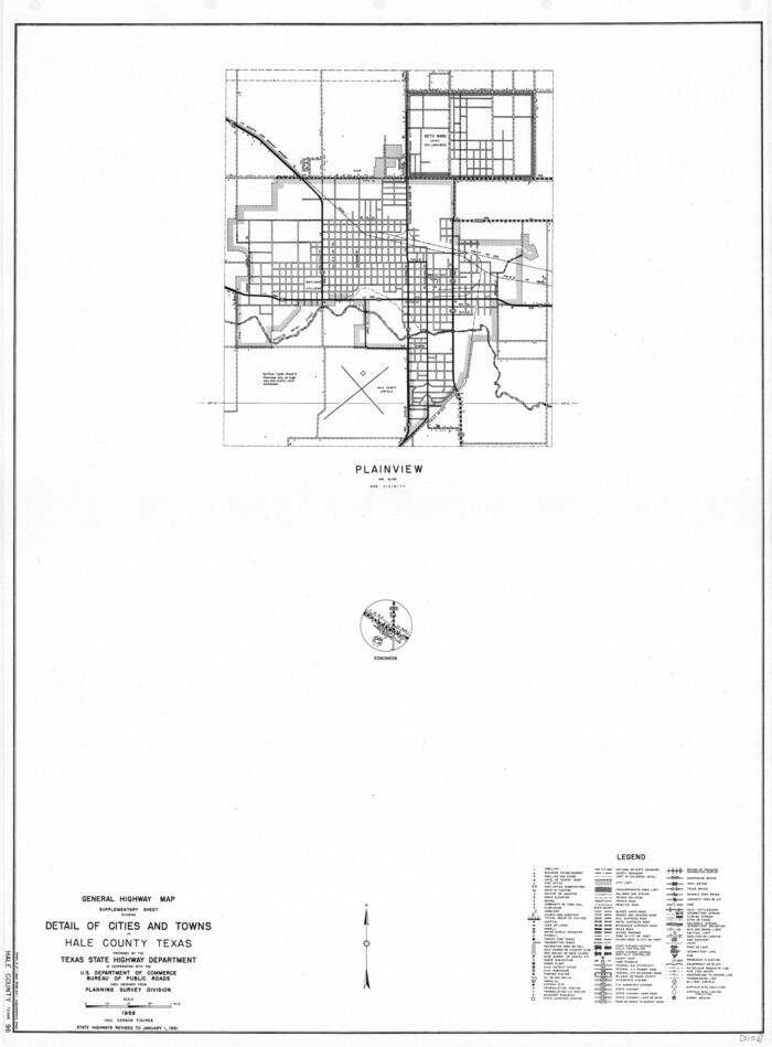
General Highway Map. Detail of Cities and Towns in Hale County, Texas [Plainview and vicinity]
Print $20.00
General Highway Map. Detail of Cities and Towns in Hale County, Texas [Plainview and vicinity]
1961
Size: 24.6 x 18.2 inches
79494
Artesian Company Subdivision

Print $20.00
- Digital $50.00
Artesian Company Subdivision
1955
Size: 12.0 x 15.8 inches
92698
General Highway Map, Hale County, Texas

Print $20.00
- Digital $50.00
General Highway Map, Hale County, Texas
1949
Size: 18.8 x 25.9 inches
92661
Spade Ranch Hockley County, Texas

Print $3.00
- Digital $50.00
Spade Ranch Hockley County, Texas
1948
Size: 17.6 x 7.7 inches
92226
General Highway Map, Hale County, Texas

Print $20.00
General Highway Map, Hale County, Texas
1940
Size: 24.8 x 18.4 inches
79108
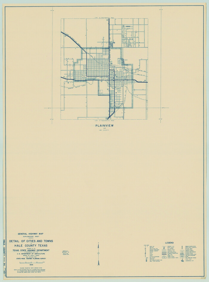
General Highway Map. Detail of Cities and Towns in Hale County, Texas [Plainview and vicinity]
Print $20.00
General Highway Map. Detail of Cities and Towns in Hale County, Texas [Plainview and vicinity]
1940
Size: 25.0 x 18.5 inches
79109
Hale County Working Sketch Graphic Index

Print $20.00
- Digital $50.00
Hale County Working Sketch Graphic Index
1931
Size: 46.4 x 36.9 inches
76562
Petersburg, Hale County, Texas

Print $20.00
- Digital $50.00
Petersburg, Hale County, Texas
1927
Size: 16.1 x 28.4 inches
92699
Hale County Working Sketch 2

Print $20.00
- Digital $50.00
Hale County Working Sketch 2
1916
Size: 13.5 x 13.1 inches
63322
Working Sketch Showing Scrap Lands in Hale County

Print $20.00
- Digital $50.00
Working Sketch Showing Scrap Lands in Hale County
1915
Size: 22.7 x 11.1 inches
90742
Hall County Sketch File 36

Print $4.00
- Digital $50.00
Hall County Sketch File 36
1914
Size: 11.2 x 8.8 inches
24895
Lamb County Sketch File 10

Print $22.00
- Digital $50.00
Lamb County Sketch File 10
1912
Size: 20.0 x 31.2 inches
11972
Hockley County Sketch File 14

Print $20.00
- Digital $50.00
Hockley County Sketch File 14
1911
Size: 26.5 x 17.5 inches
11773
Hale County Sketch File 26

Print $40.00
- Digital $50.00
Hale County Sketch File 26
1911
Size: 20.7 x 54.4 inches
10471
Hale County Sketch File 25

Print $8.00
- Digital $50.00
Hale County Sketch File 25
1911
Size: 14.4 x 8.9 inches
24772
Hale County Working Sketch 8
Print $20.00
- Digital $50.00
Hale County Working Sketch 8
1982
-
Size
22.2 x 34.5 inches
-
Map/Doc
63328
-
Creation Date
1982
Hale County Working Sketch 5
Print $20.00
- Digital $50.00
Hale County Working Sketch 5
1980
-
Size
15.0 x 11.1 inches
-
Map/Doc
63325
-
Creation Date
1980
Swisher County Working Sketch 6
Print $20.00
- Digital $50.00
Swisher County Working Sketch 6
1979
-
Size
23.2 x 19.7 inches
-
Map/Doc
62417
-
Creation Date
1979
Hale County Working Sketch 4
Print $20.00
- Digital $50.00
Hale County Working Sketch 4
1979
-
Size
22.7 x 18.7 inches
-
Map/Doc
63324
-
Creation Date
1979
Floyd County Working Sketch 6
Print $20.00
- Digital $50.00
Floyd County Working Sketch 6
1965
-
Size
22.9 x 31.3 inches
-
Map/Doc
69185
-
Creation Date
1965
Hale County Working Sketch 7
Print $20.00
- Digital $50.00
Hale County Working Sketch 7
1963
-
Size
24.4 x 20.6 inches
-
Map/Doc
63327
-
Creation Date
1963
Hale County Working Sketch 6
Print $40.00
- Digital $50.00
Hale County Working Sketch 6
1963
-
Size
68.9 x 38.8 inches
-
Map/Doc
63326
-
Creation Date
1963
Hale County Working Sketch 3
Print $20.00
- Digital $50.00
Hale County Working Sketch 3
1963
-
Size
27.0 x 22.2 inches
-
Map/Doc
63323
-
Creation Date
1963
Lamb County Working Sketch 3
Print $20.00
- Digital $50.00
Lamb County Working Sketch 3
1962
-
Size
32.1 x 37.7 inches
-
Map/Doc
70276
-
Creation Date
1962
General Highway Map, Hale County, Texas
Print $20.00
General Highway Map, Hale County, Texas
1961
-
Size
24.7 x 18.2 inches
-
Map/Doc
79493
-
Creation Date
1961
General Highway Map. Detail of Cities and Towns in Hale County, Texas [Plainview and vicinity]
Print $20.00
General Highway Map. Detail of Cities and Towns in Hale County, Texas [Plainview and vicinity]
1961
-
Size
24.6 x 18.2 inches
-
Map/Doc
79494
-
Creation Date
1961
Anton Quadrangle

Print $20.00
- Digital $50.00
Anton Quadrangle
1957
-
Size
18.1 x 22.1 inches
-
Map/Doc
92814
-
Creation Date
1957
Artesian Company Subdivision
Print $20.00
- Digital $50.00
Artesian Company Subdivision
1955
-
Size
12.0 x 15.8 inches
-
Map/Doc
92698
-
Creation Date
1955
General Highway Map, Hale County, Texas
Print $20.00
- Digital $50.00
General Highway Map, Hale County, Texas
1949
-
Size
18.8 x 25.9 inches
-
Map/Doc
92661
-
Creation Date
1949
Spade Ranch Hockley County, Texas
Print $3.00
- Digital $50.00
Spade Ranch Hockley County, Texas
1948
-
Size
17.6 x 7.7 inches
-
Map/Doc
92226
-
Creation Date
1948
General Highway Map, Hale County, Texas
Print $20.00
General Highway Map, Hale County, Texas
1940
-
Size
24.8 x 18.4 inches
-
Map/Doc
79108
-
Creation Date
1940
General Highway Map. Detail of Cities and Towns in Hale County, Texas [Plainview and vicinity]
Print $20.00
General Highway Map. Detail of Cities and Towns in Hale County, Texas [Plainview and vicinity]
1940
-
Size
25.0 x 18.5 inches
-
Map/Doc
79109
-
Creation Date
1940
Hale County

Print $40.00
- Digital $50.00
Hale County
1931
-
Size
48.5 x 38.2 inches
-
Map/Doc
1846
-
Creation Date
1931
Hale County

Print $20.00
- Digital $50.00
Hale County
1931
-
Size
46.2 x 37.9 inches
-
Map/Doc
73166
-
Creation Date
1931
Hale County

Print $20.00
- Digital $50.00
Hale County
1931
-
Size
39.8 x 32.3 inches
-
Map/Doc
77298
-
Creation Date
1931
Hale County

Print $20.00
- Digital $50.00
Hale County
1931
-
Size
47.8 x 39.0 inches
-
Map/Doc
95516
-
Creation Date
1931
Hale County Working Sketch Graphic Index
Print $20.00
- Digital $50.00
Hale County Working Sketch Graphic Index
1931
-
Size
46.4 x 36.9 inches
-
Map/Doc
76562
-
Creation Date
1931
Petersburg, Hale County, Texas
Print $20.00
- Digital $50.00
Petersburg, Hale County, Texas
1927
-
Size
16.1 x 28.4 inches
-
Map/Doc
92699
-
Creation Date
1927
Hale County Working Sketch 2
Print $20.00
- Digital $50.00
Hale County Working Sketch 2
1916
-
Size
13.5 x 13.1 inches
-
Map/Doc
63322
-
Creation Date
1916
Working Sketch Showing Scrap Lands in Hale County
Print $20.00
- Digital $50.00
Working Sketch Showing Scrap Lands in Hale County
1915
-
Size
22.7 x 11.1 inches
-
Map/Doc
90742
-
Creation Date
1915
Hall County Sketch File 36
Print $4.00
- Digital $50.00
Hall County Sketch File 36
1914
-
Size
11.2 x 8.8 inches
-
Map/Doc
24895
-
Creation Date
1914
Lamb County Sketch File 10
Print $22.00
- Digital $50.00
Lamb County Sketch File 10
1912
-
Size
20.0 x 31.2 inches
-
Map/Doc
11972
-
Creation Date
1912
Hockley County Sketch File 14
Print $20.00
- Digital $50.00
Hockley County Sketch File 14
1911
-
Size
26.5 x 17.5 inches
-
Map/Doc
11773
-
Creation Date
1911
Hale County Sketch File 26
Print $40.00
- Digital $50.00
Hale County Sketch File 26
1911
-
Size
20.7 x 54.4 inches
-
Map/Doc
10471
-
Creation Date
1911
Hale County Sketch File 25
Print $8.00
- Digital $50.00
Hale County Sketch File 25
1911
-
Size
14.4 x 8.9 inches
-
Map/Doc
24772
-
Creation Date
1911