Kent County Working Sketch 25

Print $20.00
- Digital $50.00
Kent County Working Sketch 25
1989
Size: 18.8 x 18.5 inches
69641
Kent County Working Sketch 24

Print $20.00
- Digital $50.00
Kent County Working Sketch 24
1988
Size: 30.5 x 21.2 inches
70031
Kent County Working Sketch 23

Print $20.00
- Digital $50.00
Kent County Working Sketch 23
1987
Size: 47.2 x 43.0 inches
70030
Kent County Working Sketch 22

Print $20.00
- Digital $50.00
Kent County Working Sketch 22
1987
Size: 42.7 x 43.1 inches
70029
Kent County Working Sketch 21

Print $20.00
- Digital $50.00
Kent County Working Sketch 21
1981
Size: 43.5 x 37.5 inches
70028
Kent County Working Sketch 20

Print $40.00
- Digital $50.00
Kent County Working Sketch 20
1980
Size: 50.7 x 44.1 inches
70027
Scurry County Working Sketch 8

Print $40.00
- Digital $50.00
Scurry County Working Sketch 8
1980
Size: 34.5 x 49.5 inches
63837
Kent County Working Sketch 19

Print $40.00
- Digital $50.00
Kent County Working Sketch 19
1980
Size: 36.8 x 51.5 inches
70026
Kent County Working Sketch 18

Print $20.00
- Digital $50.00
Kent County Working Sketch 18
1974
Size: 33.5 x 31.5 inches
70025
Kent County Working Sketch 17

Print $20.00
- Digital $50.00
Kent County Working Sketch 17
1973
Size: 34.8 x 36.4 inches
70024
Kent County Working Sketch 16

Print $20.00
- Digital $50.00
Kent County Working Sketch 16
1972
Size: 32.4 x 31.5 inches
70023
Kent County Working Sketch 15

Print $40.00
- Digital $50.00
Kent County Working Sketch 15
1971
Size: 32.3 x 48.3 inches
70022
Kent County Working Sketch Graphic Index

Print $20.00
- Digital $50.00
Kent County Working Sketch Graphic Index
1971
Size: 44.7 x 37.0 inches
76604
Dickens County Working Sketch 10

Print $40.00
- Digital $50.00
Dickens County Working Sketch 10
1965
Size: 62.2 x 39.5 inches
68658
Kent County Working Sketch 14

Print $20.00
- Digital $50.00
Kent County Working Sketch 14
1965
Size: 28.2 x 35.4 inches
70021
Kent County Working Sketch 13

Print $20.00
- Digital $50.00
Kent County Working Sketch 13
1963
Size: 27.9 x 44.2 inches
70020
General Highway Map, Kent County, Texas

Print $20.00
General Highway Map, Kent County, Texas
1961
Size: 18.2 x 24.6 inches
79550
Kent County Rolled Sketch 7

Print $40.00
- Digital $50.00
Kent County Rolled Sketch 7
1954
Size: 51.8 x 42.6 inches
10221
Kent County Working Sketch 12

Print $20.00
- Digital $50.00
Kent County Working Sketch 12
1953
Size: 33.8 x 24.3 inches
70019
Kent County Working Sketch 9

Print $20.00
- Digital $50.00
Kent County Working Sketch 9
1953
Size: 33.0 x 43.8 inches
70016
Chapman and McFarlin Production Co. Cogdell Ranch Kent County, Texas

Print $2.00
- Digital $50.00
Chapman and McFarlin Production Co. Cogdell Ranch Kent County, Texas
1952
Size: 9.0 x 8.9 inches
92190
Kent County Working Sketch 7

Print $20.00
- Digital $50.00
Kent County Working Sketch 7
1952
Size: 32.7 x 23.7 inches
70014
Kent County Working Sketch 6

Print $20.00
- Digital $50.00
Kent County Working Sketch 6
1952
Size: 27.4 x 23.8 inches
70013
Kent County Working Sketch 8

Print $20.00
- Digital $50.00
Kent County Working Sketch 8
1952
Size: 27.2 x 37.1 inches
70015
Kent County Rolled Sketch 5

Print $20.00
- Digital $50.00
Kent County Rolled Sketch 5
1951
Size: 43.7 x 36.9 inches
78522
Chapman and Farlin Producing Co. Cogdell Ranch Kent County, Texas

Print $20.00
- Digital $50.00
Chapman and Farlin Producing Co. Cogdell Ranch Kent County, Texas
1951
Size: 12.6 x 16.6 inches
92193
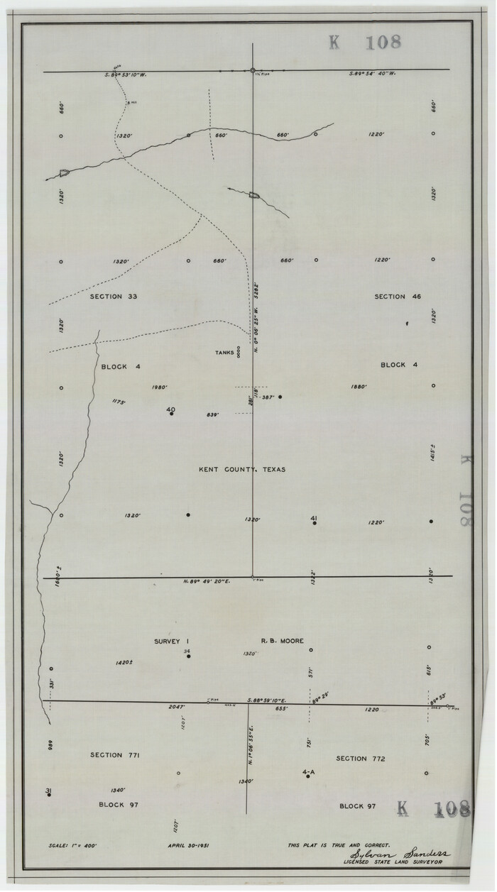
[Kent County Block 4, Sections 33 and 46, Block 97, Sections 771 and 772]
Print $2.00
- Digital $50.00
[Kent County Block 4, Sections 33 and 46, Block 97, Sections 771 and 772]
1951
Size: 8.7 x 15.6 inches
92192
Kent County Working Sketch 25
Print $20.00
- Digital $50.00
Kent County Working Sketch 25
1989
-
Size
18.8 x 18.5 inches
-
Map/Doc
69641
-
Creation Date
1989
Kent County Working Sketch 24
Print $20.00
- Digital $50.00
Kent County Working Sketch 24
1988
-
Size
30.5 x 21.2 inches
-
Map/Doc
70031
-
Creation Date
1988
Kent County Working Sketch 23
Print $20.00
- Digital $50.00
Kent County Working Sketch 23
1987
-
Size
47.2 x 43.0 inches
-
Map/Doc
70030
-
Creation Date
1987
Kent County Working Sketch 22
Print $20.00
- Digital $50.00
Kent County Working Sketch 22
1987
-
Size
42.7 x 43.1 inches
-
Map/Doc
70029
-
Creation Date
1987
Kent County Working Sketch 21
Print $20.00
- Digital $50.00
Kent County Working Sketch 21
1981
-
Size
43.5 x 37.5 inches
-
Map/Doc
70028
-
Creation Date
1981
Kent County Working Sketch 20
Print $40.00
- Digital $50.00
Kent County Working Sketch 20
1980
-
Size
50.7 x 44.1 inches
-
Map/Doc
70027
-
Creation Date
1980
Scurry County Working Sketch 8
Print $40.00
- Digital $50.00
Scurry County Working Sketch 8
1980
-
Size
34.5 x 49.5 inches
-
Map/Doc
63837
-
Creation Date
1980
Kent County Working Sketch 19
Print $40.00
- Digital $50.00
Kent County Working Sketch 19
1980
-
Size
36.8 x 51.5 inches
-
Map/Doc
70026
-
Creation Date
1980
Kent County Working Sketch 18
Print $20.00
- Digital $50.00
Kent County Working Sketch 18
1974
-
Size
33.5 x 31.5 inches
-
Map/Doc
70025
-
Creation Date
1974
Kent County Working Sketch 17
Print $20.00
- Digital $50.00
Kent County Working Sketch 17
1973
-
Size
34.8 x 36.4 inches
-
Map/Doc
70024
-
Creation Date
1973
Kent County Working Sketch 16
Print $20.00
- Digital $50.00
Kent County Working Sketch 16
1972
-
Size
32.4 x 31.5 inches
-
Map/Doc
70023
-
Creation Date
1972
Kent County

Print $20.00
- Digital $50.00
Kent County
1971
-
Size
44.6 x 37.0 inches
-
Map/Doc
73205
-
Creation Date
1971
Kent County

Print $20.00
- Digital $50.00
Kent County
1971
-
Size
40.9 x 33.5 inches
-
Map/Doc
77338
-
Creation Date
1971
Kent County

Print $20.00
- Digital $50.00
Kent County
1971
-
Size
46.1 x 38.4 inches
-
Map/Doc
95555
-
Creation Date
1971
Kent County Working Sketch 15
Print $40.00
- Digital $50.00
Kent County Working Sketch 15
1971
-
Size
32.3 x 48.3 inches
-
Map/Doc
70022
-
Creation Date
1971
Kent County Working Sketch Graphic Index
Print $20.00
- Digital $50.00
Kent County Working Sketch Graphic Index
1971
-
Size
44.7 x 37.0 inches
-
Map/Doc
76604
-
Creation Date
1971
Dickens County Working Sketch 10
Print $40.00
- Digital $50.00
Dickens County Working Sketch 10
1965
-
Size
62.2 x 39.5 inches
-
Map/Doc
68658
-
Creation Date
1965
Kent County Working Sketch 14
Print $20.00
- Digital $50.00
Kent County Working Sketch 14
1965
-
Size
28.2 x 35.4 inches
-
Map/Doc
70021
-
Creation Date
1965
Kent County Working Sketch 13
Print $20.00
- Digital $50.00
Kent County Working Sketch 13
1963
-
Size
27.9 x 44.2 inches
-
Map/Doc
70020
-
Creation Date
1963
General Highway Map, Kent County, Texas
Print $20.00
General Highway Map, Kent County, Texas
1961
-
Size
18.2 x 24.6 inches
-
Map/Doc
79550
-
Creation Date
1961
Kent County Rolled Sketch 7
Print $40.00
- Digital $50.00
Kent County Rolled Sketch 7
1954
-
Size
51.8 x 42.6 inches
-
Map/Doc
10221
-
Creation Date
1954
Kent County Working Sketch 12
Print $20.00
- Digital $50.00
Kent County Working Sketch 12
1953
-
Size
33.8 x 24.3 inches
-
Map/Doc
70019
-
Creation Date
1953
Kent County Working Sketch 9
Print $20.00
- Digital $50.00
Kent County Working Sketch 9
1953
-
Size
33.0 x 43.8 inches
-
Map/Doc
70016
-
Creation Date
1953
Chapman and McFarlin Production Co. Cogdell Ranch Kent County, Texas
Print $2.00
- Digital $50.00
Chapman and McFarlin Production Co. Cogdell Ranch Kent County, Texas
1952
-
Size
9.0 x 8.9 inches
-
Map/Doc
92190
-
Creation Date
1952
Kent County Working Sketch 7
Print $20.00
- Digital $50.00
Kent County Working Sketch 7
1952
-
Size
32.7 x 23.7 inches
-
Map/Doc
70014
-
Creation Date
1952
Kent County Working Sketch 6
Print $20.00
- Digital $50.00
Kent County Working Sketch 6
1952
-
Size
27.4 x 23.8 inches
-
Map/Doc
70013
-
Creation Date
1952
Kent County Working Sketch 8
Print $20.00
- Digital $50.00
Kent County Working Sketch 8
1952
-
Size
27.2 x 37.1 inches
-
Map/Doc
70015
-
Creation Date
1952
Kent County Rolled Sketch 5
Print $20.00
- Digital $50.00
Kent County Rolled Sketch 5
1951
-
Size
43.7 x 36.9 inches
-
Map/Doc
78522
-
Creation Date
1951
Chapman and Farlin Producing Co. Cogdell Ranch Kent County, Texas
Print $20.00
- Digital $50.00
Chapman and Farlin Producing Co. Cogdell Ranch Kent County, Texas
1951
-
Size
12.6 x 16.6 inches
-
Map/Doc
92193
-
Creation Date
1951
[Kent County Block 4, Sections 33 and 46, Block 97, Sections 771 and 772]
Print $2.00
- Digital $50.00
[Kent County Block 4, Sections 33 and 46, Block 97, Sections 771 and 772]
1951
-
Size
8.7 x 15.6 inches
-
Map/Doc
92192
-
Creation Date
1951