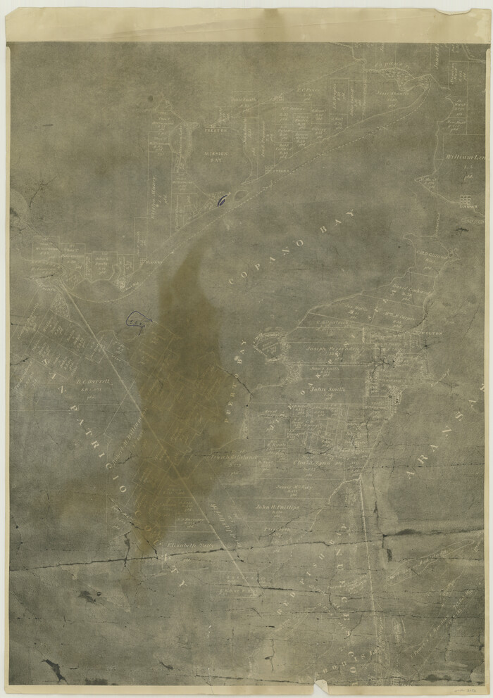
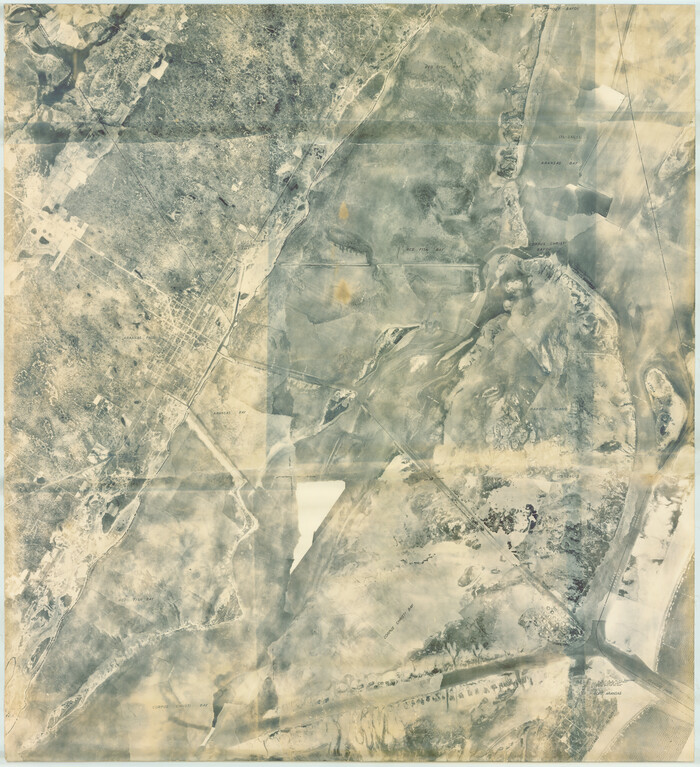
[William Steele Survey near Copano Bay]
Print $20.00
- Digital $50.00
[William Steele Survey near Copano Bay]
1927
Size: 26.1 x 18.4 inches
2082
[William Steele Survey near Copano Bay]
Print $3.00
- Digital $50.00
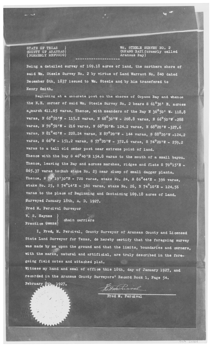
[William Steele Survey near Copano Bay]
1927
Size: 15.5 x 9.5 inches
60284
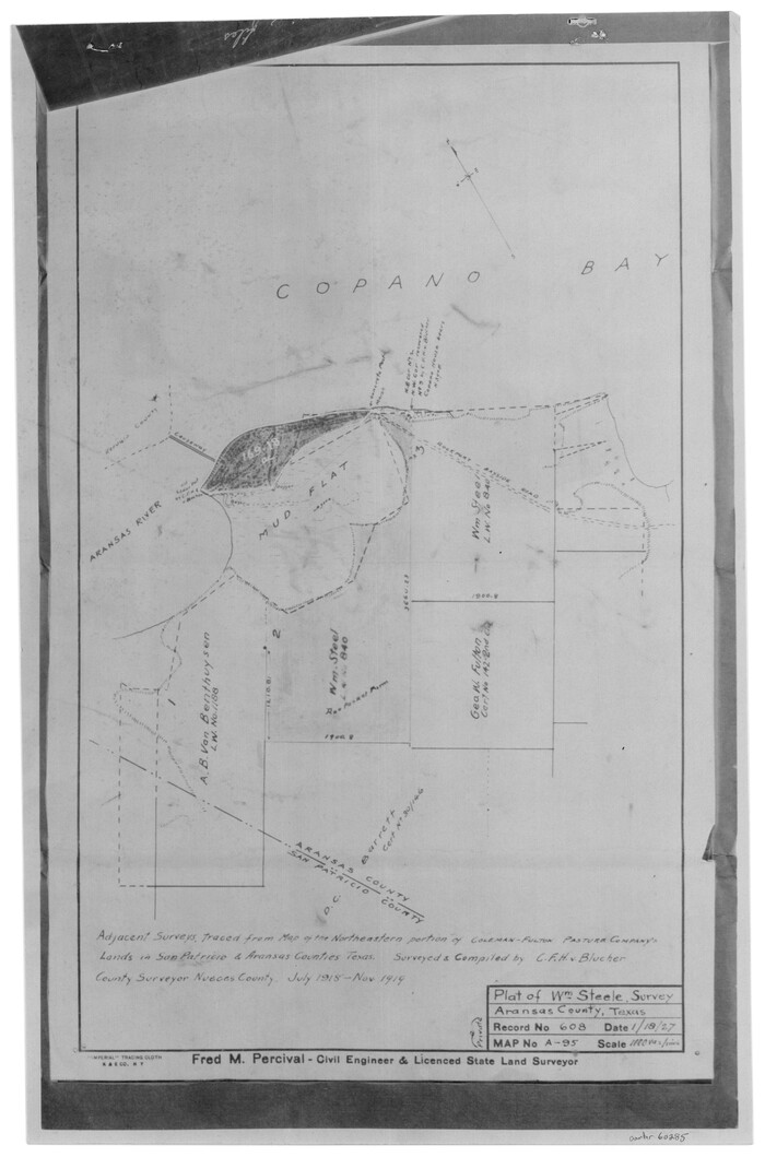
[William Steele Survey near Copano Bay]
Print $3.00
- Digital $50.00
[William Steele Survey near Copano Bay]
1927
Size: 14.9 x 9.8 inches
60285
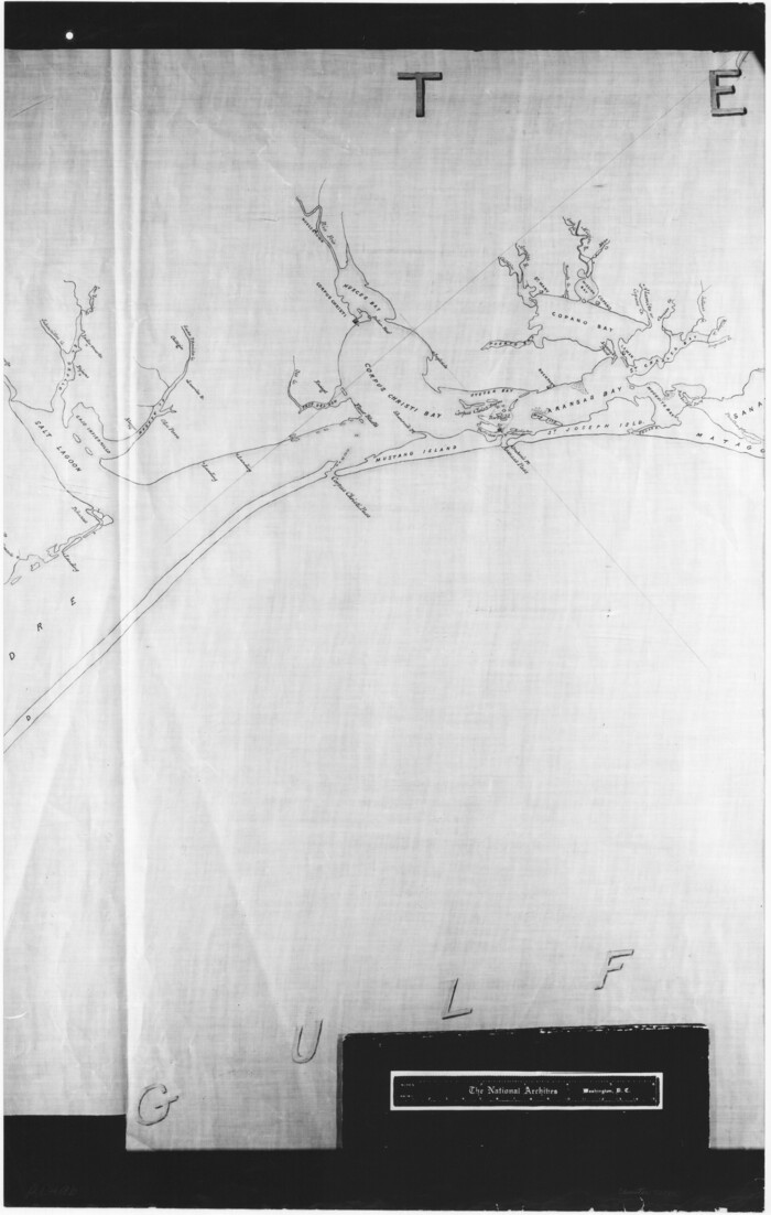
[Three-Marine League line stipulation as determined by US Supreme Court, October 1968 term; corrections to stipulation; Texas GLO approximations of county areas embraced by county boundaries, shoreline and 3-marine league line and 3-mile line]

Print $64.00
[Three-Marine League line stipulation as determined by US Supreme Court, October 1968 term; corrections to stipulation; Texas GLO approximations of county areas embraced by county boundaries, shoreline and 3-marine league line and 3-mile line]
1962
Size: 13.4 x 8.7 inches
61371
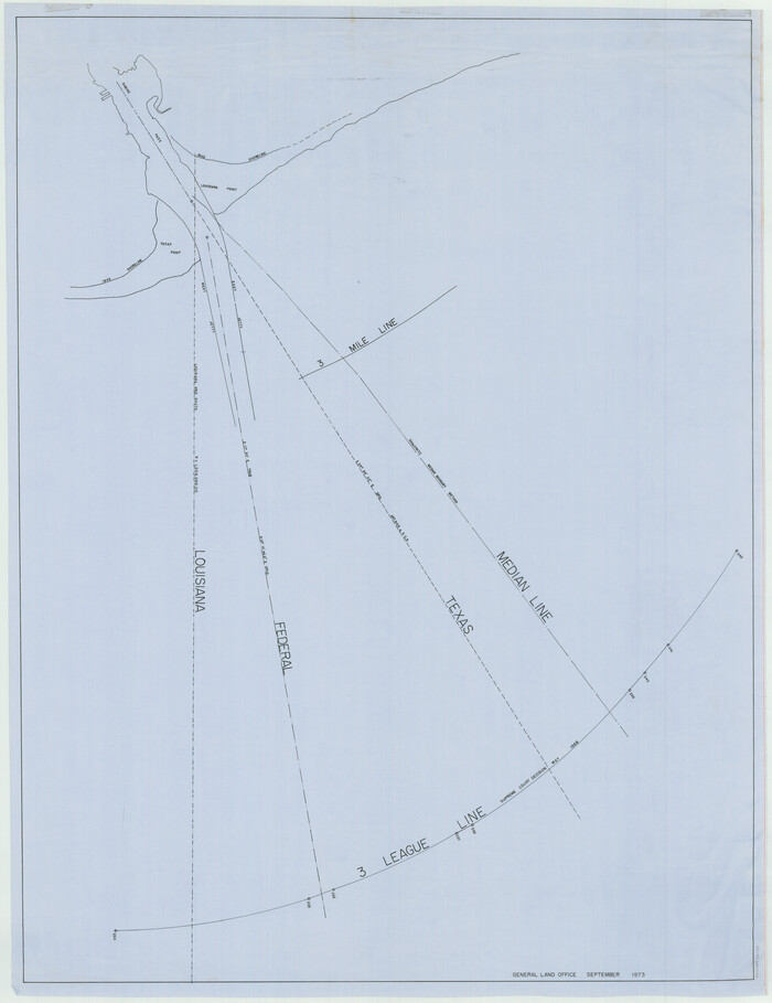
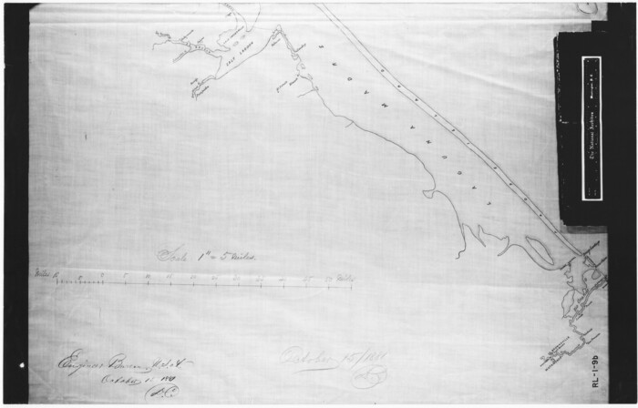
[Three Mile Line and Three League Line]
Print $20.00
- Digital $50.00
[Three Mile Line and Three League Line]
1973
Size: 43.2 x 33.3 inches
76120
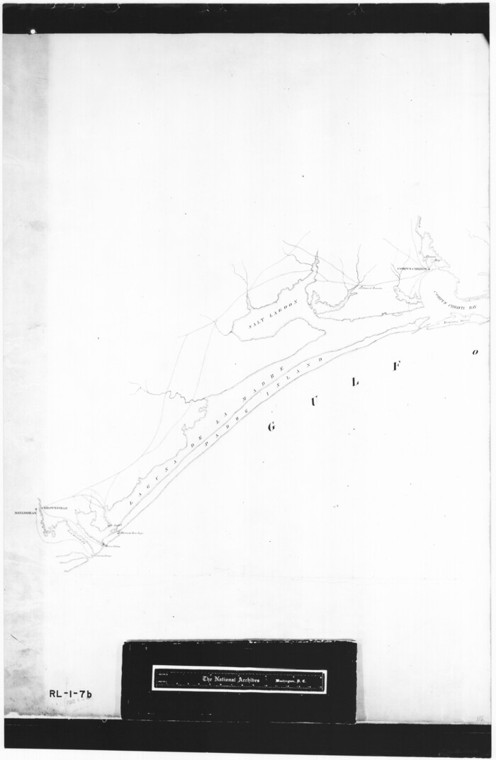
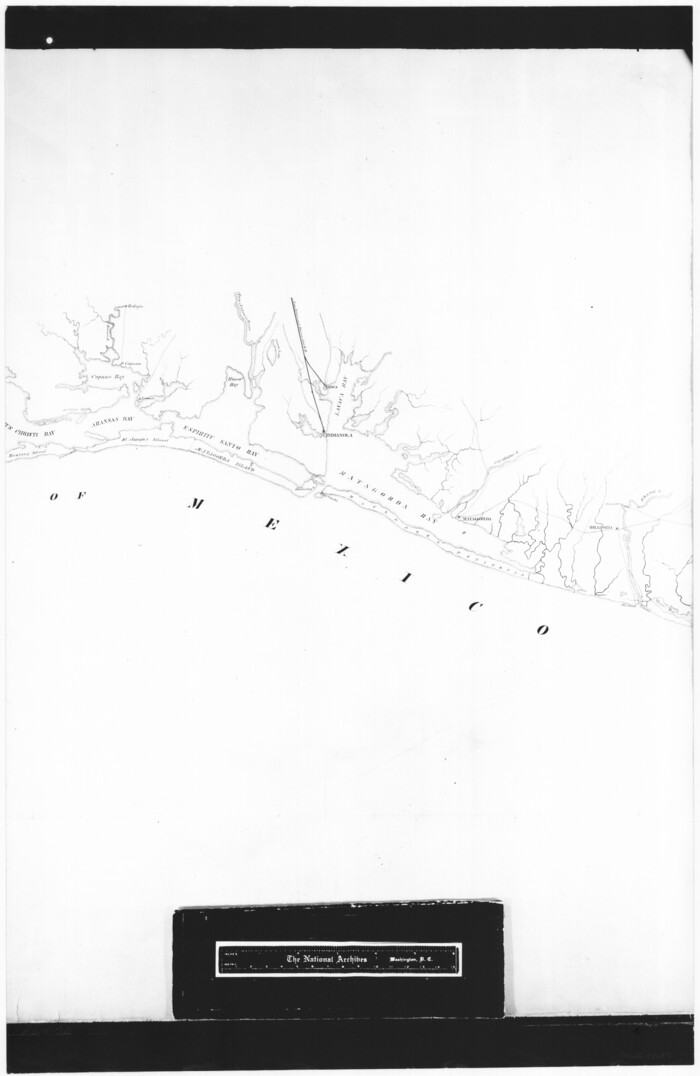
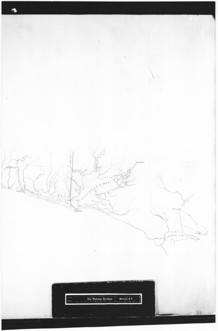
[Texas Gulf Coast from Rio Grande to Sabine Lake]
Print $20.00
- Digital $50.00
[Texas Gulf Coast from Rio Grande to Sabine Lake]
Size: 28.0 x 18.3 inches
72686
[Texas Gulf Coast from Rio Grande to Sabine Lake]
Print $20.00
- Digital $50.00
[Texas Gulf Coast from Rio Grande to Sabine Lake]
Size: 28.1 x 18.3 inches
72687
[Texas Gulf Coast from Rio Grande to Sabine Lake]
Print $20.00
- Digital $50.00
[Texas Gulf Coast from Rio Grande to Sabine Lake]
Size: 27.8 x 18.3 inches
72688
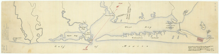
[Sketch of Oyster Bay, Bastrop Bay, Chocolate Bay, and West Bay]
Print $20.00
- Digital $50.00
[Sketch of Oyster Bay, Bastrop Bay, Chocolate Bay, and West Bay]
1871
Size: 6.0 x 23.9 inches
3103
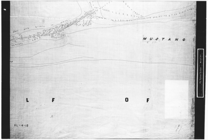
[Redfish Bay, Aransas Pass, and part of Mustang Island]
Print $40.00
- Digital $50.00
[Redfish Bay, Aransas Pass, and part of Mustang Island]
1930
Size: 51.0 x 46.5 inches
83009
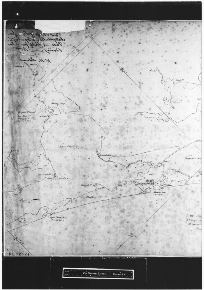
[Reconnaissance report of Lieut. Scariott around Laguna del Madre and up to Fort San Saba]
Print $20.00
- Digital $50.00
[Reconnaissance report of Lieut. Scariott around Laguna del Madre and up to Fort San Saba]
Size: 25.2 x 18.2 inches
73006
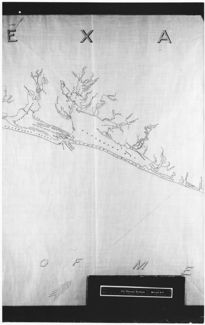
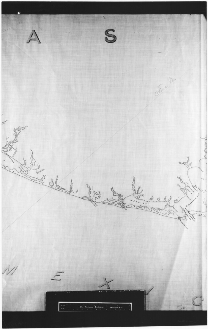
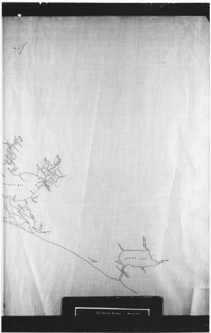
[Gulf Coast of Texas]
Print $20.00
- Digital $50.00
[Gulf Coast of Texas]
1881
Size: 18.2 x 28.5 inches
72701
[Gulf Coast of Texas]
Print $20.00
- Digital $50.00
[Gulf Coast of Texas]
1881
Size: 28.6 x 18.2 inches
72702
[Gulf Coast of Texas]
Print $20.00
- Digital $50.00
[Gulf Coast of Texas]
1881
Size: 28.9 x 18.2 inches
72703
[Gulf Coast of Texas]
Print $20.00
- Digital $50.00
[Gulf Coast of Texas]
1881
Size: 28.7 x 18.2 inches
72704
[Gulf Coast of Texas]
Print $20.00
- Digital $50.00
[Gulf Coast of Texas]
1881
Size: 28.7 x 18.2 inches
72705
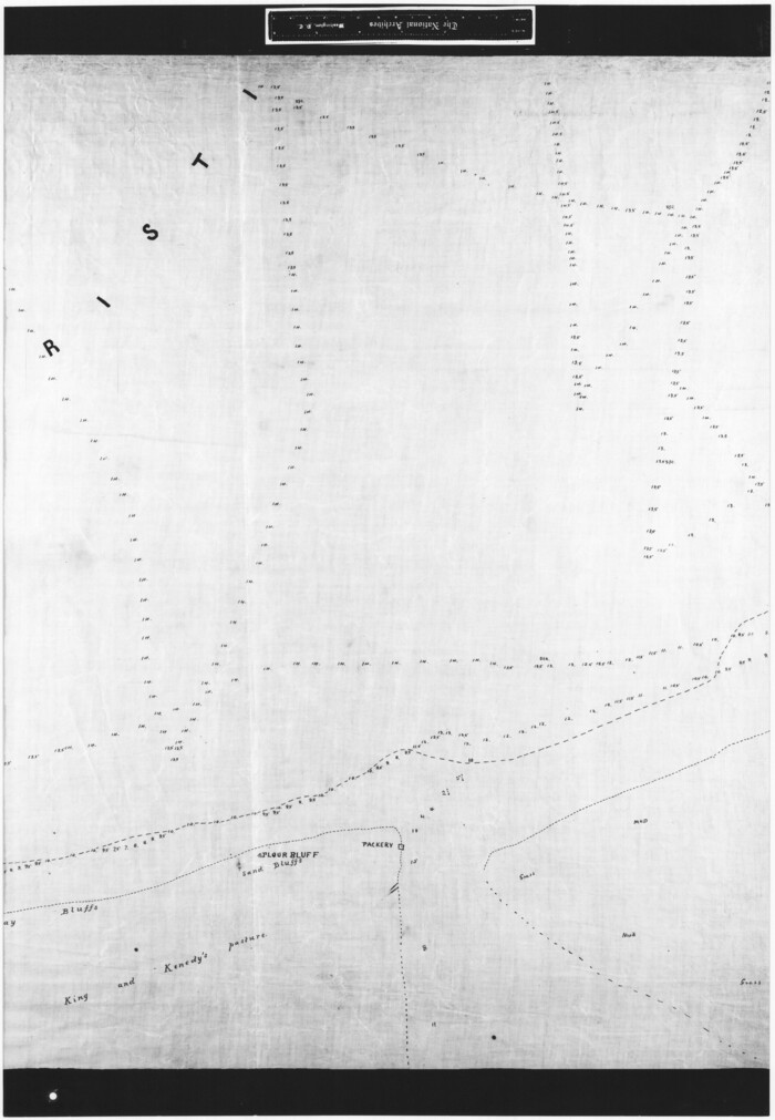
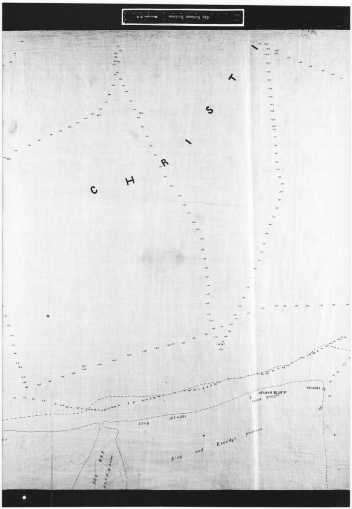
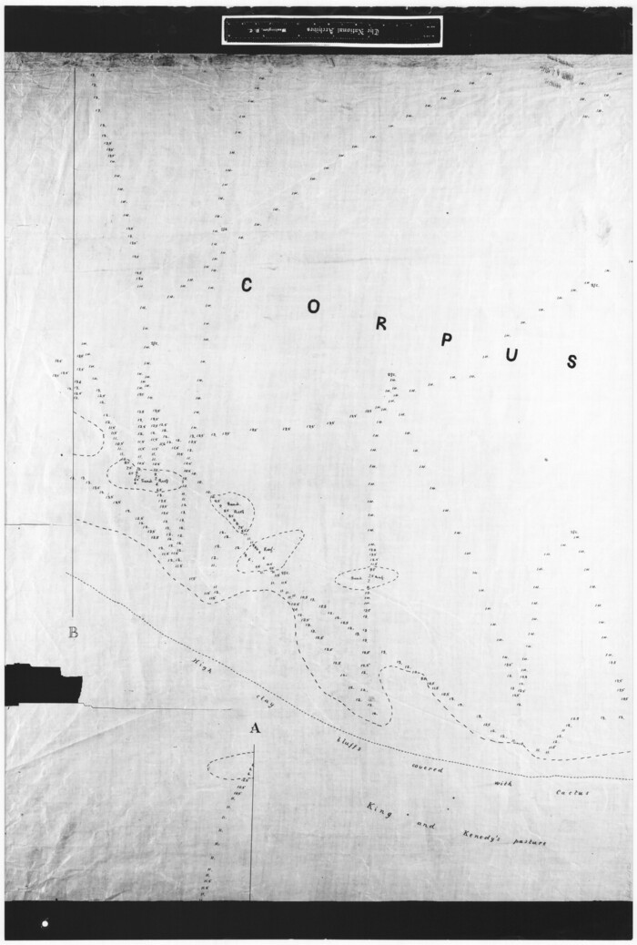
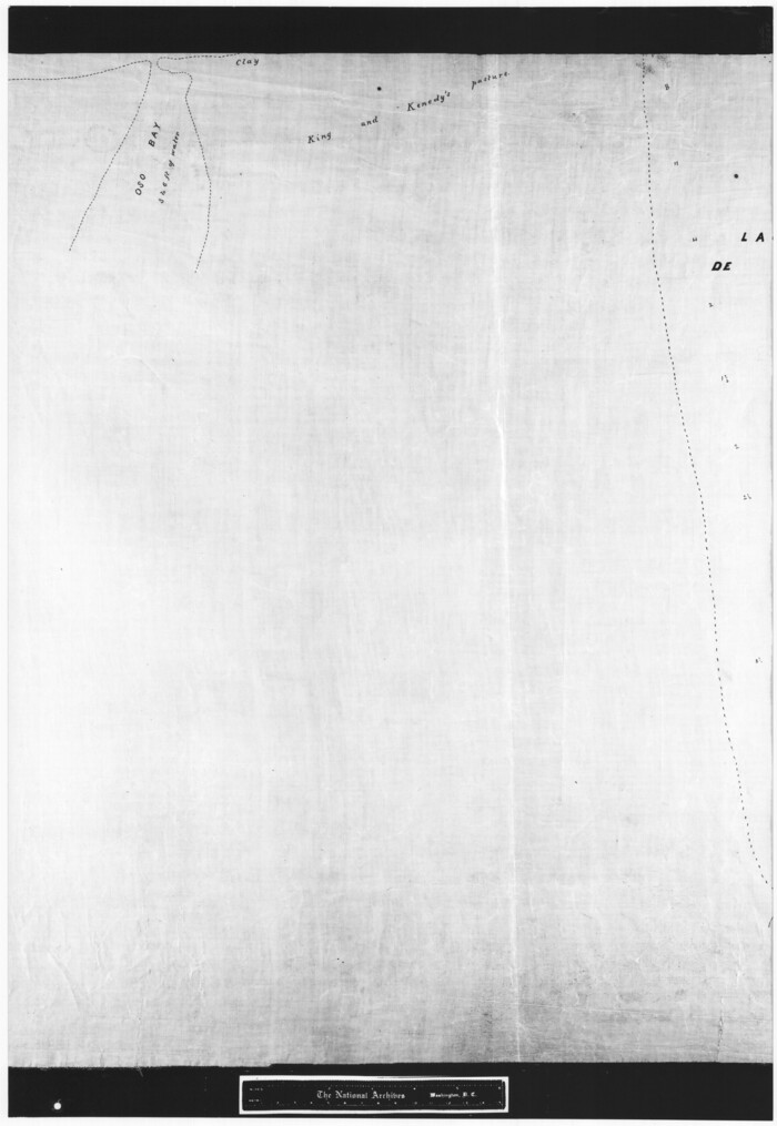
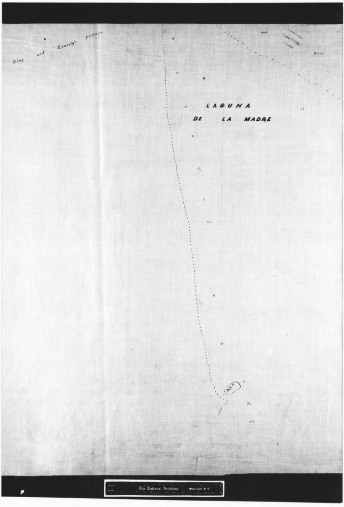
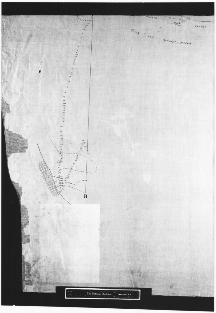
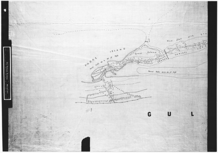
[Corpus Christi Bay, Padre Island, Mustang Island, Laguna de la Madre, King and Kenedy's Pasture]
Print $20.00
- Digital $50.00
[Corpus Christi Bay, Padre Island, Mustang Island, Laguna de la Madre, King and Kenedy's Pasture]
Size: 18.2 x 27.0 inches
73040
[Corpus Christi Bay, Padre Island, Mustang Island, Laguna de la Madre, King and Kenedy's Pasture]
Print $20.00
- Digital $50.00
[Corpus Christi Bay, Padre Island, Mustang Island, Laguna de la Madre, King and Kenedy's Pasture]
Size: 26.2 x 18.1 inches
73041
[Corpus Christi Bay, Padre Island, Mustang Island, Laguna de la Madre, King and Kenedy's Pasture]
Print $20.00
- Digital $50.00
[Corpus Christi Bay, Padre Island, Mustang Island, Laguna de la Madre, King and Kenedy's Pasture]
Size: 26.2 x 18.2 inches
73042
[Corpus Christi Bay, Padre Island, Mustang Island, Laguna de la Madre, King and Kenedy's Pasture]
Print $20.00
- Digital $50.00
[Corpus Christi Bay, Padre Island, Mustang Island, Laguna de la Madre, King and Kenedy's Pasture]
Size: 27.0 x 18.2 inches
73043
[Corpus Christi Bay, Padre Island, Mustang Island, Laguna de la Madre, King and Kenedy's Pasture]
Print $20.00
- Digital $50.00
[Corpus Christi Bay, Padre Island, Mustang Island, Laguna de la Madre, King and Kenedy's Pasture]
Size: 26.5 x 18.2 inches
73044
[Corpus Christi Bay, Padre Island, Mustang Island, Laguna de la Madre, King and Kenedy's Pasture]
Print $20.00
- Digital $50.00
[Corpus Christi Bay, Padre Island, Mustang Island, Laguna de la Madre, King and Kenedy's Pasture]
Size: 26.6 x 18.1 inches
73045
[Corpus Christi Bay, Padre Island, Mustang Island, Laguna de la Madre, King and Kenedy's Pasture]
Print $20.00
- Digital $50.00
[Corpus Christi Bay, Padre Island, Mustang Island, Laguna de la Madre, King and Kenedy's Pasture]
Size: 26.4 x 18.2 inches
73046
[Corpus Christi Bay, Padre Island, Mustang Island, Laguna de la Madre, King and Kenedy's Pasture]
Print $20.00
- Digital $50.00
[Corpus Christi Bay, Padre Island, Mustang Island, Laguna de la Madre, King and Kenedy's Pasture]
Size: 18.2 x 26.0 inches
73047
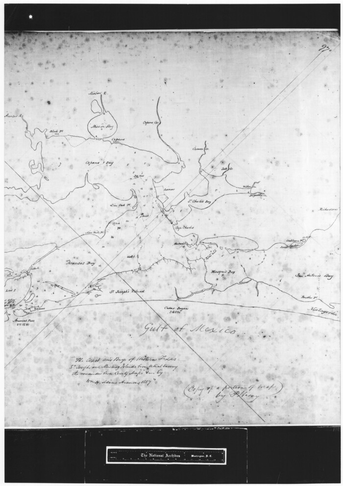
[Copy of a portion of] The Coast & Bays of Western Texas, St. Joseph's and Mustang Islands from Actual Survey, the Remainder from County Maps, Etc.
Print $20.00
- Digital $50.00
[Copy of a portion of] The Coast & Bays of Western Texas, St. Joseph's and Mustang Islands from Actual Survey, the Remainder from County Maps, Etc.
1857
Size: 26.0 x 18.3 inches
72768
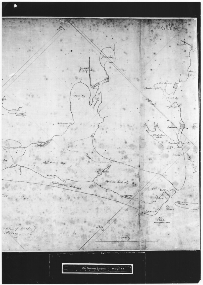
[Copy of a portion of] The Coast & Bays of Western Texas, St. Joseph's and Mustang Islands from Actual Survey, the Remainder from County Maps, Etc.
Print $20.00
- Digital $50.00
[Copy of a portion of] The Coast & Bays of Western Texas, St. Joseph's and Mustang Islands from Actual Survey, the Remainder from County Maps, Etc.
1857
Size: 25.9 x 18.3 inches
72769
[Copy of a portion of] The Coast & Bays of Western Texas, St. Joseph's and Mustang Islands from Actual Survey, the Remainder from County Maps, Etc.
Print $20.00
- Digital $50.00
[Copy of a portion of] The Coast & Bays of Western Texas, St. Joseph's and Mustang Islands from Actual Survey, the Remainder from County Maps, Etc.
1857
Size: 25.7 x 18.3 inches
72770
[Copied from a chart of Galveston Bar and Harbor]
Print $20.00
- Digital $50.00
[Copied from a chart of Galveston Bar and Harbor]
1846
Size: 18.3 x 25.3 inches
72760
[William Steele Survey near Copano Bay]
Print $20.00
- Digital $50.00
[William Steele Survey near Copano Bay]
1927
-
Size
26.1 x 18.4 inches
-
Map/Doc
2082
-
Creation Date
1927
[William Steele Survey near Copano Bay]
Print $3.00
- Digital $50.00
[William Steele Survey near Copano Bay]
1927
-
Size
15.5 x 9.5 inches
-
Map/Doc
60284
-
Creation Date
1927
[William Steele Survey near Copano Bay]
Print $3.00
- Digital $50.00
[William Steele Survey near Copano Bay]
1927
-
Size
14.9 x 9.8 inches
-
Map/Doc
60285
-
Creation Date
1927
[Three-Marine League line stipulation as determined by US Supreme Court, October 1968 term; corrections to stipulation; Texas GLO approximations of county areas embraced by county boundaries, shoreline and 3-marine league line and 3-mile line]
Print $64.00
[Three-Marine League line stipulation as determined by US Supreme Court, October 1968 term; corrections to stipulation; Texas GLO approximations of county areas embraced by county boundaries, shoreline and 3-marine league line and 3-mile line]
1962
-
Size
13.4 x 8.7 inches
-
Map/Doc
61371
-
Creation Date
1962
[Three Mile Line and Three League Line]
Print $20.00
- Digital $50.00
[Three Mile Line and Three League Line]
1973
-
Size
43.2 x 33.3 inches
-
Map/Doc
76120
-
Creation Date
1973
[Texas Gulf Coast]
![72677, [Texas Gulf Coast], General Map Collection](https://historictexasmaps.com/wmedia_w700/maps/72677.tif.jpg)
Print $20.00
- Digital $50.00
[Texas Gulf Coast]
-
Size
27.3 x 18.2 inches
-
Map/Doc
72677
[Texas Gulf Coast]
![72678, [Texas Gulf Coast], General Map Collection](https://historictexasmaps.com/wmedia_w700/maps/72678.tif.jpg)
Print $20.00
- Digital $50.00
[Texas Gulf Coast]
-
Size
18.3 x 27.6 inches
-
Map/Doc
72678
[Texas Gulf Coast from Rio Grande to Sabine Lake]
Print $20.00
- Digital $50.00
[Texas Gulf Coast from Rio Grande to Sabine Lake]
-
Size
28.0 x 18.3 inches
-
Map/Doc
72686
[Texas Gulf Coast from Rio Grande to Sabine Lake]
Print $20.00
- Digital $50.00
[Texas Gulf Coast from Rio Grande to Sabine Lake]
-
Size
28.1 x 18.3 inches
-
Map/Doc
72687
[Texas Gulf Coast from Rio Grande to Sabine Lake]
Print $20.00
- Digital $50.00
[Texas Gulf Coast from Rio Grande to Sabine Lake]
-
Size
27.8 x 18.3 inches
-
Map/Doc
72688
[Sketch of Oyster Bay, Bastrop Bay, Chocolate Bay, and West Bay]
Print $20.00
- Digital $50.00
[Sketch of Oyster Bay, Bastrop Bay, Chocolate Bay, and West Bay]
1871
-
Size
6.0 x 23.9 inches
-
Map/Doc
3103
-
Creation Date
1871
[Redfish Bay, Aransas Pass, and part of Mustang Island]
Print $40.00
- Digital $50.00
[Redfish Bay, Aransas Pass, and part of Mustang Island]
1930
-
Size
51.0 x 46.5 inches
-
Map/Doc
83009
-
Creation Date
1930
[Reconnaissance report of Lieut. Scariott around Laguna del Madre and up to Fort San Saba]
Print $20.00
- Digital $50.00
[Reconnaissance report of Lieut. Scariott around Laguna del Madre and up to Fort San Saba]
-
Size
25.2 x 18.2 inches
-
Map/Doc
73006
[Gulf Coast of Texas]
Print $20.00
- Digital $50.00
[Gulf Coast of Texas]
1881
-
Size
18.2 x 28.5 inches
-
Map/Doc
72701
-
Creation Date
1881
[Gulf Coast of Texas]
Print $20.00
- Digital $50.00
[Gulf Coast of Texas]
1881
-
Size
28.6 x 18.2 inches
-
Map/Doc
72702
-
Creation Date
1881
[Gulf Coast of Texas]
Print $20.00
- Digital $50.00
[Gulf Coast of Texas]
1881
-
Size
28.9 x 18.2 inches
-
Map/Doc
72703
-
Creation Date
1881
[Gulf Coast of Texas]
Print $20.00
- Digital $50.00
[Gulf Coast of Texas]
1881
-
Size
28.7 x 18.2 inches
-
Map/Doc
72704
-
Creation Date
1881
[Gulf Coast of Texas]
Print $20.00
- Digital $50.00
[Gulf Coast of Texas]
1881
-
Size
28.7 x 18.2 inches
-
Map/Doc
72705
-
Creation Date
1881
[Corpus Christi Bay, Padre Island, Mustang Island, Laguna de la Madre, King and Kenedy's Pasture]
Print $20.00
- Digital $50.00
[Corpus Christi Bay, Padre Island, Mustang Island, Laguna de la Madre, King and Kenedy's Pasture]
-
Size
18.2 x 27.0 inches
-
Map/Doc
73040
[Corpus Christi Bay, Padre Island, Mustang Island, Laguna de la Madre, King and Kenedy's Pasture]
Print $20.00
- Digital $50.00
[Corpus Christi Bay, Padre Island, Mustang Island, Laguna de la Madre, King and Kenedy's Pasture]
-
Size
26.2 x 18.1 inches
-
Map/Doc
73041
[Corpus Christi Bay, Padre Island, Mustang Island, Laguna de la Madre, King and Kenedy's Pasture]
Print $20.00
- Digital $50.00
[Corpus Christi Bay, Padre Island, Mustang Island, Laguna de la Madre, King and Kenedy's Pasture]
-
Size
26.2 x 18.2 inches
-
Map/Doc
73042
[Corpus Christi Bay, Padre Island, Mustang Island, Laguna de la Madre, King and Kenedy's Pasture]
Print $20.00
- Digital $50.00
[Corpus Christi Bay, Padre Island, Mustang Island, Laguna de la Madre, King and Kenedy's Pasture]
-
Size
27.0 x 18.2 inches
-
Map/Doc
73043
[Corpus Christi Bay, Padre Island, Mustang Island, Laguna de la Madre, King and Kenedy's Pasture]
Print $20.00
- Digital $50.00
[Corpus Christi Bay, Padre Island, Mustang Island, Laguna de la Madre, King and Kenedy's Pasture]
-
Size
26.5 x 18.2 inches
-
Map/Doc
73044
[Corpus Christi Bay, Padre Island, Mustang Island, Laguna de la Madre, King and Kenedy's Pasture]
Print $20.00
- Digital $50.00
[Corpus Christi Bay, Padre Island, Mustang Island, Laguna de la Madre, King and Kenedy's Pasture]
-
Size
26.6 x 18.1 inches
-
Map/Doc
73045
[Corpus Christi Bay, Padre Island, Mustang Island, Laguna de la Madre, King and Kenedy's Pasture]
Print $20.00
- Digital $50.00
[Corpus Christi Bay, Padre Island, Mustang Island, Laguna de la Madre, King and Kenedy's Pasture]
-
Size
26.4 x 18.2 inches
-
Map/Doc
73046
[Corpus Christi Bay, Padre Island, Mustang Island, Laguna de la Madre, King and Kenedy's Pasture]
Print $20.00
- Digital $50.00
[Corpus Christi Bay, Padre Island, Mustang Island, Laguna de la Madre, King and Kenedy's Pasture]
-
Size
18.2 x 26.0 inches
-
Map/Doc
73047
[Copy of a portion of] The Coast & Bays of Western Texas, St. Joseph's and Mustang Islands from Actual Survey, the Remainder from County Maps, Etc.
Print $20.00
- Digital $50.00
[Copy of a portion of] The Coast & Bays of Western Texas, St. Joseph's and Mustang Islands from Actual Survey, the Remainder from County Maps, Etc.
1857
-
Size
26.0 x 18.3 inches
-
Map/Doc
72768
-
Creation Date
1857
[Copy of a portion of] The Coast & Bays of Western Texas, St. Joseph's and Mustang Islands from Actual Survey, the Remainder from County Maps, Etc.
Print $20.00
- Digital $50.00
[Copy of a portion of] The Coast & Bays of Western Texas, St. Joseph's and Mustang Islands from Actual Survey, the Remainder from County Maps, Etc.
1857
-
Size
25.9 x 18.3 inches
-
Map/Doc
72769
-
Creation Date
1857
[Copy of a portion of] The Coast & Bays of Western Texas, St. Joseph's and Mustang Islands from Actual Survey, the Remainder from County Maps, Etc.
Print $20.00
- Digital $50.00
[Copy of a portion of] The Coast & Bays of Western Texas, St. Joseph's and Mustang Islands from Actual Survey, the Remainder from County Maps, Etc.
1857
-
Size
25.7 x 18.3 inches
-
Map/Doc
72770
-
Creation Date
1857
[Copied from a chart of Galveston Bar and Harbor]
Print $20.00
- Digital $50.00
[Copied from a chart of Galveston Bar and Harbor]
1846
-
Size
18.3 x 25.3 inches
-
Map/Doc
72760
-
Creation Date
1846